MyTopo
Stevinson California US Topo Map
Couldn't load pickup availability
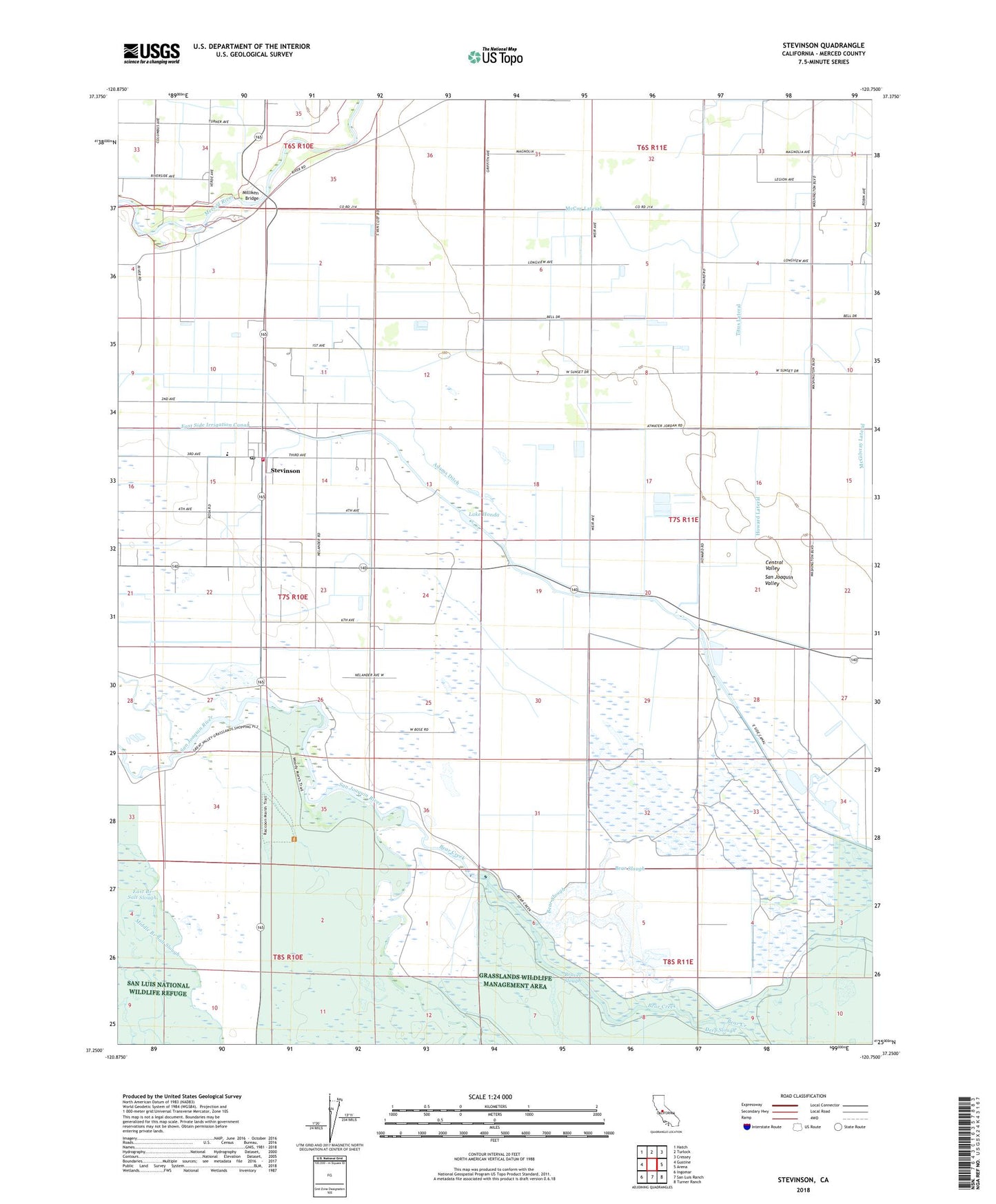
2021 topographic map quadrangle Stevinson in the state of California. Scale: 1:24000. Based on the newly updated USGS 7.5' US Topo map series, this map is in the following counties: Merced. The map contains contour data, water features, and other items you are used to seeing on USGS maps, but also has updated roads and other features. This is the next generation of topographic maps. Printed on high-quality waterproof paper with UV fade-resistant inks.
Quads adjacent to this one:
West: Gustine
Northwest: Hatch
North: Turlock
Northeast: Cressey
East: Arena
Southeast: Turner Ranch
South: San Luis Ranch
Southwest: Ingomar
This map covers the same area as the classic USGS quad with code o37120c7.
Contains the following named places: Adams Ditch, Bear Slough, Bravel Slough, East Branch Salt Slough, East Side Irrigation Canal, Gallo Bamboo Dairy, Gallo Bear Creek Dairy, Hagaman Park, Howard Lateral, Lake Honda, Livingston Substation, McCoy Lateral, Merced County Fire Department Stevinson Fire Station 97, Merquin Elementary School, Middle Branch Salt Slough, Milliken Bridge, Modesto Gun Club, Riverside Ditch, Stevinson, Stevinson Branch Merced County Library, Stevinson Census Designated Place, Stevinson Post Office, Stevinson Strip, Titus Lateral, Wickstrom Jersey Farms, ZIP Code: 95374