MyTopo
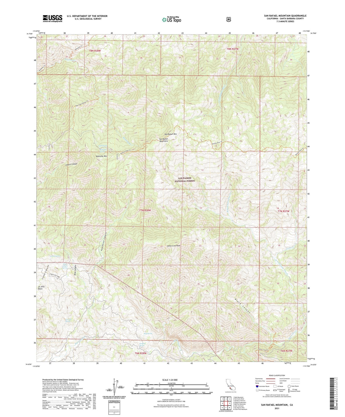
San Rafael Mountain California US Topo Map
Couldn't load pickup availability
Also explore the San Rafael Mountain Forest Service Topo of this same quad for updated USFS data
2021 topographic map quadrangle San Rafael Mountain in the state of California. Scale: 1:24000. Based on the newly updated USGS 7.5' US Topo map series, this map is in the following counties: Santa Barbara. The map contains contour data, water features, and other items you are used to seeing on USGS maps, but also has updated roads and other features. This is the next generation of topographic maps. Printed on high-quality waterproof paper with UV fade-resistant inks.
Quads adjacent to this one:
West: Figueroa Mountain
Northwest: Bald Mountain
North: Hurricane Deck
Northeast: Salisbury Potrero
East: Big Pine Mountain
Southeast: Little Pine Mountain
South: San Marcos Pass
Southwest: Lake Cachuma
Contains the following named places: Big Cone Spruce Camp, Black Canyon, Coche Creek, Cold Spring, Demesio Spring, Doty Cabin, East Fork Santa Cruz Creek, Flores Camp, Grand Spring, La Jolla Basin, Live Oak Spring, Manzana Camp, Manzana Narrows Camp, McKinley Mountain, McKinley Spring, Mine Canyon, Mine Canyon Spring, Mission Pine Camp, Mud Spring, Peachtree Canyon, San Rafael Mountain, San Rafael Mountains, Santa Cruz Guard Station, Santa Cruz Peak, Santa Cruz Rustic Campsite, Santa Cruz Trail, West Fork Santa Cruz Creek