MyTopo
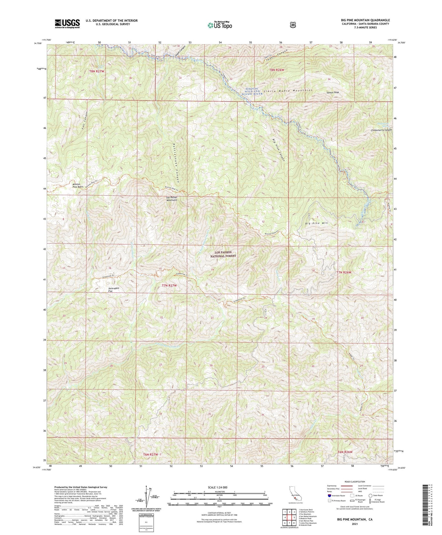
Big Pine Mountain California US Topo Map
Couldn't load pickup availability
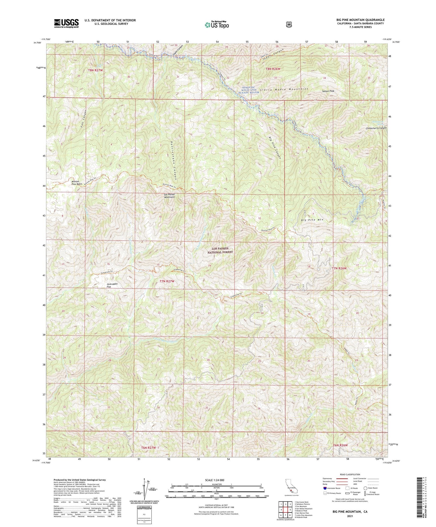
Also explore the Big Pine Mountain Forest Service Topo of this same quad for updated USFS data
2021 topographic map quadrangle Big Pine Mountain in the state of California. Scale: 1:24000. Based on the newly updated USGS 7.5' US Topo map series, this map is in the following counties: Santa Barbara. The map contains contour data, water features, and other items you are used to seeing on USGS maps, but also has updated roads and other features. This is the next generation of topographic maps. Printed on high-quality waterproof paper with UV fade-resistant inks.
Quads adjacent to this one:
West: San Rafael Mountain
Northwest: Hurricane Deck
North: Salisbury Potrero
Northeast: Fox Mountain
East: Madulce Peak
Southeast: Hildreth Peak
South: Little Pine Mountain
Southwest: San Marcos Pass
Contains the following named places: Alamar Guard Station, Bear Campground, Big Pine Campground, Big Pine Canyon, Big Pine Mountain, Bluff Camp Forest Service Faciltiy, Bluff Campground, Chokecherry Spring, Coche Campground, Cottonwood Campground, Grapevine Creek, Grapevine Trail, Heath Campground, Jackrabbit Flat, Judell Canyon, Logan Canyon, Lower Bear Campground, Lower Grapevine Campground, Mansfield Campground, Mission Pine Basin, Mission Pine Basin Campground, Mission Pine Trail, Narrows Campground, Pelch Cabin, Pelch Camp, Pens Campground, Poplar Campground, Rattlesnake Canyon, Samon Peak, Sisquoc Condor Sanctuary, Sisquoc Falls, The Pines Campground, Upper Grapevine Campground