
MyTopo
Sanborn Slough California US Topo Map
Couldn't load pickup availability
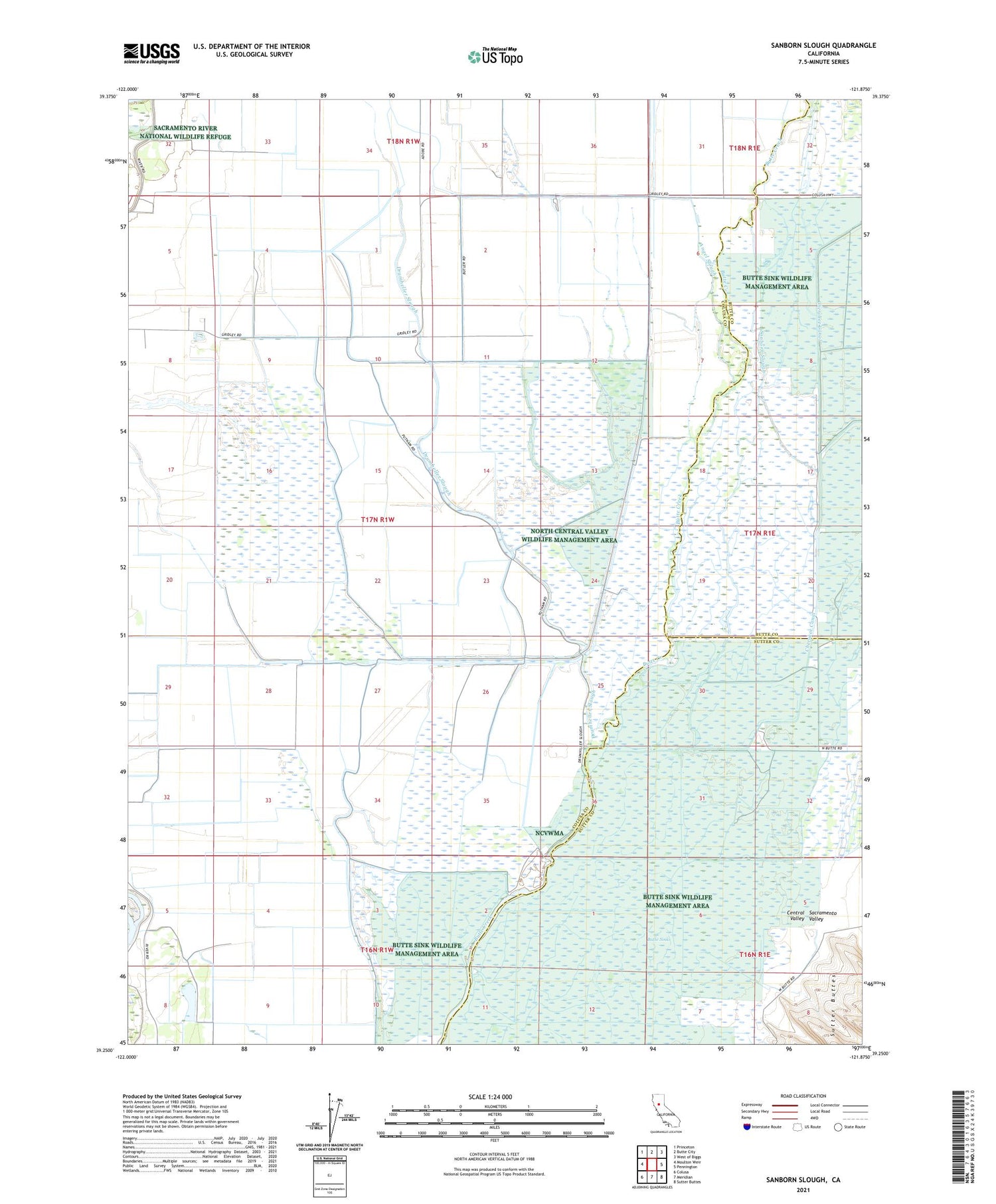
2021 topographic map quadrangle Sanborn Slough in the state of California. Scale: 1:24000. Based on the newly updated USGS 7.5' US Topo map series, this map is in the following counties: Colusa, Sutter, Butte. The map contains contour data, water features, and other items you are used to seeing on USGS maps, but also has updated roads and other features. This is the next generation of topographic maps. Printed on high-quality waterproof paper with UV fade-resistant inks.
Quads adjacent to this one:
West: Moulton Weir
Northwest: Princeton
North: Butte City
Northeast: West of Biggs
East: Pennington
Southeast: Sutter Buttes
South: Meridian
Southwest: Colusa
This map covers the same area as the classic USGS quad with code o39121c8.
Contains the following named places: Angel Slough, Butte Sink, Butte Sink Wildlife Management Area, California Duck Club, Drumheller Slough, Field and Tule Club, French Crossing, Hangtown Gun Club, Harmony School, Oroville Gun Club, Sanborn Slough, Sanborn Slough Gun Club, Sutter Butte Outing Club, The Berry Patch, Tule Goose Gun Club, White Mallard Hunting Club, Wild Goose Country Club, Winchester Gun Club, ZIP Code: 95932


