MyTopo
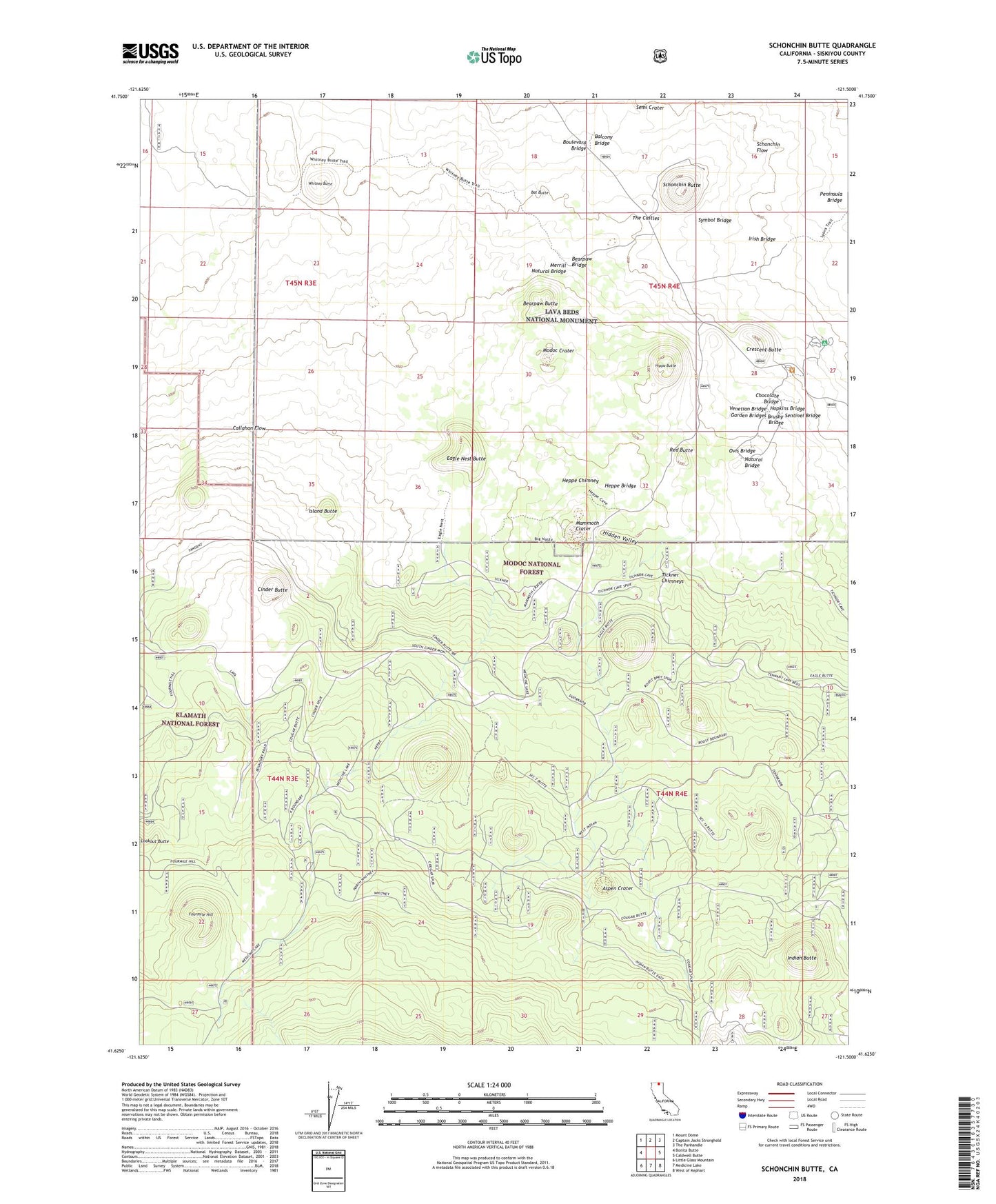
Schonchin Butte California US Topo Map
Couldn't load pickup availability
Also explore the Schonchin Butte Forest Service Topo of this same quad for updated USFS data
2022 topographic map quadrangle Schonchin Butte in the state of California. Scale: 1:24000. Based on the newly updated USGS 7.5' US Topo map series, this map is in the following counties: Siskiyou. The map contains contour data, water features, and other items you are used to seeing on USGS maps, but also has updated roads and other features. This is the next generation of topographic maps. Printed on high-quality waterproof paper with UV fade-resistant inks.
Quads adjacent to this one:
West: Bonita Butte
Northwest: Mount Dome
North: Captain Jacks Stronghold
Northeast: The Panhandle
East: Caldwell Butte
Southeast: West of Kephart
South: Medicine Lake
Southwest: Little Glass Mountain
This map covers the same area as the classic USGS quad with code o41121f5.
Contains the following named places: Aspen Crater, Balcony Bridge, Bat Butte, Bearpaw Bridge, Bearpaw Butte, Big Nasty Trail, Boulevard Bridge, Brushy Bridge, Bunchgrass Trail, Callahan Flow, Chocolate Bridge, Cinder Butte, Crescent Butte, Eagle Nest Butte, Fourmile Hill, Garden Bridges, Heppe Bridge, Heppe Chimney, Hidden Valley, Hippo Butte, Hopkins Bridge, Indian Butte, Indian Well Campground, Irish Bridge, Island Butte, Mammoth Crater, Merrill Natural Bridge, Missing Link Trail, Modoc Crater, Natural Bridge, Ovis Bridge, Peninsula Bridge, Red Butte, Schonchin Butte, Semi Crater, Sentinel Bridge, Symbol Bridge, The Castles, Tickner Chimneys, Venetian Bridge, Whitney Butte, Whitney Butte Trail