MyTopo
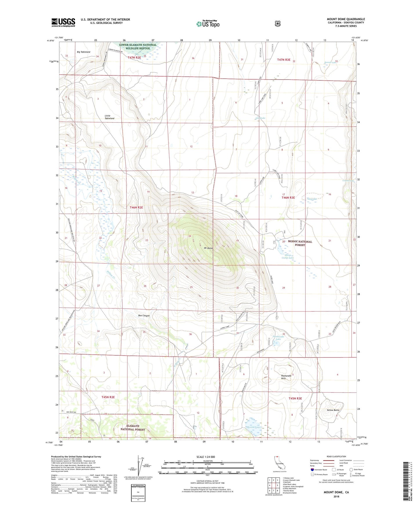
Mount Dome California US Topo Map
Couldn't load pickup availability
Also explore the Mount Dome Forest Service Topo of this same quad for updated USFS data
2022 topographic map quadrangle Mount Dome in the state of California. Scale: 1:24000. Based on the newly updated USGS 7.5' US Topo map series, this map is in the following counties: Siskiyou. The map contains contour data, water features, and other items you are used to seeing on USGS maps, but also has updated roads and other features. This is the next generation of topographic maps. Printed on high-quality waterproof paper with UV fade-resistant inks.
Quads adjacent to this one:
West: Red Rock Lakes
Northwest: Sheepy Lake
North: Lower Klamath Lake
Northeast: Hatfield
East: Captain Jacks Stronghold
Southeast: Schonchin Butte
South: Bonita Butte
Southwest: Sharp Mountain
This map covers the same area as the classic USGS quad with code o41121g6.
Contains the following named places: Bonita Lake, Box Canyon, Deep Lake, Laird Lake, Laird Landing, Lairds Camp, Little Tableland, Mount Dome, Panhandle Hills, Panhandle Lake, Sheep Camp Lake, Stinson Cabin, Summit Lake, Willow Creek Ranch, Yellow Butte