MyTopo
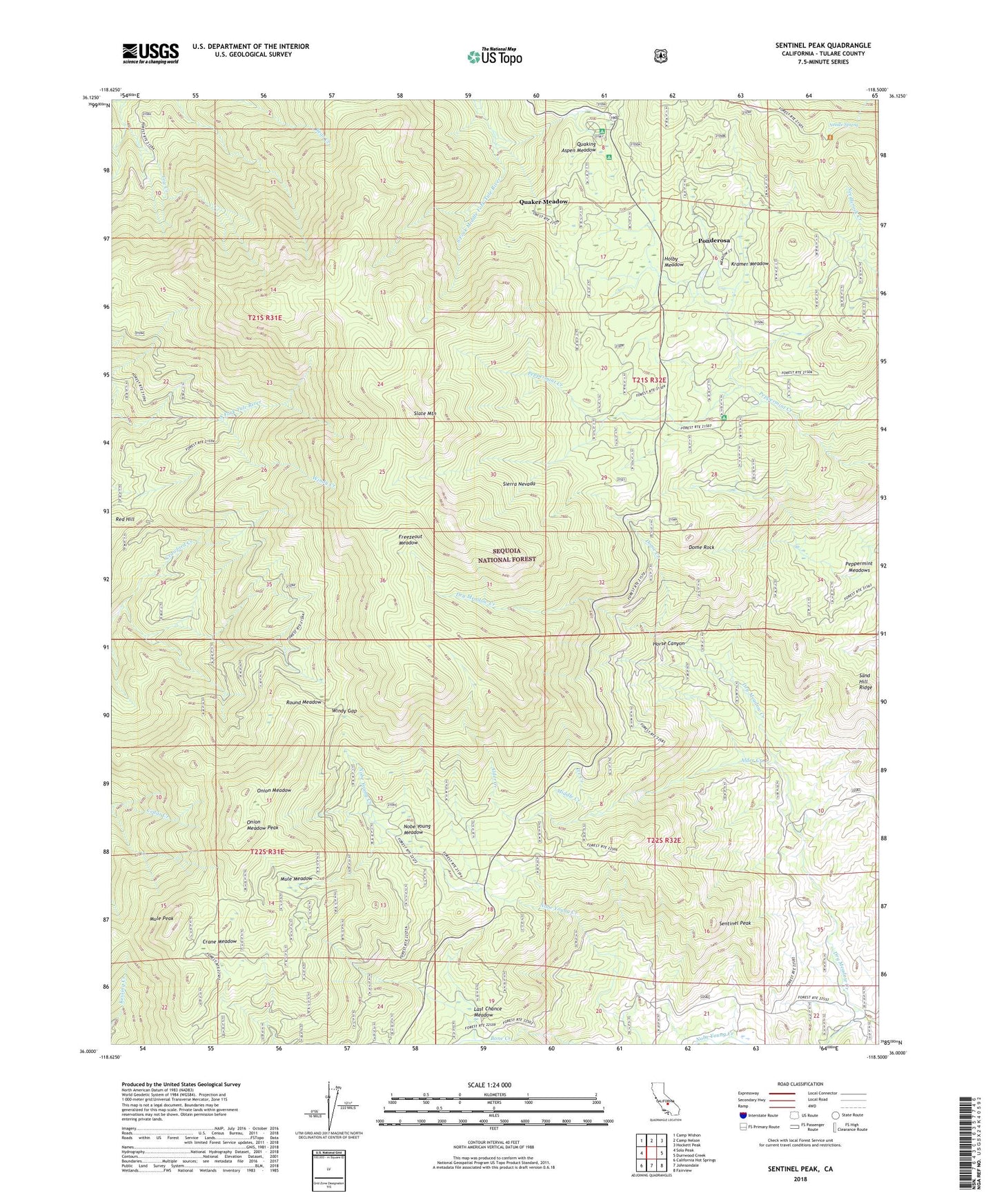
Sentinel Peak California US Topo Map
Couldn't load pickup availability
Also explore the Sentinel Peak Forest Service Topo of this same quad for updated USFS data
2021 topographic map quadrangle Sentinel Peak in the state of California. Scale: 1:24000. Based on the newly updated USGS 7.5' US Topo map series, this map is in the following counties: Tulare. The map contains contour data, water features, and other items you are used to seeing on USGS maps, but also has updated roads and other features. This is the next generation of topographic maps. Printed on high-quality waterproof paper with UV fade-resistant inks.
Quads adjacent to this one:
West: Solo Peak
Northwest: Camp Wishon
North: Camp Nelson
Northeast: Hockett Peak
East: Durrwood Creek
Southeast: Fairview
South: Johnsondale
Southwest: California Hot Springs
This map covers the same area as the classic USGS quad with code o36118a5.
Contains the following named places: Alder Creek, Camp Whitsett, Campground Guard Station, Carver Camp, Crane Meadow, Crane Meadow Camp, Crawford Camp, Crawford Creek, Dome Creek, Dome Rock, Freezeout Meadow, Giant Sequoia National Monument, Holby Meadow, Horse Canyon, Ice Creek, Kramer Meadow, Last Chance Meadow, Middle Creek, Mule Meadow, Mule Peak, Needle Spring, Nobe Young Creek, Nobe Young Meadow, Onion Meadow, Onion Meadow Peak, Peppermint Campground, Peppermint Heliport, Peyrone Camp, Peyrone Grove, Ponderosa, Ponderosa Census Designated Place, Quaker Meadow, Quaking Aspen Campground, Quaking Aspen Group Campground, Quaking Aspen Meadow, Red Hill Grove, Round Meadow, Sand Hill Ridge, Sentinel Peak, Sequoia National Forest, Slate Mountain, Summit Trail, Windy Gap, ZIP Code: 93208