
MyTopo
Seventeenmile Point California US Topo Map
Couldn't load pickup availability
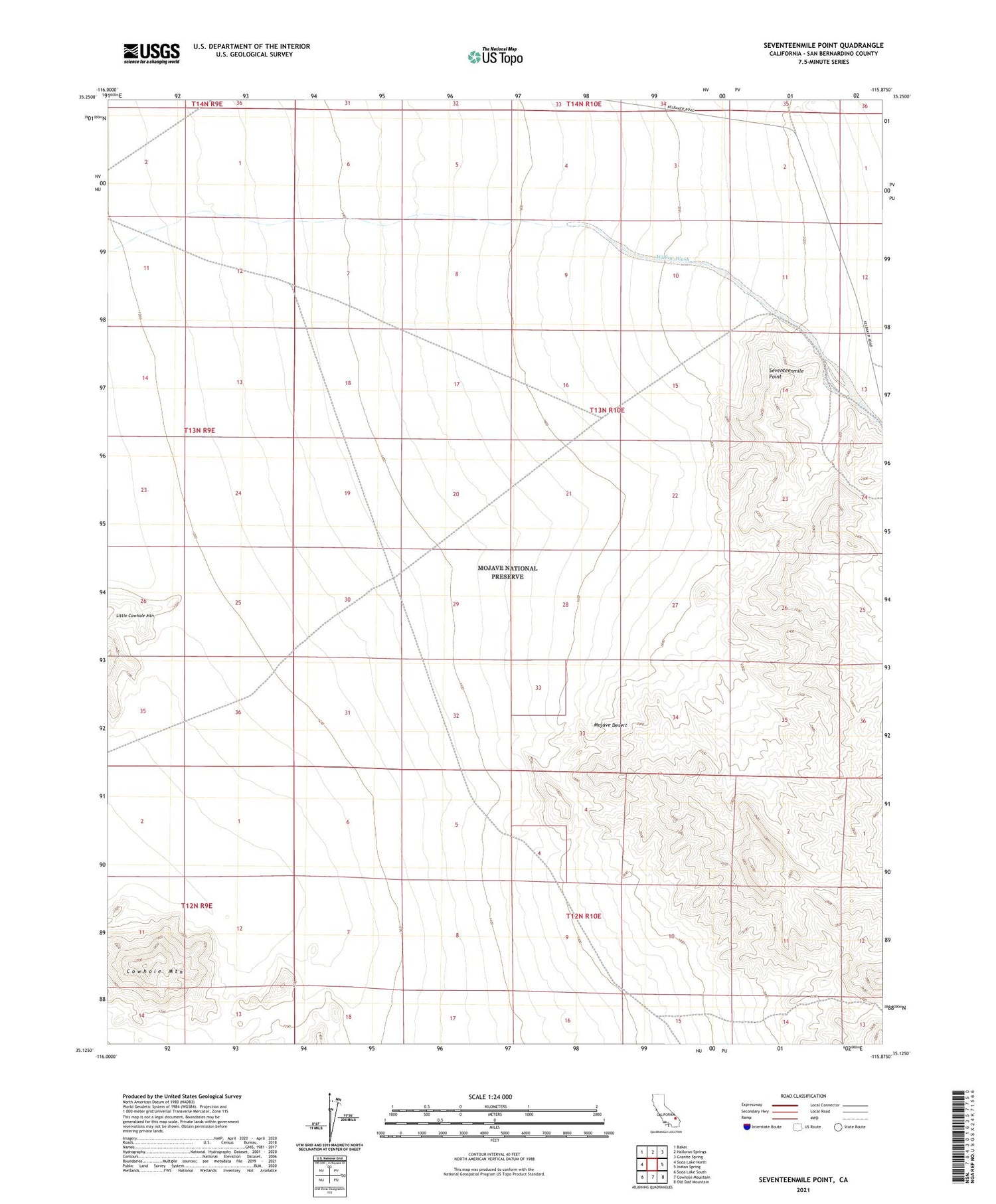
2021 topographic map quadrangle Seventeenmile Point in the state of California. Scale: 1:24000. Based on the newly updated USGS 7.5' US Topo map series, this map is in the following counties: San Bernardino. The map contains contour data, water features, and other items you are used to seeing on USGS maps, but also has updated roads and other features. This is the next generation of topographic maps. Printed on high-quality waterproof paper with UV fade-resistant inks.
Quads adjacent to this one:
West: Soda Lake North
Northwest: Baker
North: Halloran Springs
Northeast: Granite Spring
East: Indian Spring
Southeast: Old Dad Mountain
South: Cowhole Mountain
Southwest: Soda Lake South
This map covers the same area as the classic USGS quad with code o35115b8.
Contains the following named places: Branningan Mine, Cowhole Mountain, Indian Creek, Newberry Springs-Baker Division, Oro Fino Mine, Paymaster Mine, Seventeenmile Point, Tank Nine, Willow Wash


