MyTopo
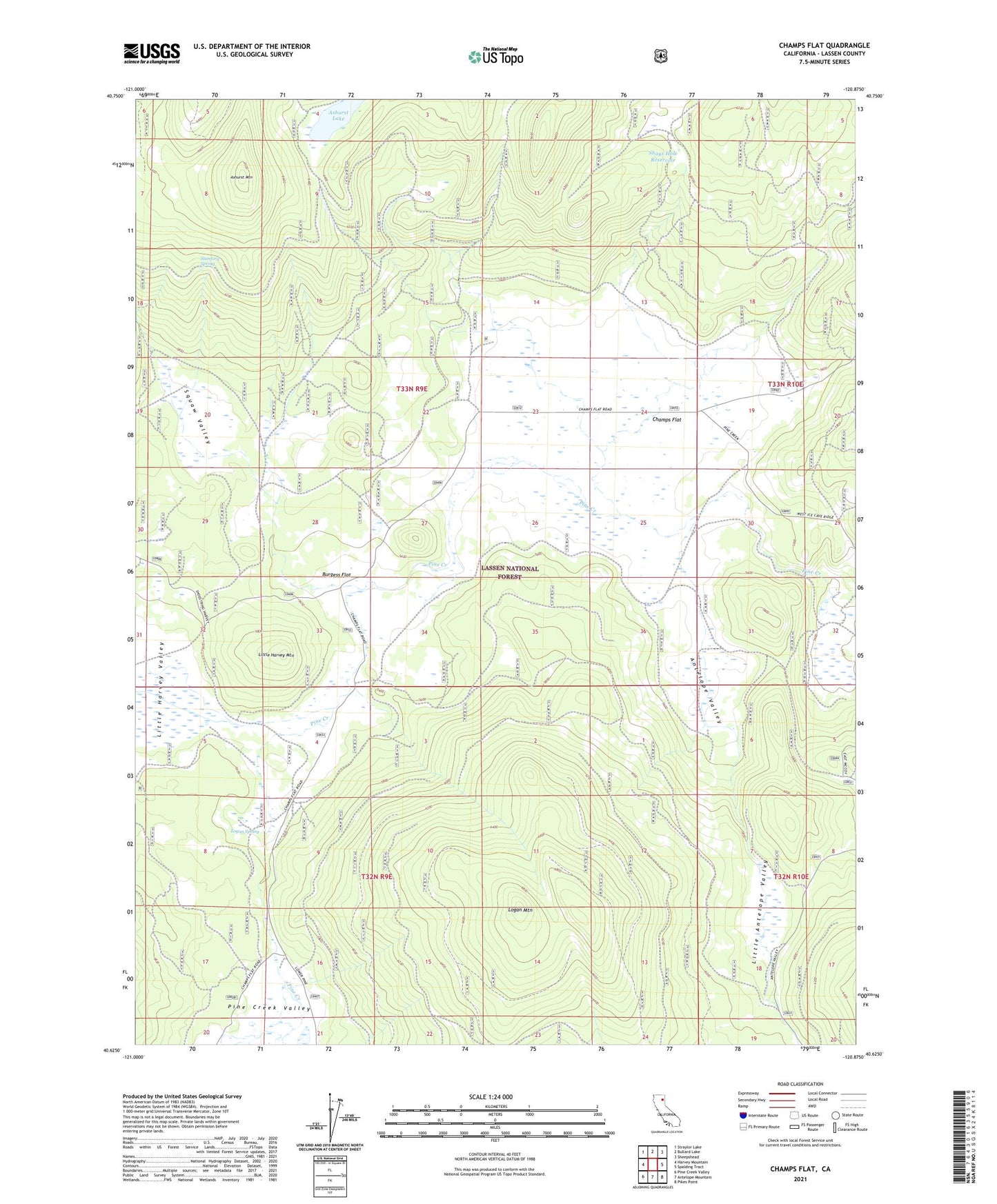
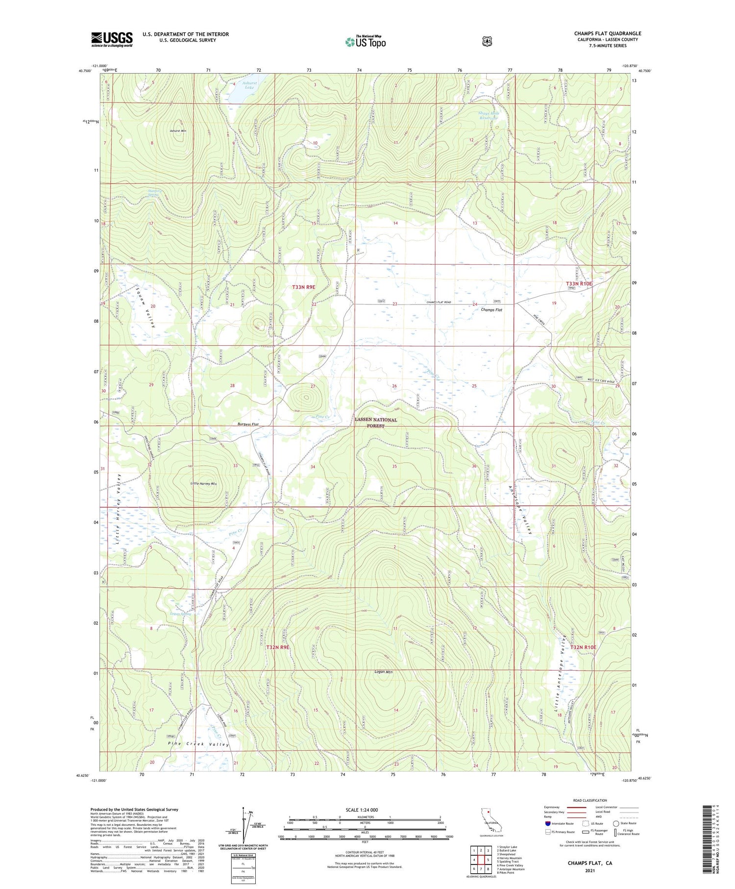
Champs Flat California US Topo Map
Couldn't load pickup availability
Also explore the Champs Flat Forest Service Topo of this same quad for updated USFS data
2023 topographic map quadrangle Champs Flat in the state of California. Scale: 1:24000. Based on the newly updated USGS 7.5' US Topo map series, this map is in the following counties: Lassen. The map contains contour data, water features, and other items you are used to seeing on USGS maps, but also has updated roads and other features. This is the next generation of topographic maps. Printed on high-quality waterproof paper with UV fade-resistant inks.
Quads adjacent to this one:
West: Harvey Mountain
Northwest: Straylor Lake
North: Bullard Lake
Northeast: Sheepshead
East: Spalding Tract
Southeast: Pikes Point
South: Antelope Mountain
Southwest: Pine Creek Valley
This map covers the same area as the classic USGS quad with code o40120f8.
Contains the following named places: Antelope Valley, Ashurst Lake, Ashurst Mountain, Burgess Flat, Camp Ten, Champs Flat, Fleming Well, Little Antelope Campground, Little Antelope Valley, Little Antelope Well, Little Harvey Mountain, Little Harvey Valley, Logan Mountain, Logan Spring, McCoy Water Pit, Opdyke Cow Camp, Pine Creek Valley, Salt Cabin, Shays Hole Reservoir, Smith Cow Camp, Squaw Valley, Stanford Headquarters, Stanford Spring, Stones Headquarters