MyTopo
Sisquoc California US Topo Map
Couldn't load pickup availability
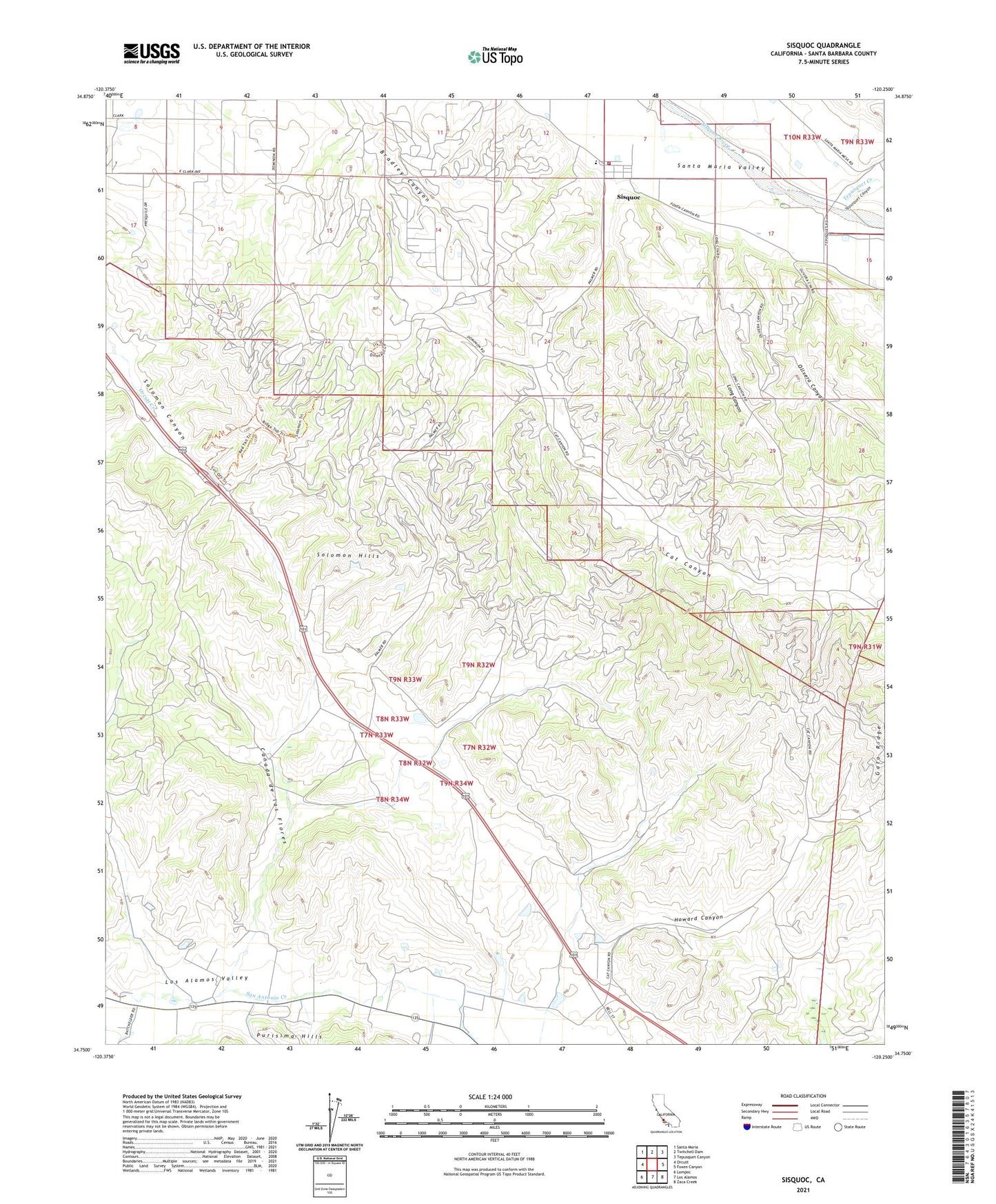
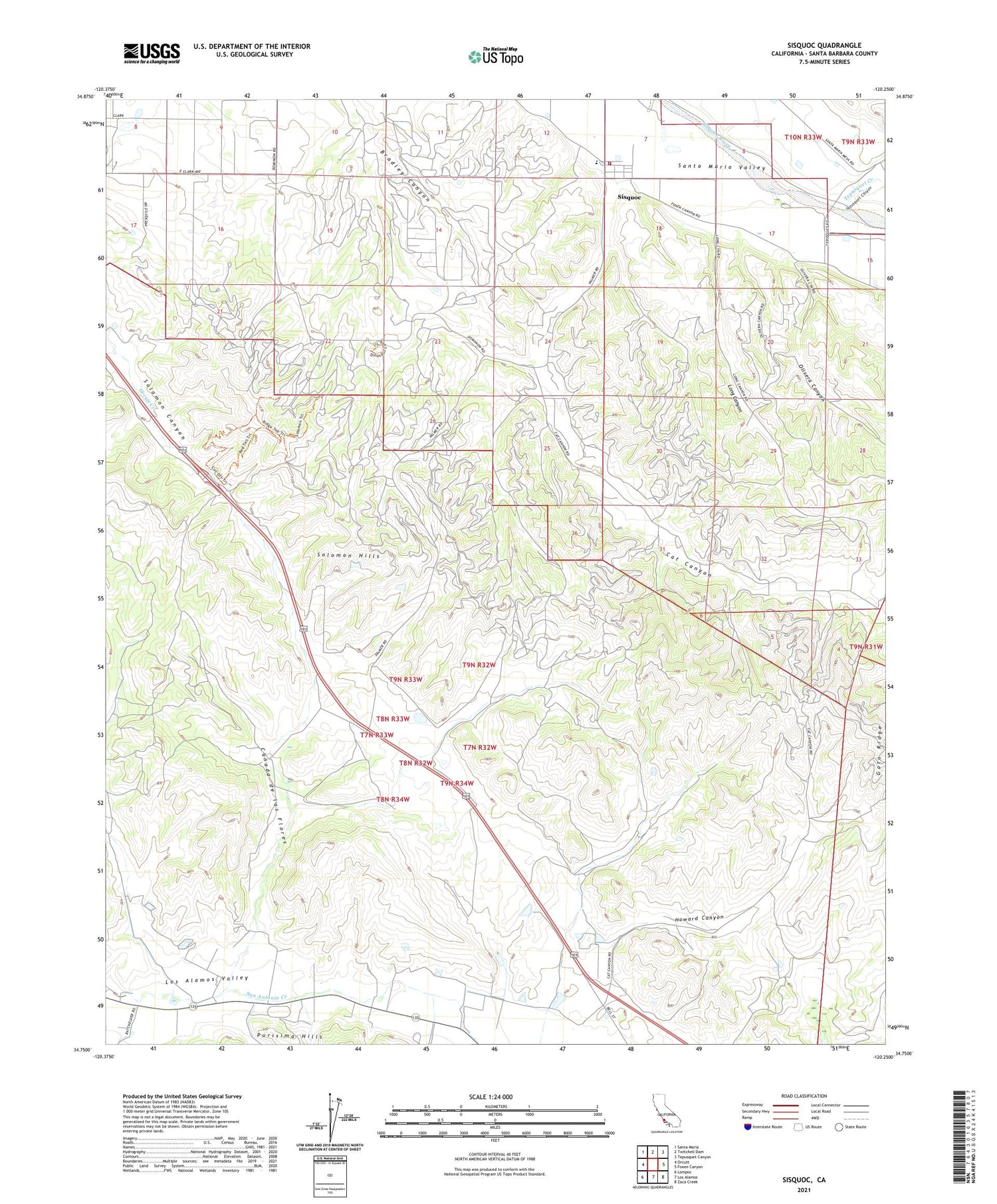
2021 topographic map quadrangle Sisquoc in the state of California. Scale: 1:24000. Based on the newly updated USGS 7.5' US Topo map series, this map is in the following counties: Santa Barbara. The map contains contour data, water features, and other items you are used to seeing on USGS maps, but also has updated roads and other features. This is the next generation of topographic maps. Printed on high-quality waterproof paper with UV fade-resistant inks.
Quads adjacent to this one:
West: Orcutt
Northwest: Santa Maria
North: Twitchell Dam
Northeast: Tepusquet Canyon
East: Foxen Canyon
Southeast: Zaca Creek
South: Los Alamos
Southwest: Lompoc
This map covers the same area as the classic USGS quad with code o34120g3.
Contains the following named places: Benjamin Foxen Elementary School, Blockman School, Canada de las Flores, Cat Canyon, Cat Canyon Oil Field, Gato Ridge, Howard Canyon, Long Canyon, Los Alamos, Olive School, Olivera Canyon, Palmer, Roadamite, Santa Barbara County Fire Department Station 23, Sisquoc, Sisquoc Census Designated Place, Sisquoc Grange, Sisquoc Quarry, Tepusquet Canyon, Tepusquet Creek