MyTopo
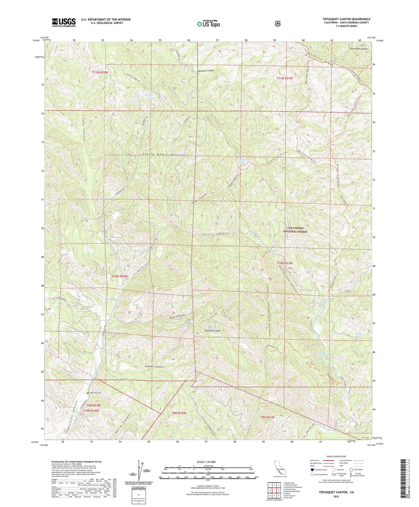
Tepusquet Canyon California US Topo Map
Couldn't load pickup availability
Also explore the Tepusquet Canyon Forest Service Topo of this same quad for updated USFS data
2021 topographic map quadrangle Tepusquet Canyon in the state of California. Scale: 1:24000. Based on the newly updated USGS 7.5' US Topo map series, this map is in the following counties: Santa Barbara. The map contains contour data, water features, and other items you are used to seeing on USGS maps, but also has updated roads and other features. This is the next generation of topographic maps. Printed on high-quality waterproof paper with UV fade-resistant inks.
Quads adjacent to this one:
West: Twitchell Dam
Northwest: Huasna Peak
North: Chimney Canyon
Northeast: Miranda Pine Mountain
East: Manzanita Mountain
Southeast: Zaca Lake
South: Foxen Canyon
Southwest: Sisquoc
This map covers the same area as the classic USGS quad with code o34120h2.
Contains the following named places: Adams Ranch, Alejandro Campsite, Barrel Springs, Barrel Springs Recreation Site, Bear Campsite, Bear Canyon, Cherokee Spring, Cigarette Spring, Colson Canyon, Colson Canyon Campgrounds, Colson Summit Quarry, Difficult Spring, Goodchild Ranch, Horseshoe Springs Recreation, Hudson Canyon, KCOY-TV (Santa Maria), KXFM-FM (Santa Maria), North Fork La Brea Creek, Oak Valley Creek, Ontiveros Cemetery, Peach Tree Spring, Rattlesnake Canyon, Ruiz Canyon, South Fork La Brea Creek, Suey Canyon, Tepusquet Peak, Tyler Canyon, Webber Ranch