MyTopo
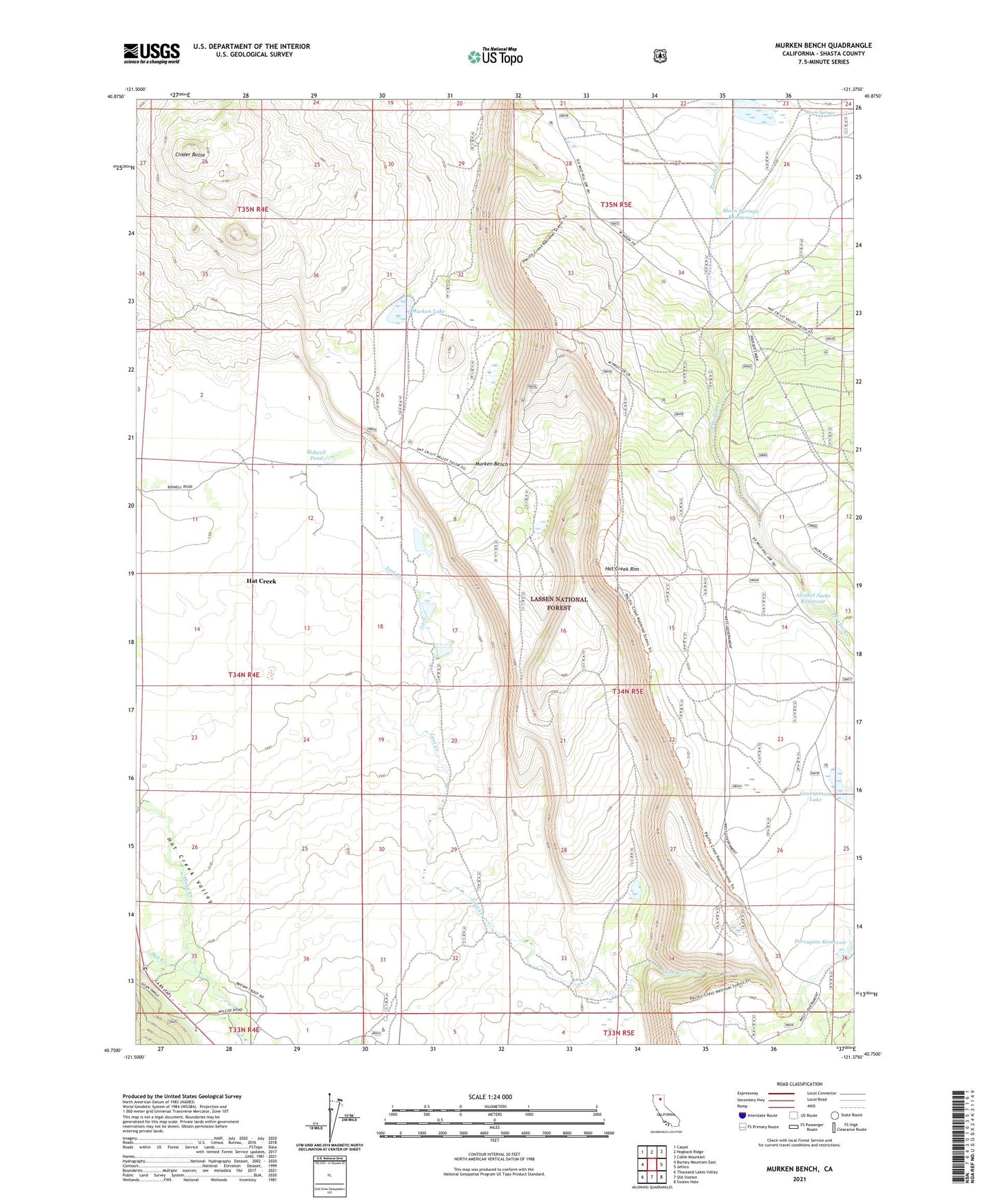
Murken Bench California US Topo Map
Couldn't load pickup availability
Also explore the Murken Bench Forest Service Topo of this same quad for updated USFS data
2021 topographic map quadrangle Murken Bench in the state of California. Scale: 1:24000. Based on the newly updated USGS 7.5' US Topo map series, this map is in the following counties: Shasta. The map contains contour data, water features, and other items you are used to seeing on USGS maps, but also has updated roads and other features. This is the next generation of topographic maps. Printed on high-quality waterproof paper with UV fade-resistant inks.
Quads adjacent to this one:
West: Burney Mountain East
Northwest: Cassel
North: Hogback Ridge
Northeast: Coble Mountain
East: Jellico
Southeast: Swains Hole
South: Old Station
Southwest: Thousand Lakes Valley
This map covers the same area as the classic USGS quad with code o40121g4.
Contains the following named places: Alcohol Jacks Reservoir, Bald Mountain Reservoir, Bidwell Pond, Bidwell Ranch, Cinder Butte, Government Lake, Government Well, Hat Creek Census Designated Place, Hat Creek Rim, Hat Creek Rim Lookout, Little Lake, Lost Creek, Moon Springs, Moon Springs Reservoir, Murken Bench, Murken Lake, Porcupine Reservoir, Procter Creek, Proctor Creek Dam, University of California Observatory, Wilcox School, Wilson Reservoir, ZIP Code: 96040