MyTopo
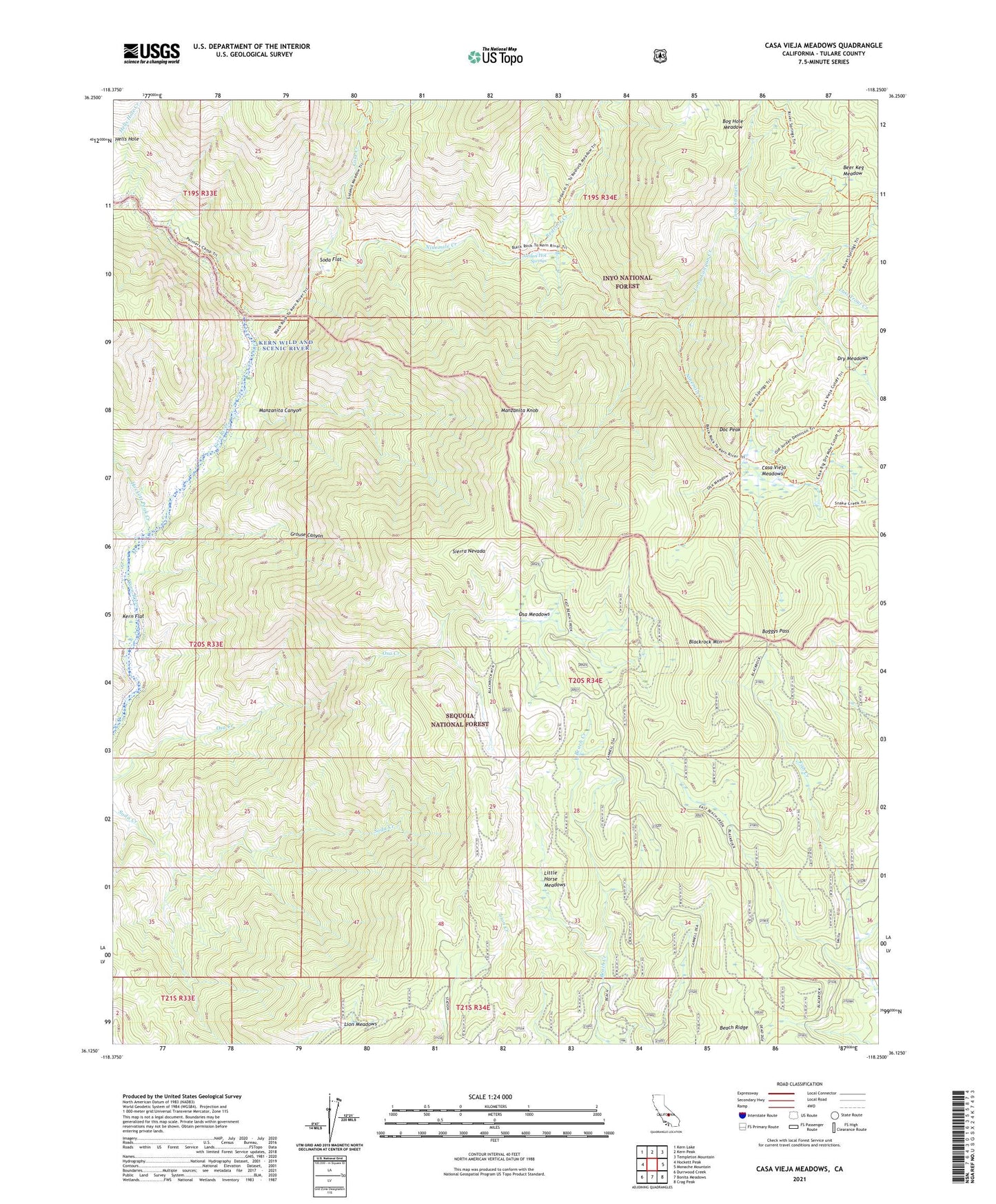
Casa Vieja Meadows California US Topo Map
Couldn't load pickup availability
Also explore the Casa Vieja Meadows Forest Service Topo of this same quad for updated USFS data
2021 topographic map quadrangle Casa Vieja Meadows in the state of California. Scale: 1:24000. Based on the newly updated USGS 7.5' US Topo map series, this map is in the following counties: Tulare. The map contains contour data, water features, and other items you are used to seeing on USGS maps, but also has updated roads and other features. This is the next generation of topographic maps. Printed on high-quality waterproof paper with UV fade-resistant inks.
Quads adjacent to this one:
West: Hockett Peak
Northwest: Kern Lake
North: Kern Peak
Northeast: Templeton Mountain
East: Monache Mountain
Southeast: Crag Peak
South: Bonita Meadows
Southwest: Durrwood Creek
This map covers the same area as the classic USGS quad with code o36118b3.
Contains the following named places: Beach Meadows Guard Station, Beer Keg Meadow, Blackrock Mountain, Bog Hole Meadow, Boggys Pass, Casa Vieja Meadows, Casa Vieja Meadows Forest Service Facility, Cold Creek, Doc Peak, Dry Meadows, Grouse Canyon, Hockett Peak Creek, Jordan Hot Springs, Kern Flat, Lion Meadows, Little Horse Meadows, Long Canyon Creek, Long Stringer, Lost Trout Creek, Manzanita Canyon, Manzanita Knob, Ninemile Creek, Osa Meadows, Painter Camp, Redrock Creek, Soda Flat