MyTopo
Bradley California US Topo Map
Couldn't load pickup availability
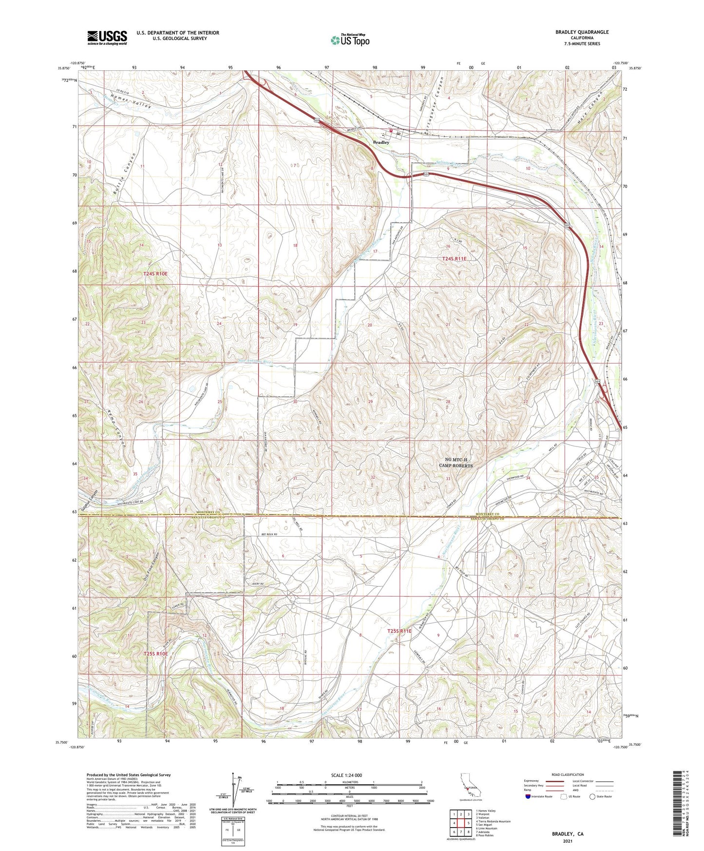
2021 topographic map quadrangle Bradley in the state of California. Scale: 1:24000. Based on the newly updated USGS 7.5' US Topo map series, this map is in the following counties: Monterey, San Luis Obispo. The map contains contour data, water features, and other items you are used to seeing on USGS maps, but also has updated roads and other features. This is the next generation of topographic maps. Printed on high-quality waterproof paper with UV fade-resistant inks.
Quads adjacent to this one:
West: Tierra Redonda Mountain
Northwest: Hames Valley
North: Wunpost
Northeast: Valleton
East: San Miguel
Southeast: Paso Robles
South: Adelaida
Southwest: Lime Mountain
This map covers the same area as the classic USGS quad with code o35120g7.
Contains the following named places: Bradley, Bradley Branch Monterey County Free Libraries, Bradley Census Designated Place, Bradley Elementary School, Bradley Post Office, Buttle Canyon, California Department of Forestry and Fire Protection Bradley Station 40, Camp Roberts, Hare Canyon, Kemp Canyon, King Well, Nacimiento Ranch, Nacimiento River, Nacimiento School, Oro Fino Canyon, Pleyto Well, Portuguese Canyon, San Antonio River, Sulphur Canyon