MyTopo
Valley Ford California US Topo Map
Couldn't load pickup availability
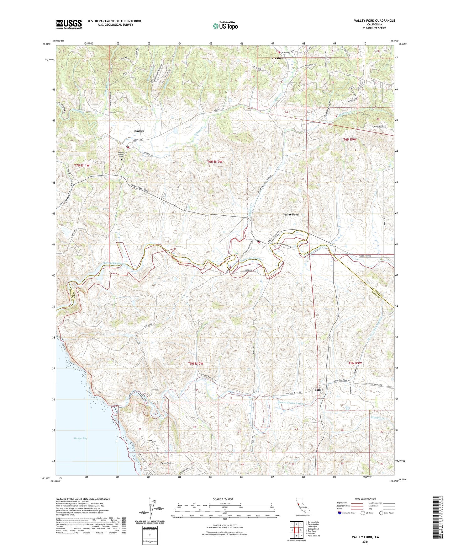
2021 topographic map quadrangle Valley Ford in the state of California. Scale: 1:24000. Based on the newly updated USGS 7.5' US Topo map series, this map is in the following counties: Sonoma, Marin. The map contains contour data, water features, and other items you are used to seeing on USGS maps, but also has updated roads and other features. This is the next generation of topographic maps. Printed on high-quality waterproof paper with UV fade-resistant inks.
Quads adjacent to this one:
West: Bodega Head
Northwest: Duncans Mills
North: Camp Meeker
Northeast: Sebastopol
East: Two Rock
Southeast: Point Reyes NE
South: Tomales
This map covers the same area as the classic USGS quad with code o38122c8.
Contains the following named places: Americano Creek, Bodega, Bodega Calvary Cemetery, Bodega Census Designated Place, Bodega Post Office, Bodega Volunteer Fire Department, Burnside School, Canada De Pogolimi, Christo and Jeanne-Claude Running Fence Park, Church of Saint Teresa of Avila, Clark School, Dillon Beach, Ebabias Creek, Estero Americano, Estero de San Antonio, Estero School, Fallon, Freestone, Gold Ridge Fire Protection District Station 3, James E Potter Elementary School, Joy Woods Redwood Tree Farm, Moretti Family Dairy, Nolan Creek, Renati Dairy, Stemple Creek, Sugarloaf, Tannery Creek, Thurston Creek, Valley Ford, Valley Ford Census Designated Place, Valley Ford Post Office, Valley Ford Volunteer Fire Department, Watson School, Watson School Historic Park, ZIP Codes: 94922, 94929, 94972