MyTopo
Two Rock California US Topo Map
Couldn't load pickup availability
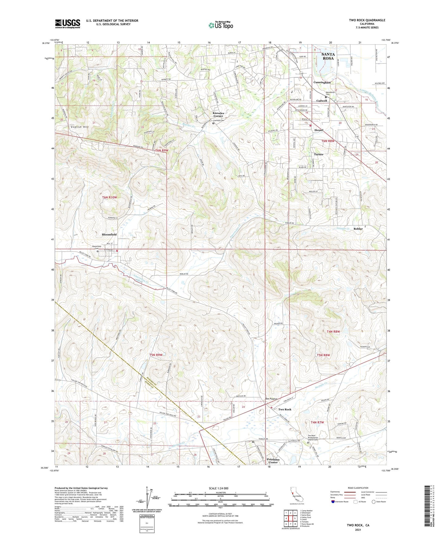
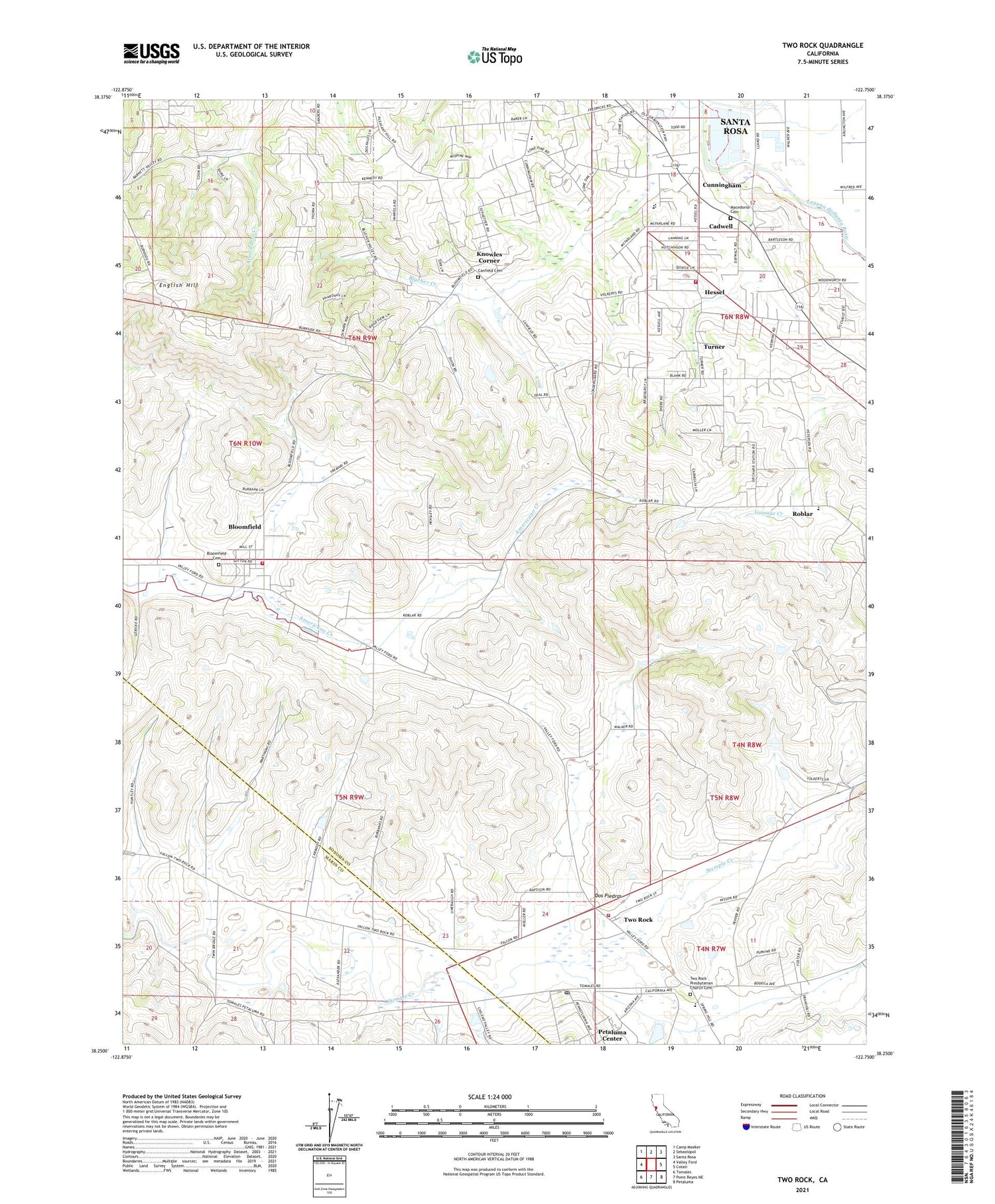
2021 topographic map quadrangle Two Rock in the state of California. Scale: 1:24000. Based on the newly updated USGS 7.5' US Topo map series, this map is in the following counties: Sonoma, Marin. The map contains contour data, water features, and other items you are used to seeing on USGS maps, but also has updated roads and other features. This is the next generation of topographic maps. Printed on high-quality waterproof paper with UV fade-resistant inks.
Quads adjacent to this one:
West: Valley Ford
Northwest: Camp Meeker
North: Sebastopol
Northeast: Santa Rosa
East: Cotati
Southeast: Petaluma
South: Point Reyes NE
Southwest: Tomales
This map covers the same area as the classic USGS quad with code o38122c7.
Contains the following named places: Albini Ranch, Alma De Luna Dairy, Aurora School, Bellwether Farms, Bloomfield, Bloomfield Cemetery, Bloomfield Census Designated Place, Bloomfield School, Bloomfield Volunteer Fire Department, Blucher, Cadwell, Canfield Cemetery, Canfield School, Coast Guard Training Center Petaluma, Cunningham, Dos Piedras, Dunham Elementary School, Emma Herbert Memorial Park, English Hill, Eucalyptus School, Fredericks, Gold Ridge Fire Protection District Station 1 Headquarters, Gold Ridge School, Gravenstein Elementary School, Hessel, Hessel Union Church, Hillcrest Middle School, Knowles Corner, Macedonia Cemetery, Martinoni Quarry, McClelland's Dairy, Meadow Lane 1050-003 Dam, Meadows Dairy, Mount Vernon School, Orchard, Petaluma Center, Petaluma Coast Guard Training Center, Petersen Brothers Dairy, Roblar, Sebastopol Division, Turner, Two Rock, Two Rock Church, Two Rock Coast Guard Station Post Office, Two Rock Elementary School, Two Rock Presbyterian Church Cemetery, Two Rock School, Two Rock Union School, Two Rock Volunteer Fire Department, Walker School, Woodworth