MyTopo
Vanguard California US Topo Map
Couldn't load pickup availability
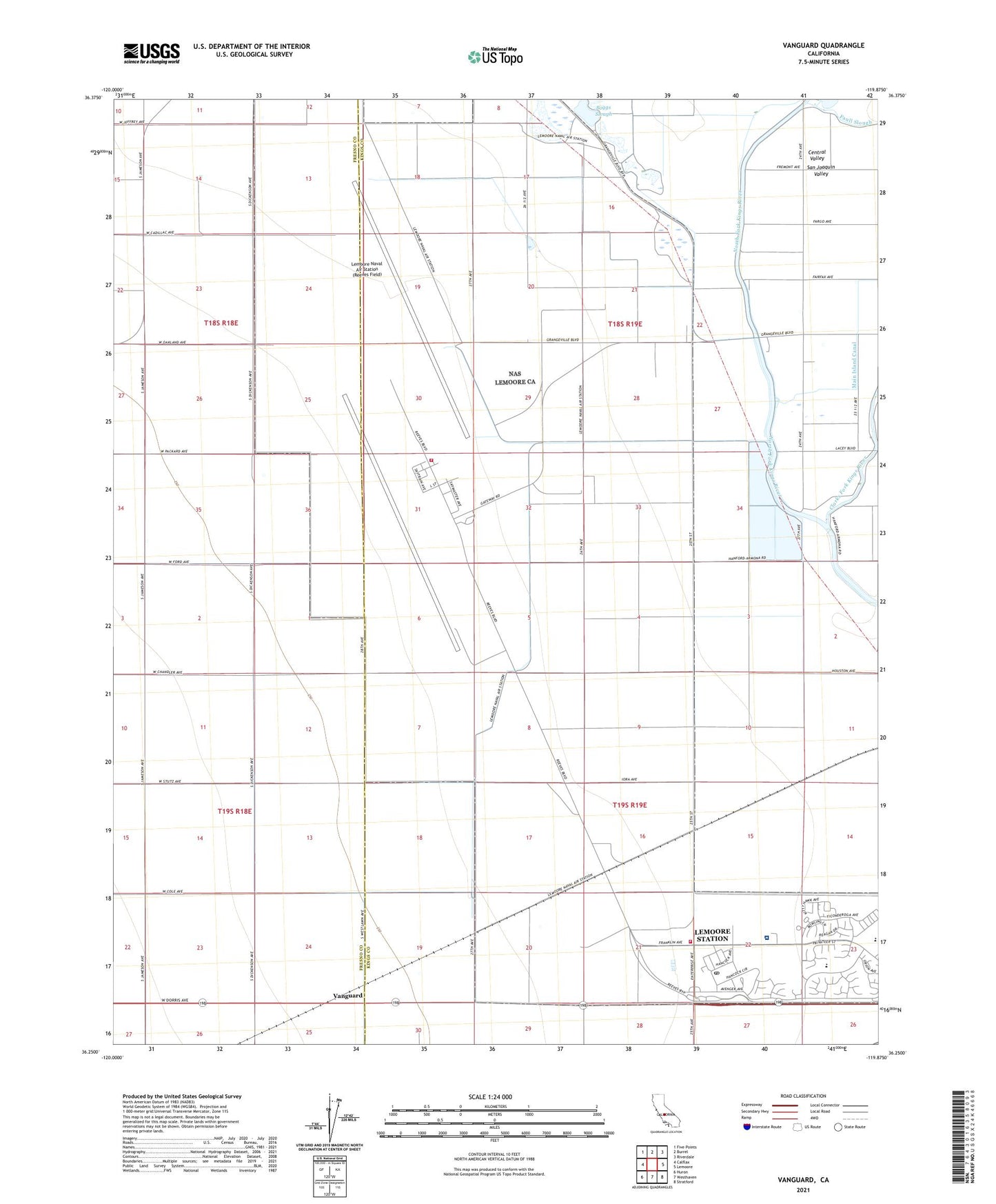
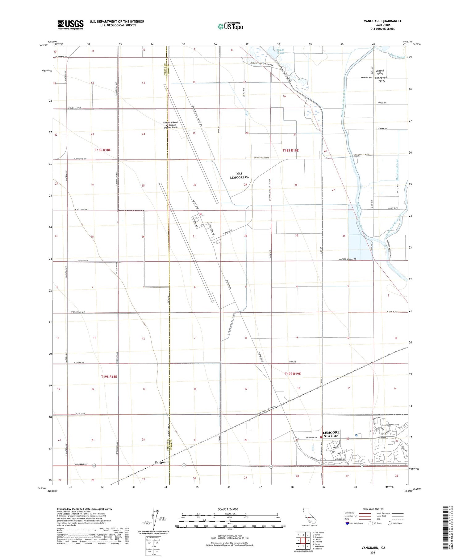
2021 topographic map quadrangle Vanguard in the state of California. Scale: 1:24000. Based on the newly updated USGS 7.5' US Topo map series, this map is in the following counties: Kings, Fresno. The map contains contour data, water features, and other items you are used to seeing on USGS maps, but also has updated roads and other features. This is the next generation of topographic maps. Printed on high-quality waterproof paper with UV fade-resistant inks.
Quads adjacent to this one:
West: Calflax
Northwest: Five Points
North: Burrel
Northeast: Riverdale
East: Lemoore
Southeast: Stratford
South: Westhaven
Southwest: Huron
This map covers the same area as the classic USGS quad with code o36119c8.
Contains the following named places: Barlow Ranch, Boggs Slough, Clarks Fork Kings River, Double O Ranch, Droogh Dairy, Lemoore Naval Air Station (Reeves Field), Lemoore Naval Air Station Post Office, Lemoore Station Census Designated Place, Lethent, Lethent School, Lima Dairy, Main Island Canal, Naval Air Station Lemoore, Naval Air Station Lemoore Federal Fire Department, Naval Air Station Lemoore Federal Fire Department Operations Crash Station, Naval Hospital Lemoore, Neutra Elementary School, Polder Ranch, San Jose School, Vanguard