MyTopo
Walker Pass California US Topo Map
Couldn't load pickup availability
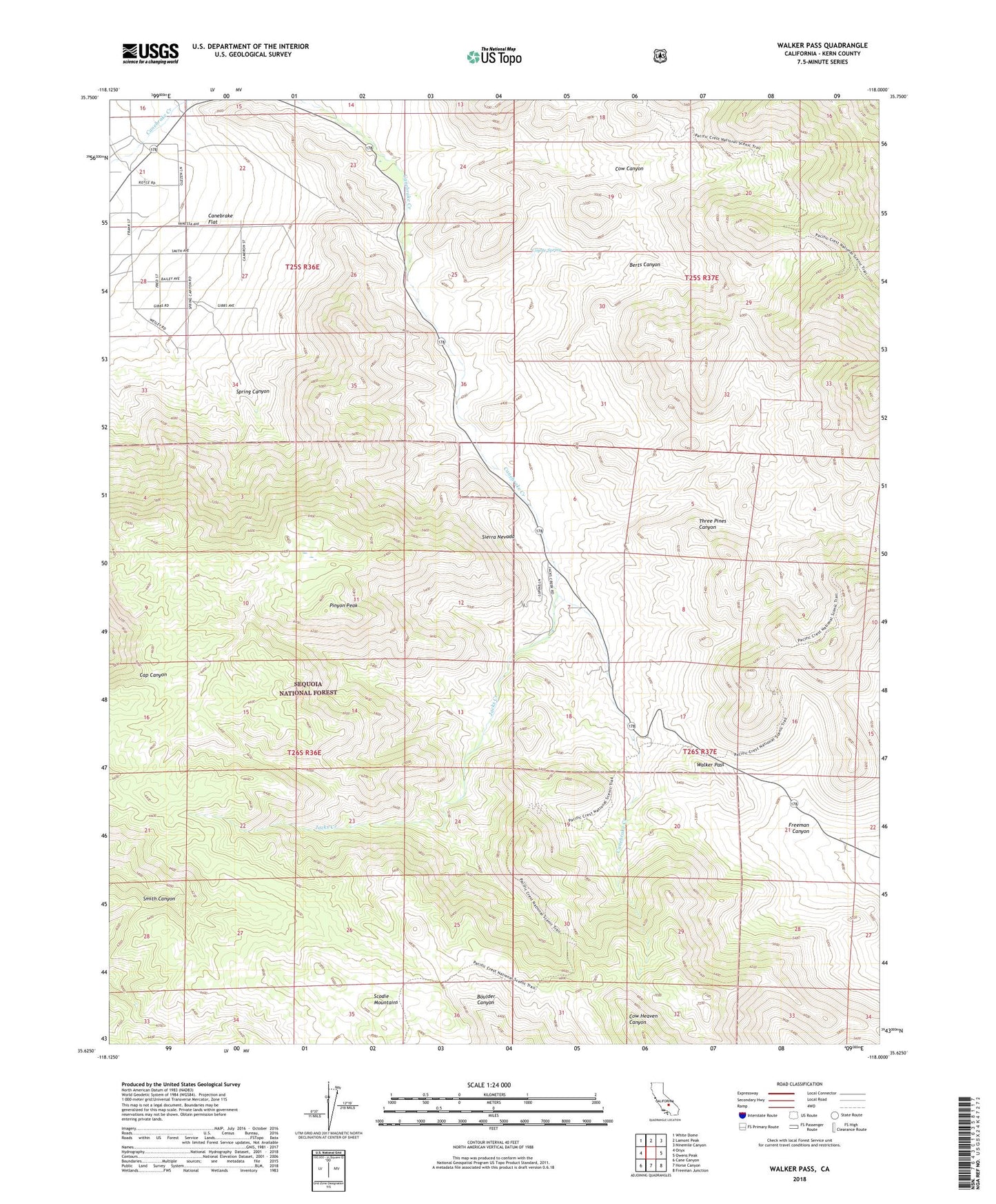
2021 topographic map quadrangle Walker Pass in the state of California. Scale: 1:24000. Based on the newly updated USGS 7.5' US Topo map series, this map is in the following counties: Kern. The map contains contour data, water features, and other items you are used to seeing on USGS maps, but also has updated roads and other features. This is the next generation of topographic maps. Printed on high-quality waterproof paper with UV fade-resistant inks.
Quads adjacent to this one:
West: Onyx
Northwest: White Dome
North: Lamont Peak
Northeast: Ninemile Canyon
East: Owens Peak
Southeast: Freeman Junction
South: Horse Canyon
Southwest: Cane Canyon
This map covers the same area as the classic USGS quad with code o35118f1.
Contains the following named places: Berts Canyon, Canebrake, Canebrake Flat, Cow Canyon, Coyote Spring, Freeman Well, Gleason Ranch, Jacks Creek, Jacks Station, Pilot Well, Pinyon Peak, Scodie Mountains, Spring Canyon, Three Pines Canyon, Walker Pass, Walker Pass Campground, ZIP Code: 93255