MyTopo
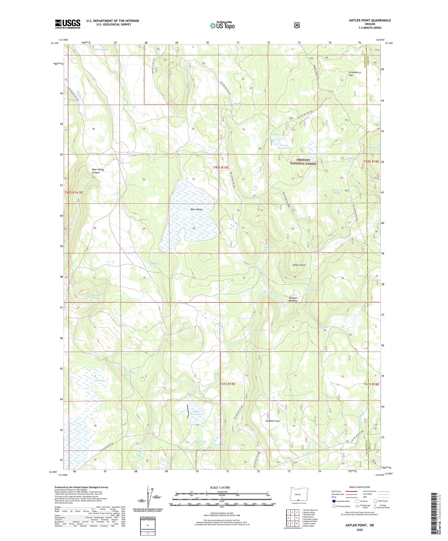
Antler Point Oregon US Topo Map
Couldn't load pickup availability
Also explore the Antler Point Forest Service Topo of this same quad for updated USFS data
2023 topographic map quadrangle Antler Point in the state of Oregon. Scale: 1:24000. Based on the newly updated USGS 7.5' US Topo map series, this map is in the following counties: Klamath, Lake. The map contains contour data, water features, and other items you are used to seeing on USGS maps, but also has updated roads and other features. This is the next generation of topographic maps. Printed on high-quality waterproof paper with UV fade-resistant inks.
Quads adjacent to this one:
West: Brady Butte
Northwest: Gerber Reservoir
North: Barnes Valley
Northeast: Arkansas Flat
East: Strawberry Butte
Southeast: Weed Valley
South: Steele Swamp
Southwest: Sagebrush Butte
This map covers the same area as the classic USGS quad with code o42120a8.
Contains the following named places: Adobe Flat, Antler Point, Antler Spring, Bear Valley, Bug Spring, Coleman Spring, Cottonwood Spring, Cronin Reservoir, Cronin Spring, Deer Spring, Grohs Dam, Grohs Reservoir, Gwinn Spring, Holbrook Spring, Johnson Meadow, Log Cabin Spring, Lost Lake, Mud Spring, Mud Spring Camp, Rock Camp Spring, Rock Creek Springs, Sorghum Flat, Warm Spring, Willow Spring