MyTopo
White Horse Mountain California US Topo Map
Couldn't load pickup availability
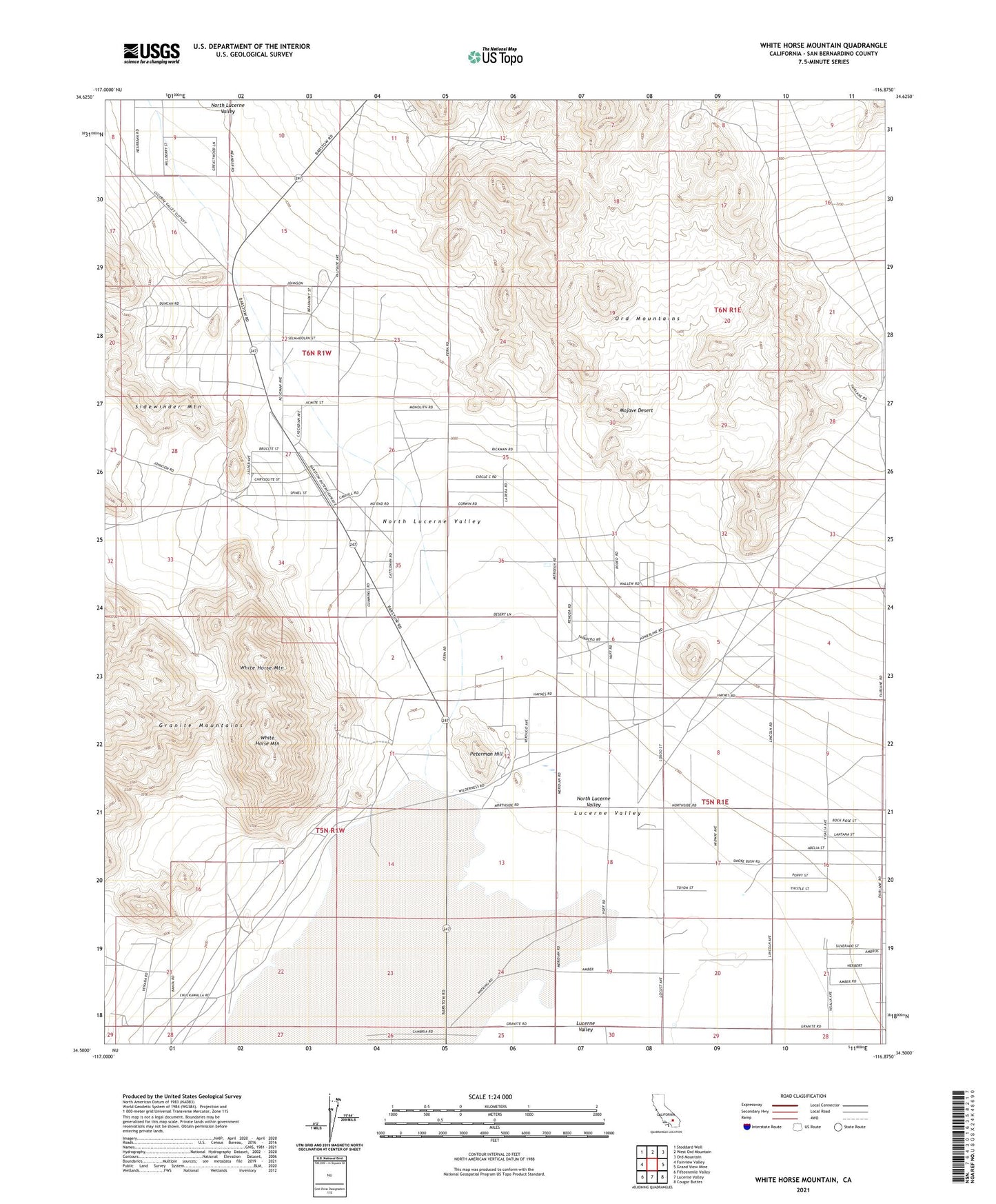
2023 topographic map quadrangle White Horse Mountain in the state of California. Scale: 1:24000. Based on the newly updated USGS 7.5' US Topo map series, this map is in the following counties: San Bernardino. The map contains contour data, water features, and other items you are used to seeing on USGS maps, but also has updated roads and other features. This is the next generation of topographic maps. Printed on high-quality waterproof paper with UV fade-resistant inks.
Quads adjacent to this one:
West: Fairview Valley
Northwest: Stoddard Well
North: West Ord Mountain
Northeast: Ord Mountain
East: Grand View Mine
Southeast: Cougar Buttes
South: Lucerne Valley
Southwest: Fifteenmile Valley
This map covers the same area as the classic USGS quad with code o34116e8.
Contains the following named places: KJQI-AM (Costa Mesa), KJQI-AM (Hesperia), Lucerne Lake, Lucerne Valley, North Lucerne Valley, Peterman Hill, White Horse Mountain, ZIP Code: 92356