MyTopo
Winters California US Topo Map
Couldn't load pickup availability
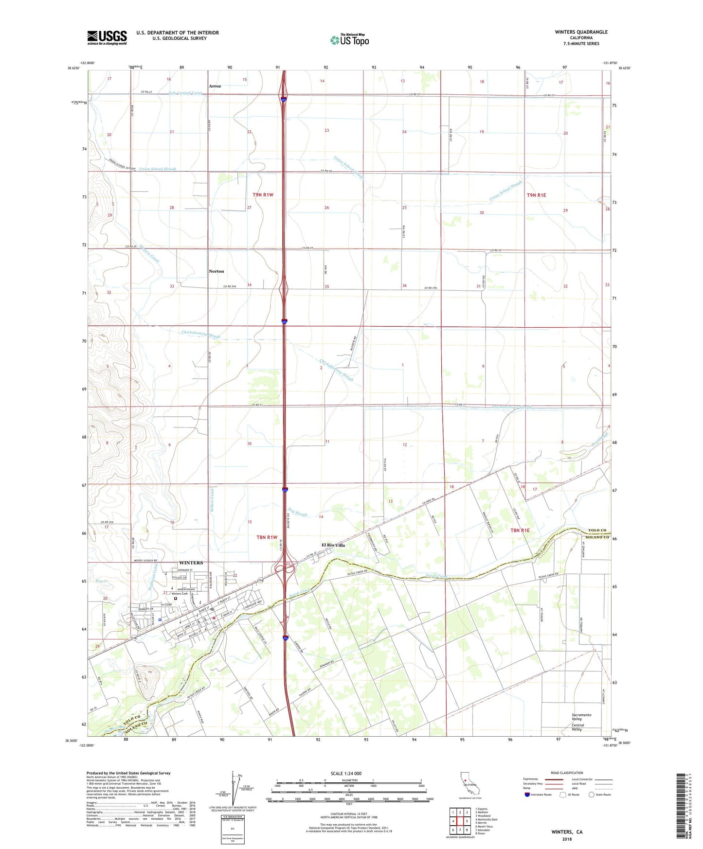
2021 topographic map quadrangle Winters in the state of California. Scale: 1:24000. Based on the newly updated USGS 7.5' US Topo map series, this map is in the following counties: Yolo, Solano. The map contains contour data, water features, and other items you are used to seeing on USGS maps, but also has updated roads and other features. This is the next generation of topographic maps. Printed on high-quality waterproof paper with UV fade-resistant inks.
Quads adjacent to this one:
West: Monticello Dam
Northwest: Esparto
North: Madison
Northeast: Woodland
East: Merritt
Southeast: Dixon
South: Allendale
Southwest: Mount Vaca
This map covers the same area as the classic USGS quad with code o38121e8.
Contains the following named places: Arroz, City of Winters, Dixon Ridge Farms, Dry Creek, El Rio Villa, Felica Diaz Park, Highland Canal, John Clayton Kinderschool, Liwaito, Norton, Rio De Los Putos, Union School, Valley Oak Park, Waggoner Elementary School, Willow Canal, Winters, Winters Branch Yolo County Library, Winters Cemetery, Winters City Hall, Winters Fire Department, Winters High School, Winters Middle School, Winters Mobile Home Park, Winters Police Department, Winters Post Office, Wolfskill School, Yolo Central Canal