MyTopo
Monticello Dam California US Topo Map
Couldn't load pickup availability
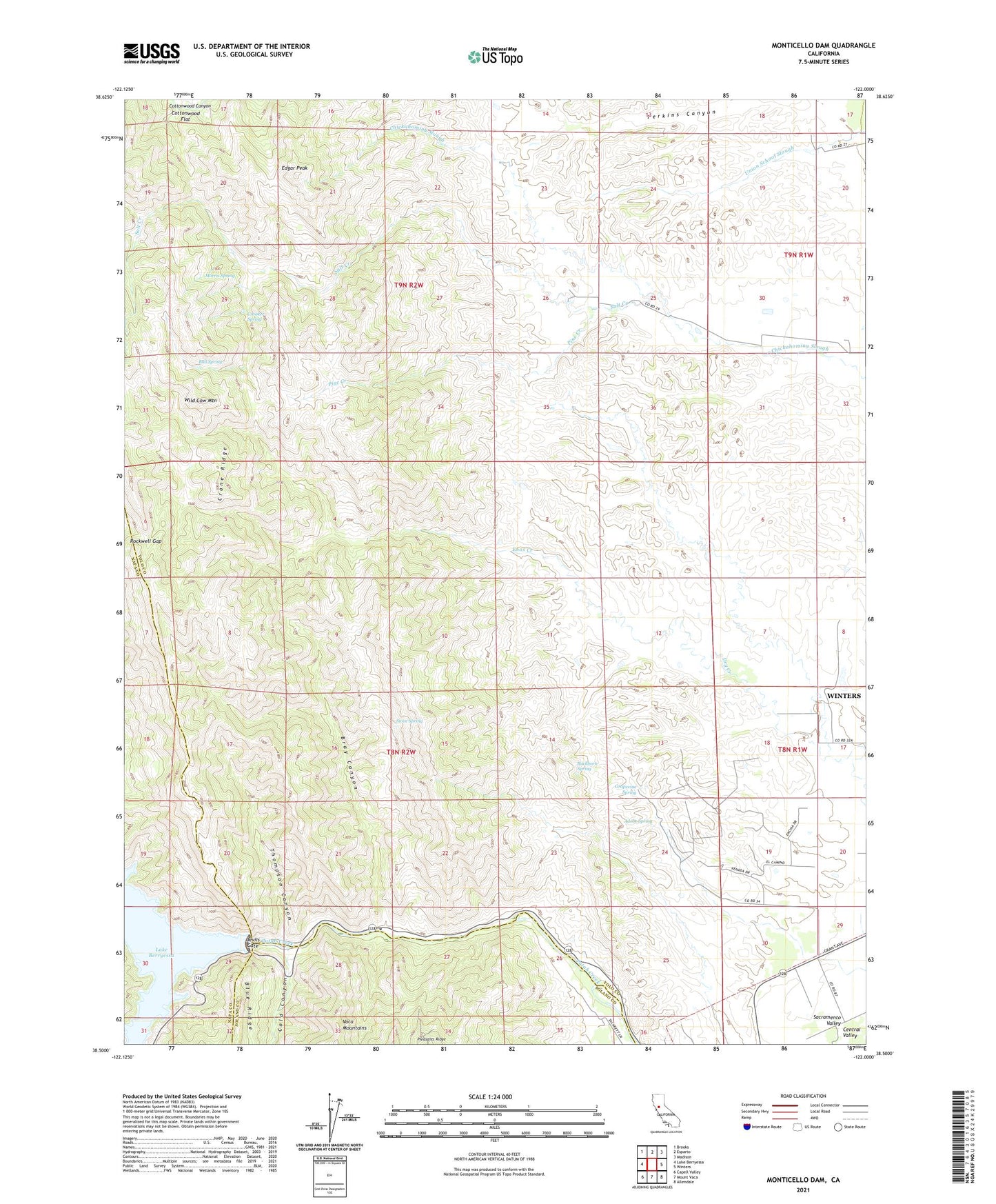
2021 topographic map quadrangle Monticello Dam in the state of California. Scale: 1:24000. Based on the newly updated USGS 7.5' US Topo map series, this map is in the following counties: Yolo, Solano, Napa. The map contains contour data, water features, and other items you are used to seeing on USGS maps, but also has updated roads and other features. This is the next generation of topographic maps. Printed on high-quality waterproof paper with UV fade-resistant inks.
Quads adjacent to this one:
West: Lake Berryessa
Northwest: Brooks
North: Esparto
Northeast: Madison
East: Winters
Southeast: Allendale
South: Mount Vaca
Southwest: Capell Valley
This map covers the same area as the classic USGS quad with code o38122e1.
Contains the following named places: Adobe Spring, Apricot School, Bray Canyon, Buckhorn Spring, Bull Spring, Chapmans Upper Ranch, Cold Canyon, Cowell Ranch, Crane Ridge, Crooker Spring, Devils Gate, Edgar Peak, Enos Creek, Grapevine Spring, Markley Canyon, Monticello Dam, Morris Spring, Pine Creek, Putah Creek State Wildlife Area, Rockwell Gap, Salt Creek, Scott Cabin, Scott Ranch, Stove Spring, Thompson Canyon, Wild Cow Mountain, Winters Division, ZIP Code: 95694