
MyTopo
Yosemite Lake California US Topo Map
Couldn't load pickup availability
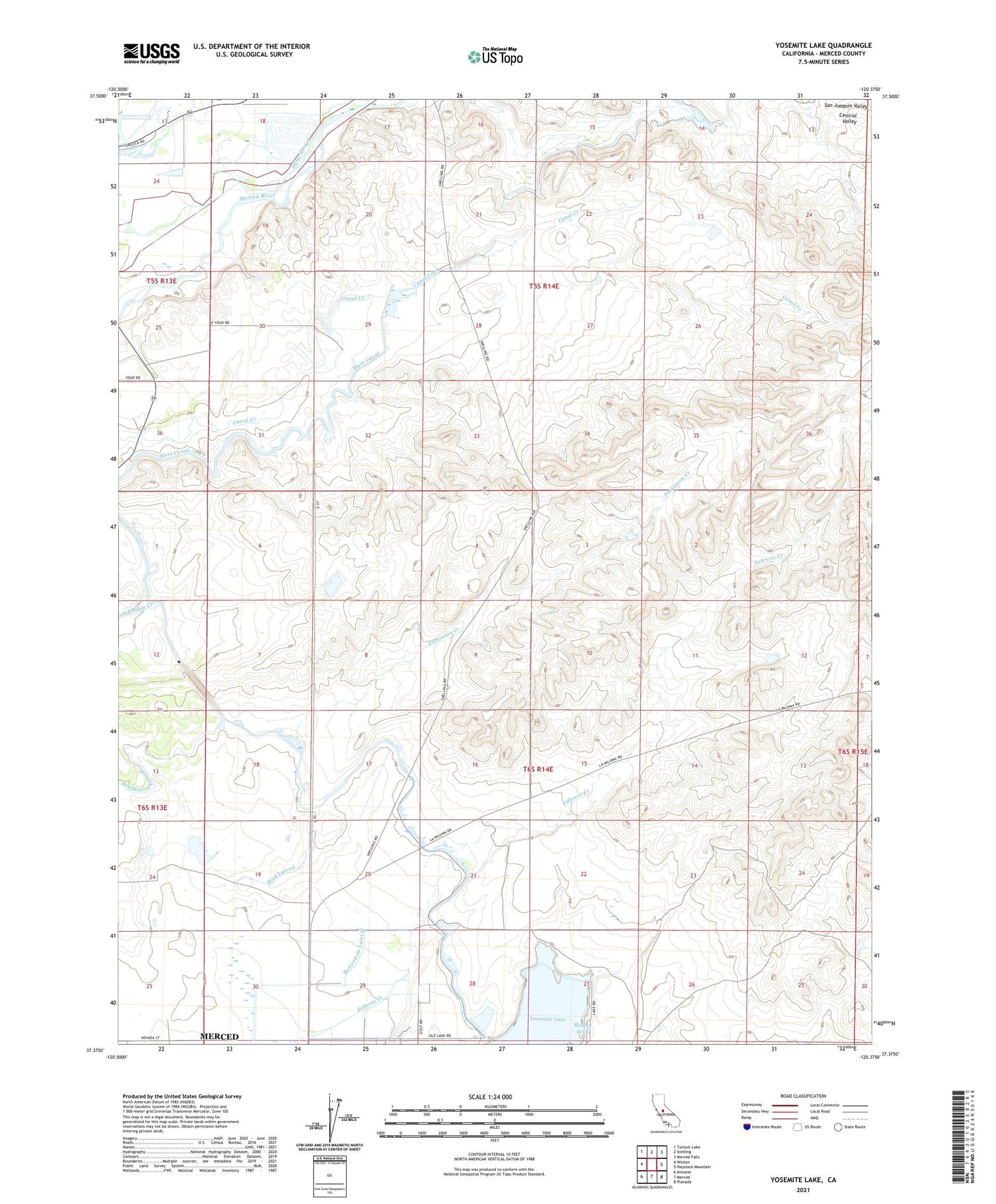
2021 topographic map quadrangle Yosemite Lake in the state of California. Scale: 1:24000. Based on the newly updated USGS 7.5' US Topo map series, this map is in the following counties: Merced. The map contains contour data, water features, and other items you are used to seeing on USGS maps, but also has updated roads and other features. This is the next generation of topographic maps. Printed on high-quality waterproof paper with UV fade-resistant inks.
Quads adjacent to this one:
West: Winton
Northwest: Turlock Lake
North: Snelling
Northeast: Merced Falls
East: Haystack Mountain
Southeast: Planada
South: Merced
Southwest: Atwater
This map covers the same area as the classic USGS quad with code o37120d4.
Contains the following named places: Bird Lateral, Cadera Lateral, Carson Pit, Highway 59 Landfill, KABX-FM (Merced), KDAT-FM (Merced), Main Canal, Merced Golf Club, Rotary Cove, Rotterdam Lateral, Rotterdam School, Upper Golf Lateral, Yosemite Lake, ZIP Code: 95348


