MyTopo
Alamosa East Colorado US Topo Map
Couldn't load pickup availability
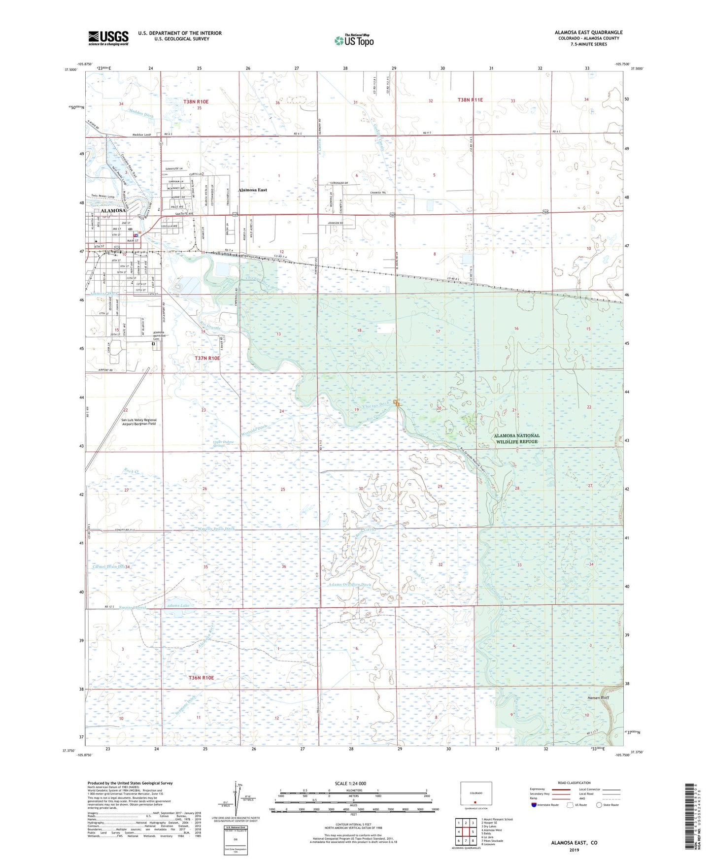
2022 topographic map quadrangle Alamosa East in the state of Colorado. Scale: 1:24000. Based on the newly updated USGS 7.5' US Topo map series, this map is in the following counties: Alamosa. The map contains contour data, water features, and other items you are used to seeing on USGS maps, but also has updated roads and other features. This is the next generation of topographic maps. Printed on high-quality waterproof paper with UV fade-resistant inks.
Quads adjacent to this one:
West: Alamosa West
Northwest: Mount Pleasant School
North: Hooper SE
Northeast: Dry Lakes
East: Baldy
Southeast: Lasauses
South: Pikes Stockade
Southwest: La Jara
This map covers the same area as the classic USGS quad with code o37105d7.
Contains the following named places: Adams Lake, Adams Overflow Ditch, Alamosa, Alamosa Christian Church, Alamosa Congregation of Jehovah's Witnesses, Alamosa Ditch, Alamosa Division, Alamosa East Census Designated Place, Alamosa Fire Department Station 1, Alamosa Municipal Cemetery, Alamosa National Wildlife Refuge, Alamosa Plaza, Alamosa Police Department, Alamosa Post Office, Alamosa River, Boyd Elementary School, Cavalry Bible Chapel, Chicago Ditch, Christian Science Society, Cole Park, Eagle Air Medical Corporation, First Christian Church, KALQ-FM (Alamosa), KGIW-AM (Alamosa), Maddux Ditch, Mountain Valley Church, Polston Elementary School, Rock Creek, Sacred Heart Church, Saint Thomas Episcopal Church, San Luis Valley Baptist Church, San Luis Valley Regional Airport/Bergman Field, Seamans Ditch, Showalter - Butler Chapel, Trinidad State Junior College Valley Campus, Upper Duhme Springs, Valley Plaza, Westside Ditch, ZIP Code: 81101