MyTopo
Baldy Colorado US Topo Map
Couldn't load pickup availability
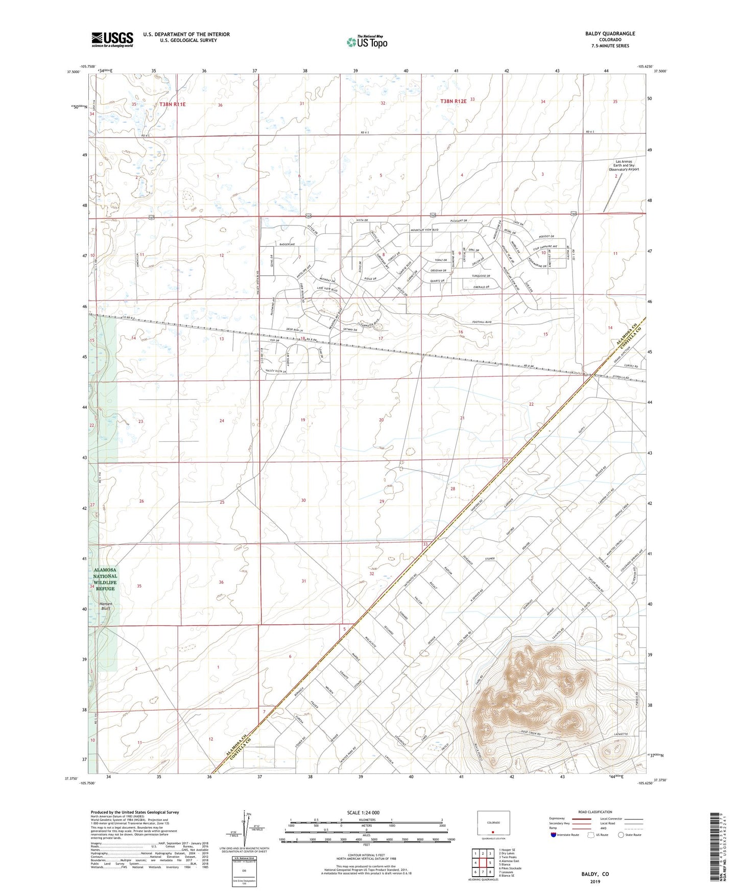
2022 topographic map quadrangle Baldy in the state of Colorado. Scale: 1:24000. Based on the newly updated USGS 7.5' US Topo map series, this map is in the following counties: Alamosa, Costilla. The map contains contour data, water features, and other items you are used to seeing on USGS maps, but also has updated roads and other features. This is the next generation of topographic maps. Printed on high-quality waterproof paper with UV fade-resistant inks.
Quads adjacent to this one:
West: Alamosa East
Northwest: Hooper SE
North: Dry Lakes
Northeast: Twin Peaks
East: Blanca
Southeast: Blanca SE
South: Lasauses
Southwest: Pikes Stockade
This map covers the same area as the classic USGS quad with code o37105d6.
Contains the following named places: Hansen Bluff, Las Arenas Earth and Sky Observatory Airport