
MyTopo
La Jara Colorado US Topo Map
Couldn't load pickup availability
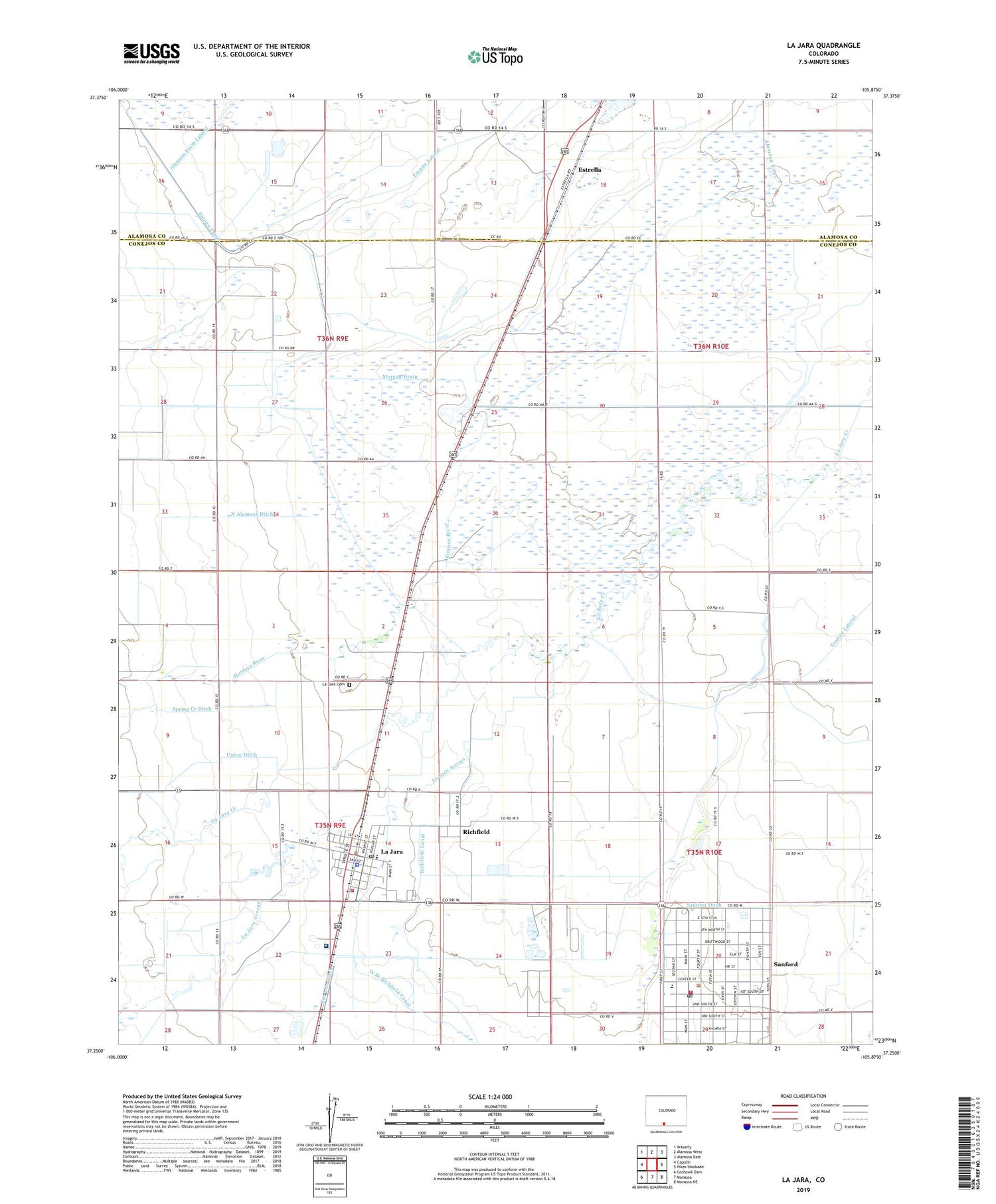
2022 topographic map quadrangle La Jara in the state of Colorado. Scale: 1:24000. Based on the newly updated USGS 7.5' US Topo map series, this map is in the following counties: Conejos, Alamosa. The map contains contour data, water features, and other items you are used to seeing on USGS maps, but also has updated roads and other features. This is the next generation of topographic maps. Printed on high-quality waterproof paper with UV fade-resistant inks.
Quads adjacent to this one:
West: Capulin
Northwest: Waverly
North: Alamosa West
Northeast: Alamosa East
East: Pikes Stockade
Southeast: Manassa NE
South: Manassa
Southwest: Goshawk Dam
This map covers the same area as the classic USGS quad with code o37105c8.
Contains the following named places: Church of Jesus Christ of Latter - day Saints, Conejos County Hospital, Empire Lateral, Estrella, First Presbyterian Church, La Jara, La Jara Arroyo, La Jara Cemetery, La Jara Division, La Jara Elementary School, La Jara Fire Department, La Jara Police Department, La Jara Post Office, Lama Airfield, Lowland Ditch, Northwest Conejos Fire Protection District, Richfield, San Luis Ditch, Sanford, Sanford Ditch, Sanford Post Office, Sanford School K - 12, Town of La Jara, Town of Sanford, Weist Ditch, West Branch Richfield Canal


