MyTopo
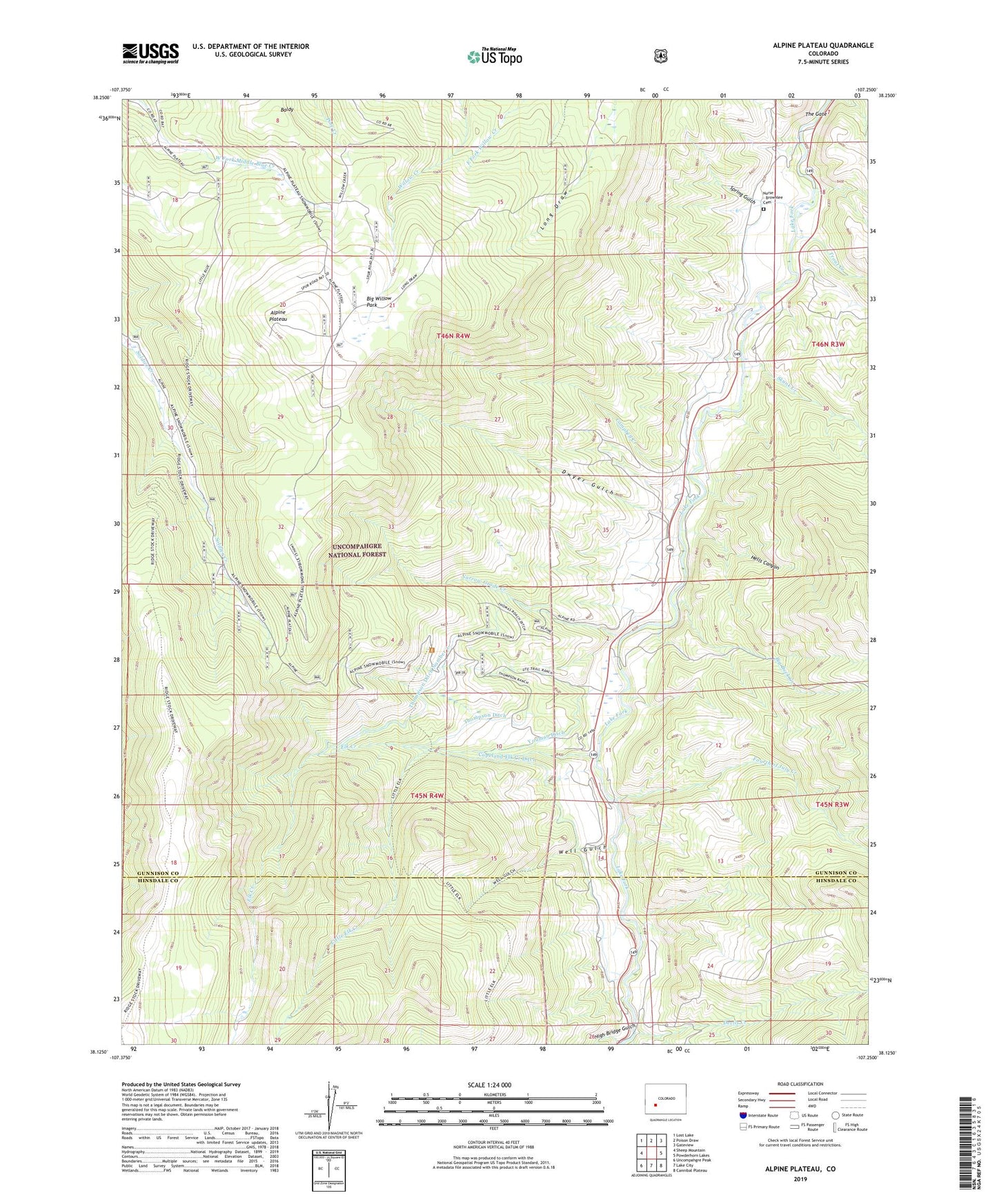
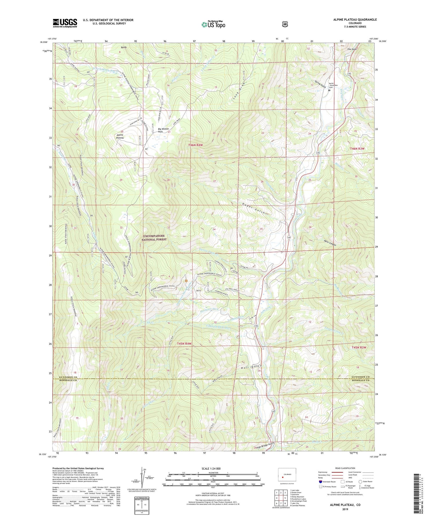
Alpine Plateau Colorado US Topo Map
Couldn't load pickup availability
Also explore the Alpine Plateau Forest Service Topo of this same quad for updated USFS data
2022 topographic map quadrangle Alpine Plateau in the state of Colorado. Scale: 1:24000. Based on the newly updated USGS 7.5' US Topo map series, this map is in the following counties: Gunnison, Hinsdale. The map contains contour data, water features, and other items you are used to seeing on USGS maps, but also has updated roads and other features. This is the next generation of topographic maps. Printed on high-quality waterproof paper with UV fade-resistant inks.
Quads adjacent to this one:
West: Sheep Mountain
Northwest: Lost Lake
North: Poison Draw
Northeast: Gateview
East: Powderhorn Lakes
Southeast: Cannibal Plateau
South: Lake City
Southwest: Uncompahgre Peak
This map covers the same area as the classic USGS quad with code o38107b3.
Contains the following named places: Alpine Corral, Alpine Plateau, Baldy, Big Buck Creek, Big Willow Park, Campbell Creek, Copeland Elk Creek Ditch, Devils Creek, Dwyer Gulch, Elk Creek, Ferrara Ranch Mine, Fourth of July Creek, Hells Canyon, High Bridge Gulch, Little Elk Creek, Narrow Grade Creek, Nurse - Brownlee Cemetery, Ridge Stock Driveway, Skunk Creek, Spring Gulch, The Gate, Thomas Ranch, Thompson Ditch, Thompson Ditch Number 2, Thompson Ranch, Trout Creek, Ute Trail Ranch, Well Gulch, Whinnery Ranch, Wilson Ranch, Youman Ditch