MyTopo
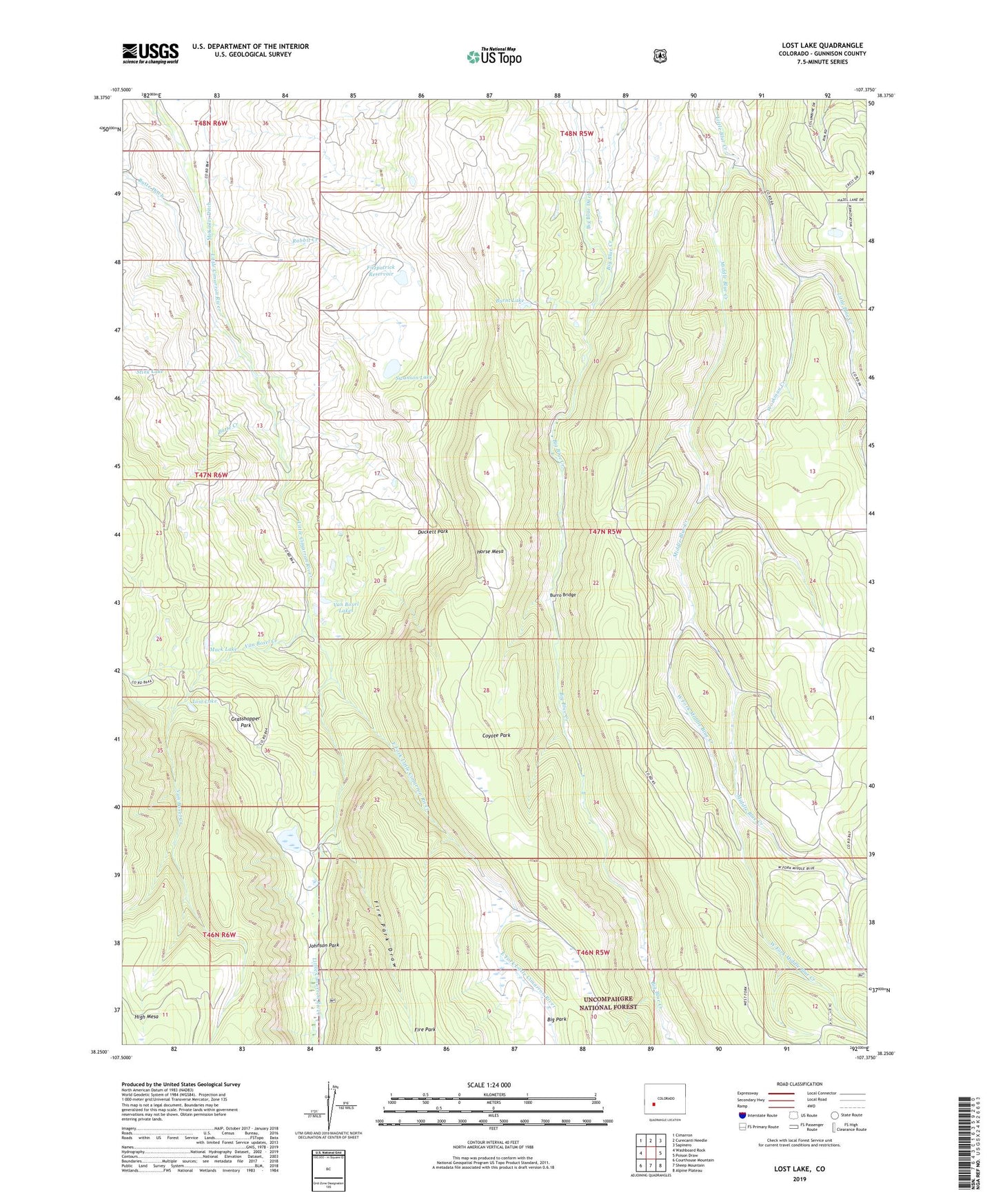
Lost Lake Colorado US Topo Map
Couldn't load pickup availability
Also explore the Lost Lake Forest Service Topo of this same quad for updated USFS data
2022 topographic map quadrangle Lost Lake in the state of Colorado. Scale: 1:24000. Based on the newly updated USGS 7.5' US Topo map series, this map is in the following counties: Gunnison. The map contains contour data, water features, and other items you are used to seeing on USGS maps, but also has updated roads and other features. This is the next generation of topographic maps. Printed on high-quality waterproof paper with UV fade-resistant inks.
Quads adjacent to this one:
West: Washboard Rock
Northwest: Cimarron
North: Curecanti Needle
Northeast: Sapinero
East: Poison Draw
Southeast: Alpine Plateau
South: Sheep Mountain
Southwest: Courthouse Mountain
This map covers the same area as the classic USGS quad with code o38107c4.
Contains the following named places: Big Park, Burnt Lake, Burro Bridge, Butte Creek, Butte Ditch, Coyote Park, Duckett Park, East Fork Little Cimarron River, Fire Park, Fire Park Draw, Fitzpatrick Reservoir, Grasshopper Park, Horse Mesa, Johnson Park, Lost Lake, Mack Lake, McKinley Ditch, Meaker Ranch, Middle Blue Creek, Miles Ranch, Moore Pasture Creek, Rabbit Creek, Reynolds Cabin, Sampson Cabin, Stink Lake, Swanson Lake, Van Boxel Creek, Van Boxel Lakes, West Fork Middle Blue Creek, Williams Cabin, Workman Creek, ZIP Code: 81220