
MyTopo
Uncompahgre Peak Colorado US Topo Map
Couldn't load pickup availability
Also explore the Uncompahgre Peak Forest Service Topo of this same quad for updated USFS data
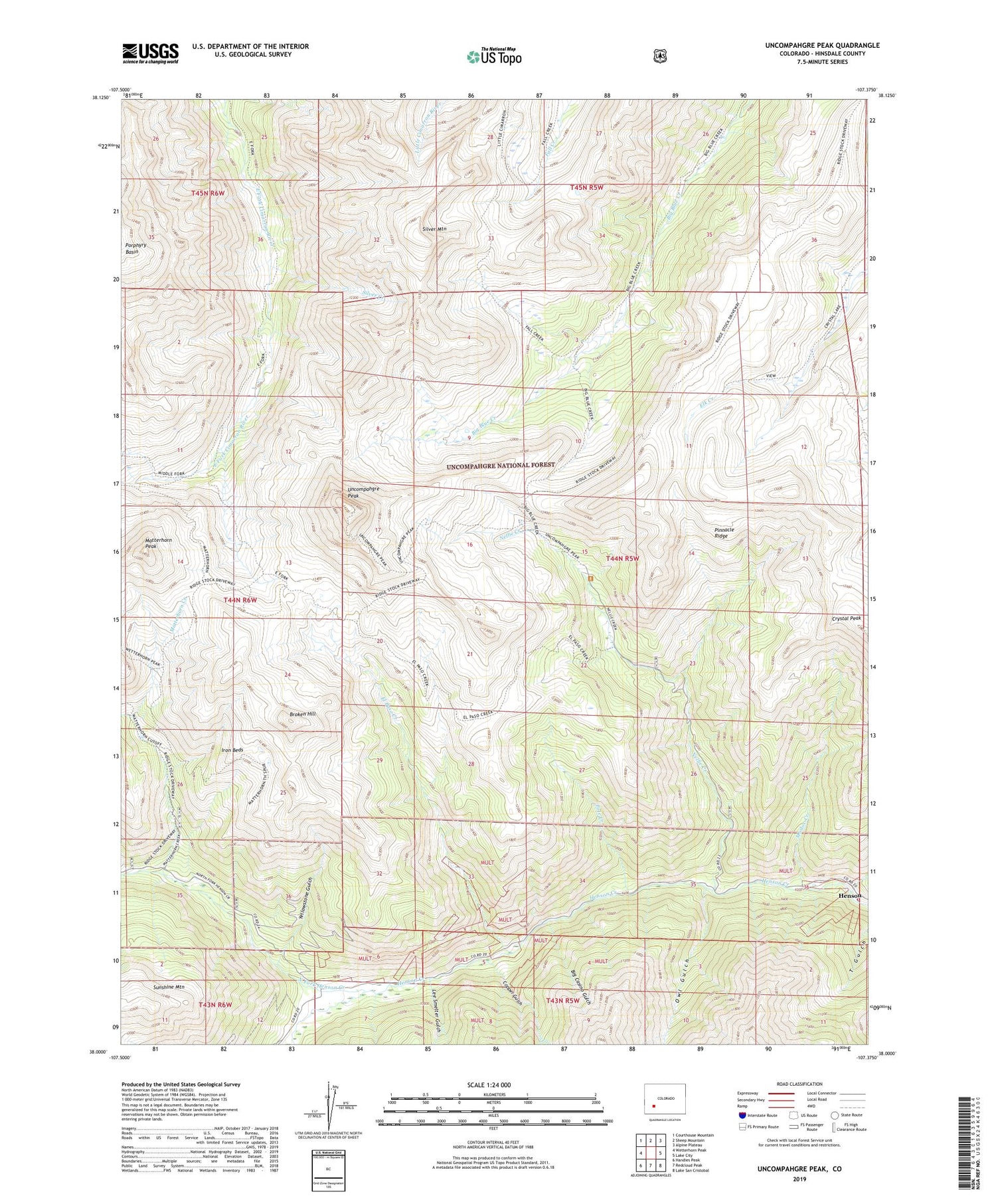
2022 topographic map quadrangle Uncompahgre Peak in the state of Colorado. Scale: 1:24000. Based on the newly updated USGS 7.5' US Topo map series, this map is in the following counties: Hinsdale. The map contains contour data, water features, and other items you are used to seeing on USGS maps, but also has updated roads and other features. This is the next generation of topographic maps. Printed on high-quality waterproof paper with UV fade-resistant inks.
Quads adjacent to this one:
West: Wetterhorn Peak
Northwest: Courthouse Mountain
North: Sheep Mountain
Northeast: Alpine Plateau
East: Lake City
Southeast: Lake San Cristobal
South: Redcloud Peak
Southwest: Handies Peak
This map covers the same area as the classic USGS quad with code o38107a4.
Contains the following named places: Ajax Number Two Mine, Bess Mine, Beth Number One Mine, Big Blue Trail, Big Blue Wilderness, Big Casino Gulch, Broken Hill, Capitol City, Capitol City Mine, Copper Gulch, Czar Mine, Czarina Mine, El Paso Creek, Excelsior Mine, Gallic-Vulcan Mine, Henson, Iron Beds, Lee Smelter Gulch, Matterhorn Creek, Matterhorn Peak, Modoc Creek, Nellie Creek, North Fork Henson Creek, Owl Gulch, Pole Creek, Pride of America Mine, Resorgimento Mine, Saint Louis Mine, Silver Creek, Silver Jack Mine, Silver Mountain, Uncompahgre Peak, Uncompahgre Wilderness, Ute and Ulay Group Mine, Ute Creek, Vermont Mine, Woodstock Mine, Yellow Medicine Mine, Yellowstone Gulch, Young America Mine


