MyTopo
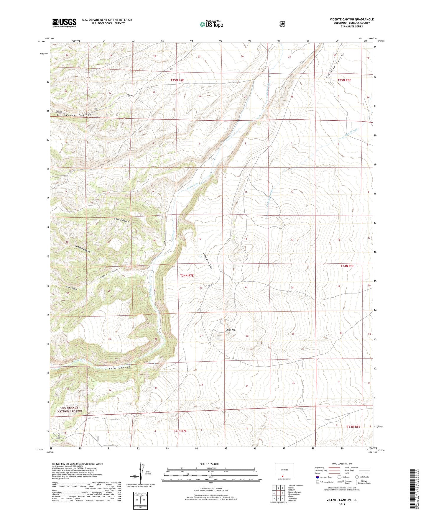
Vicente Canyon Colorado US Topo Map
Couldn't load pickup availability
Also explore the Vicente Canyon Forest Service Topo of this same quad for updated USFS data
2022 topographic map quadrangle Vicente Canyon in the state of Colorado. Scale: 1:24000. Based on the newly updated USGS 7.5' US Topo map series, this map is in the following counties: Conejos. The map contains contour data, water features, and other items you are used to seeing on USGS maps, but also has updated roads and other features. This is the next generation of topographic maps. Printed on high-quality waterproof paper with UV fade-resistant inks.
Quads adjacent to this one:
West: La Jara Canyon
Northwest: Terrace Reservoir
North: Centro
Northeast: Capulin
East: Goshawk Dam
Southeast: Antonito
South: Fox Creek
Southwest: Osier
This map covers the same area as the classic USGS quad with code o37106b2.
Contains the following named places: Alamos Ditch, Canyon del Rancho, Conejos County, Flat Top, Garambuyo Gulch, Horned Owl Retention Dam, La Jara Canyon, Leandro Canyon, Pino Real Ditch, Romero Canyon, Vicente Canyon