MyTopo
Manassa Colorado US Topo Map
Couldn't load pickup availability
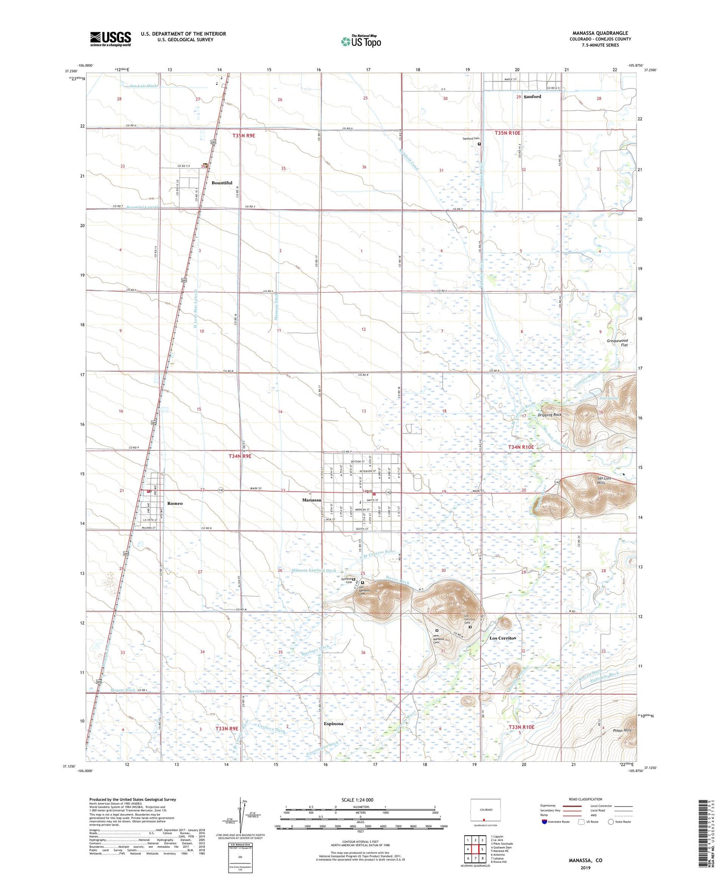
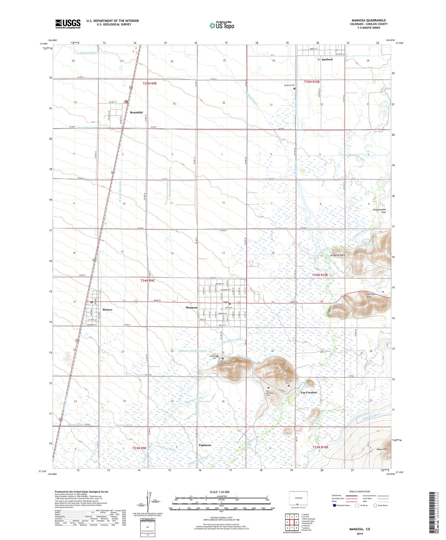
2022 topographic map quadrangle Manassa in the state of Colorado. Scale: 1:24000. Based on the newly updated USGS 7.5' US Topo map series, this map is in the following counties: Conejos. The map contains contour data, water features, and other items you are used to seeing on USGS maps, but also has updated roads and other features. This is the next generation of topographic maps. Printed on high-quality waterproof paper with UV fade-resistant inks.
Quads adjacent to this one:
West: Goshawk Dam
Northwest: Capulin
North: La Jara
Northeast: Pikes Stockade
East: Manassa NE
Southeast: Kiowa Hill
South: Lobatos
Southwest: Antonito
This map covers the same area as the classic USGS quad with code o37105b8.
Contains the following named places: Bountiful, Centauri High School, Centauri Middle School, Christensen Ditch, Church of Jesus Christ of Latter - day Saints, Cordova Ditch, Dripping Rock, East Lone Star Lateral, Eightmile Ditch, Elledges Ditch, Ephriam Ditch, Espinosa, Espinoza Ditch, J M Espinosa Ditch, Jack Dempsey Park, Jacks Irrigating Ditch, La Jara Fire Department - Romeo Station, Lama Airport, Lopez Ditch, Los Cerritos, Los Cerritos Cemetery, Manassa, Manassa Division, Manassa Eastfield Ditch, Manassa Fire Department, Manassa Police Department, Manassa Post Office, Martinez Ditch, New Manassa Cemetery, North Branch Conejos River, Old Manassa Cemetery, Richfield Canal, Rincon Ditch, Rio San Antonio, Romeo, Romeo Canal, Romeo Post Office, Salazar Ditch, Sanford Cemetery, Sego Springs, Sego Springs State Wildlife Area, Servietta Ditch, Smith Brothers Ditch, Sowards Cemetery, Stover Ditch, Town of Manassa, Town of Romeo, West Lone Star Lateral, ZIP Code: 81148