MyTopo
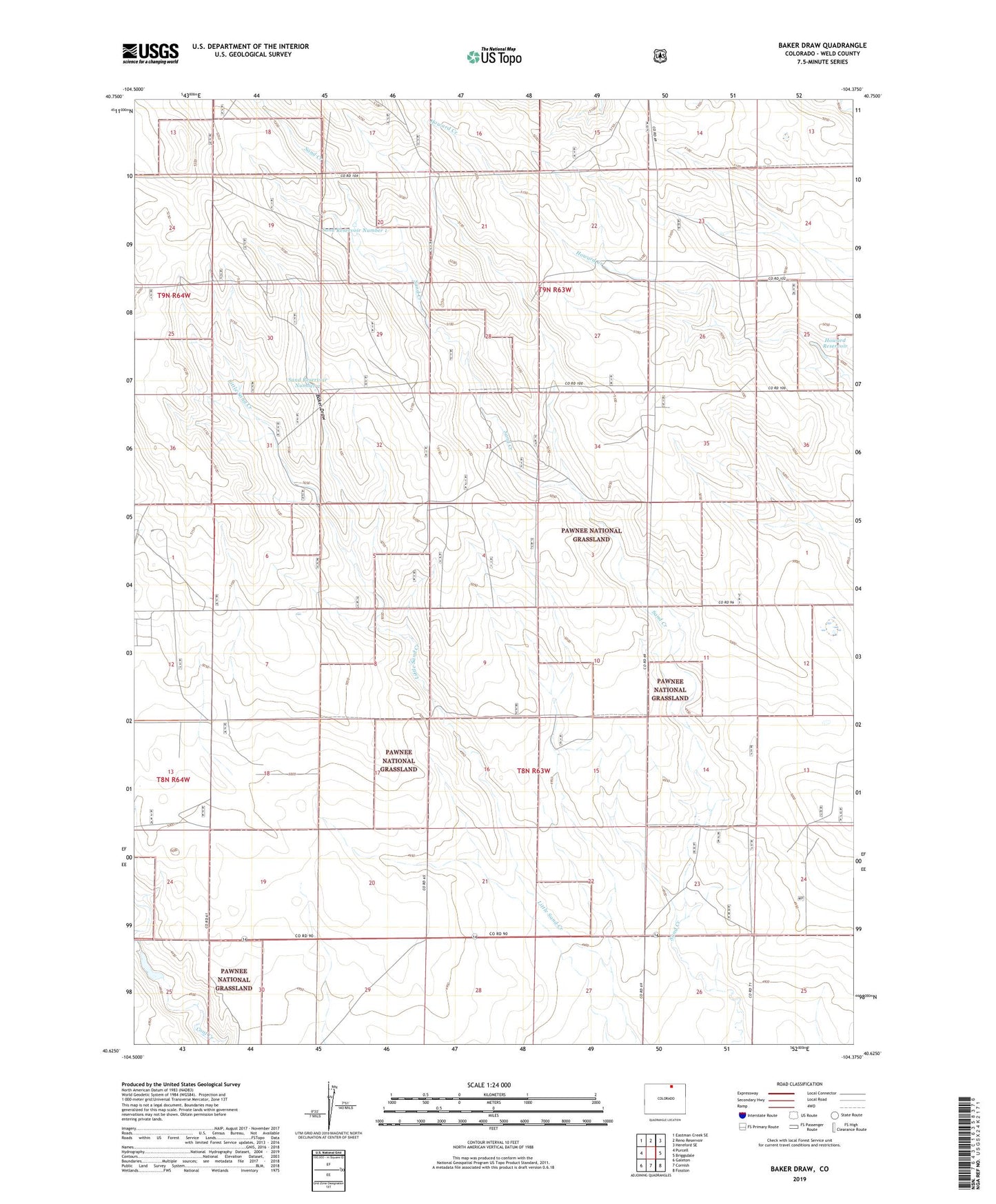
Baker Draw Colorado US Topo Map
Couldn't load pickup availability
Also explore the Baker Draw Forest Service Topo of this same quad for updated USFS data
2022 topographic map quadrangle Baker Draw in the state of Colorado. Scale: 1:24000. Based on the newly updated USGS 7.5' US Topo map series, this map is in the following counties: Weld. The map contains contour data, water features, and other items you are used to seeing on USGS maps, but also has updated roads and other features. This is the next generation of topographic maps. Printed on high-quality waterproof paper with UV fade-resistant inks.
Quads adjacent to this one:
West: Purcell
Northwest: Eastman Creek SE
North: Reno Reservoir
Northeast: Hereford SE
East: Briggsdale
Southeast: Fosston
South: Cornish
Southwest: Galeton
This map covers the same area as the classic USGS quad with code o40104f4.
Contains the following named places: Antelope Windmill, Baker Draw, Ball Windmill, Big Bend Windmill, Cayuse Windmill, Crame Windmill, Elliot Windmill, Hat Windmill, Howard Reservoir, Howard Windmill, Kaw Windmill, Key Water Well, McCartney Windmill, Missile West Water Well, Missile Windmill, Mitchell Windmill, Murphy Windmill, Mustang Windmill, Noble Windmill, Pawnee National Grassland, Phillips Windmill, Rand Windmill, Range Rider Headquarters, Range Rider Water Well, Ridge Windmill, Sand Creek Windmill, Sand Reservoir Number 1, Sand Reservoir Number 2, Sorrell Water Well, Stone Corral Windmill, Wildhorse Windmill