MyTopo
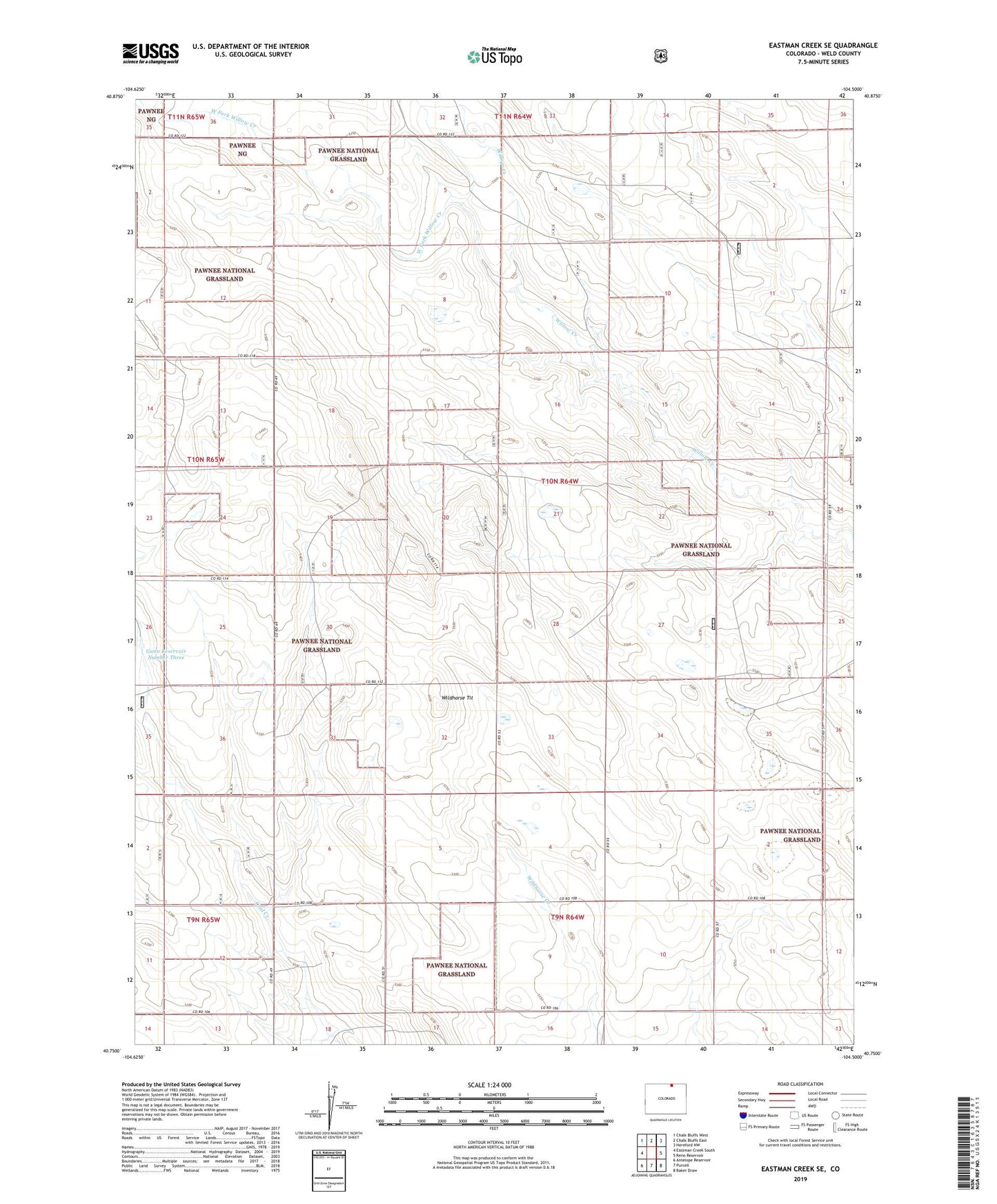
Eastman Creek SE Colorado US Topo Map
Couldn't load pickup availability
Also explore the Eastman Creek SE Forest Service Topo of this same quad for updated USFS data
2022 topographic map quadrangle Eastman Creek SE in the state of Colorado. Scale: 1:24000. Based on the newly updated USGS 7.5' US Topo map series, this map is in the following counties: Weld. The map contains contour data, water features, and other items you are used to seeing on USGS maps, but also has updated roads and other features. This is the next generation of topographic maps. Printed on high-quality waterproof paper with UV fade-resistant inks.
Quads adjacent to this one:
West: Eastman Creek South
Northwest: Chalk Bluffs West
North: Chalk Bluffs East
Northeast: Hereford NW
East: Reno Reservoir
Southeast: Baker Draw
South: Purcell
Southwest: Antelope Reservoir
This map covers the same area as the classic USGS quad with code o40104g5.
Contains the following named places: Bly Windmill, Brass Cap Windmill, Erickson Windmill, Erix Windmill, Fourteen Windmill, Glasspool Windmill, Gunn Reservoir Number Three, Gunn Windmill, Halter Windmill, Jackpot Water Well, Lamm Windmill, McNamara Junior Windmill, Vivian Windmill, West Cross Windmill, West Fork Willow Creek, Wildhorse Tit