MyTopo
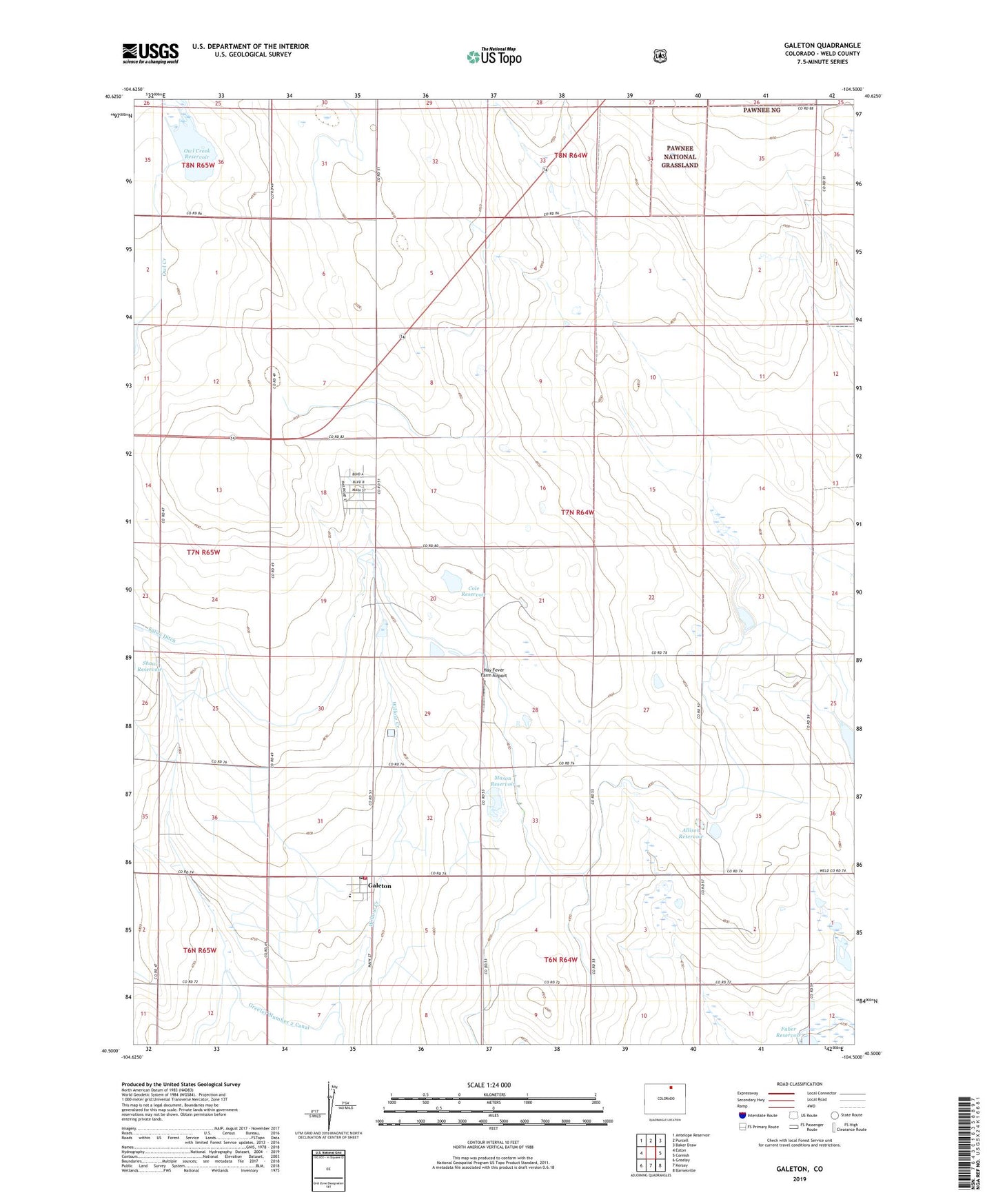
Galeton Colorado US Topo Map
Couldn't load pickup availability
Also explore the Galeton Forest Service Topo of this same quad for updated USFS data
2022 topographic map quadrangle Galeton in the state of Colorado. Scale: 1:24000. Based on the newly updated USGS 7.5' US Topo map series, this map is in the following counties: Weld. The map contains contour data, water features, and other items you are used to seeing on USGS maps, but also has updated roads and other features. This is the next generation of topographic maps. Printed on high-quality waterproof paper with UV fade-resistant inks.
Quads adjacent to this one:
West: Eaton
Northwest: Antelope Reservoir
North: Purcell
Northeast: Baker Draw
East: Cornish
Southeast: Barnesville
South: Kersey
Southwest: Greeley
This map covers the same area as the classic USGS quad with code o40104e5.
Contains the following named places: Allison Reservoir, Atwell Windmill, Cole Reservoir, Galeton, Galeton Fire Protection District, Galeton Post Office, Hay Fever Farm Airport, John Keller Dam, John Keller Reservoir, Johnson Dairy, Mason Reservoir, Owl Creek Dam, Owl Creek Reservoir