MyTopo
Blanca Colorado US Topo Map
Couldn't load pickup availability
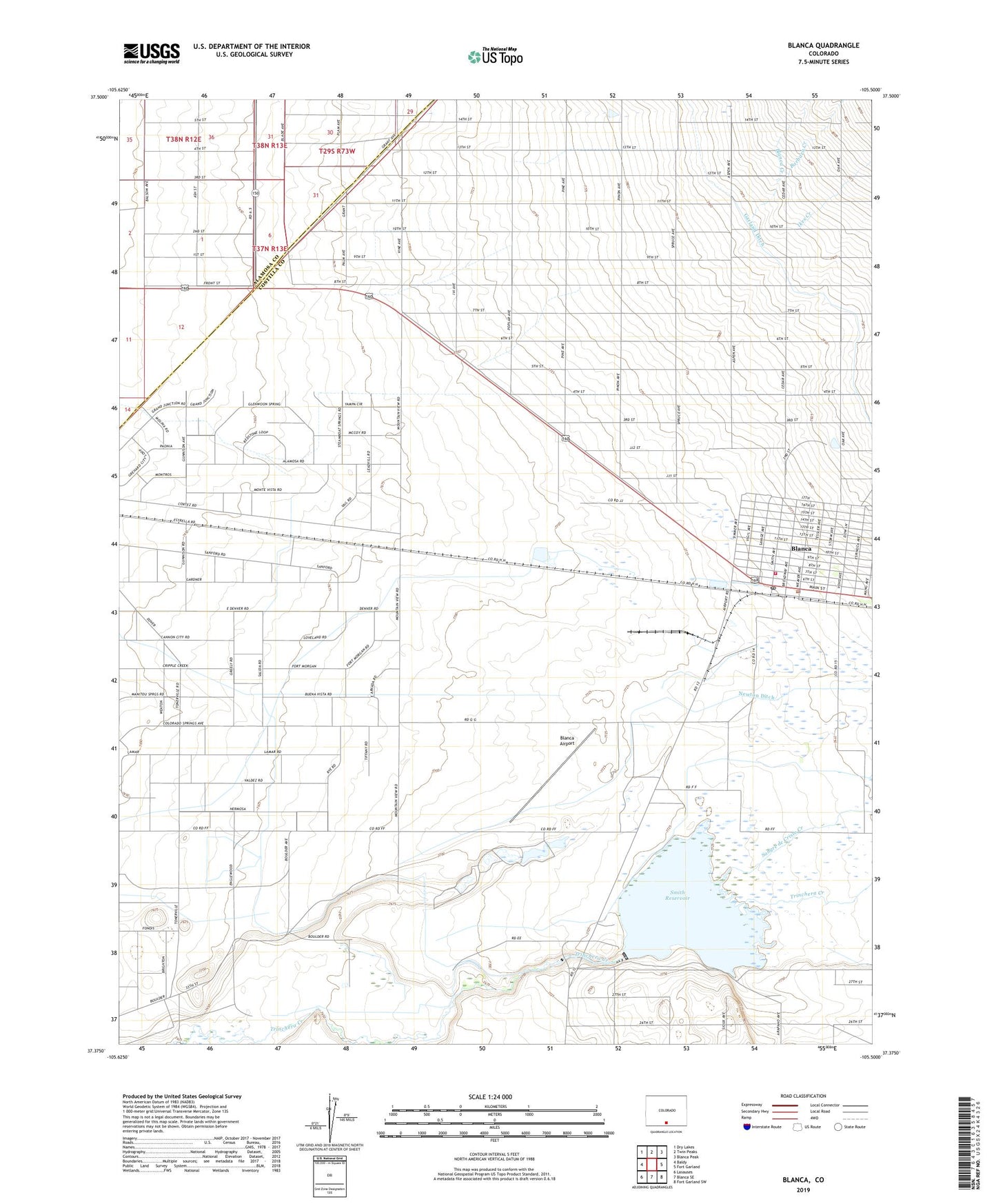
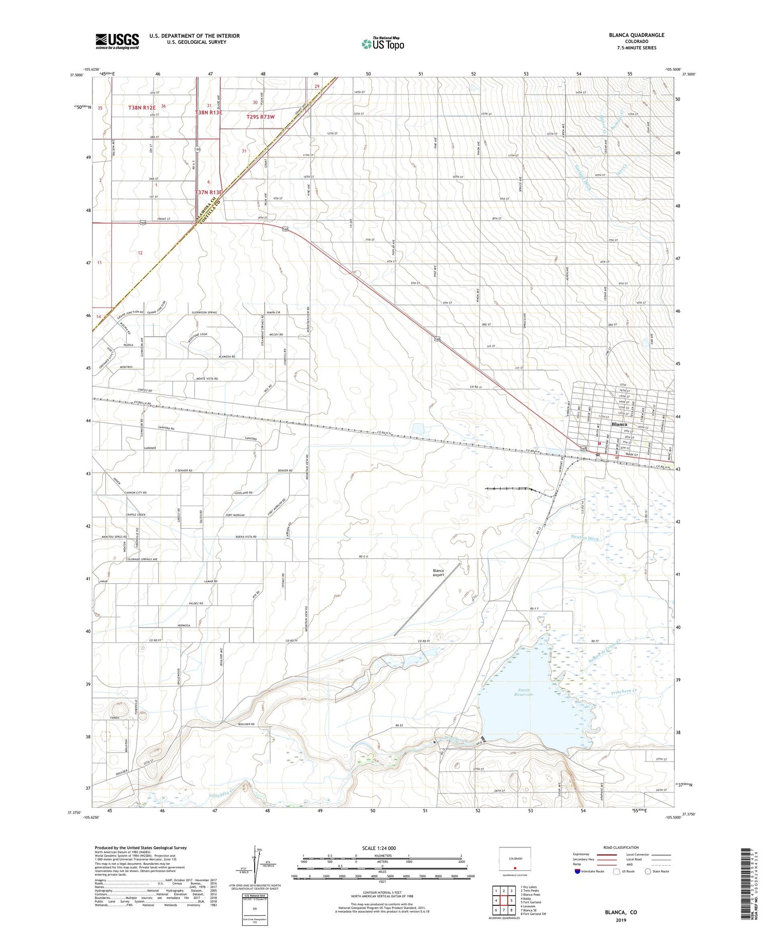
2022 topographic map quadrangle Blanca in the state of Colorado. Scale: 1:24000. Based on the newly updated USGS 7.5' US Topo map series, this map is in the following counties: Costilla, Alamosa. The map contains contour data, water features, and other items you are used to seeing on USGS maps, but also has updated roads and other features. This is the next generation of topographic maps. Printed on high-quality waterproof paper with UV fade-resistant inks.
Quads adjacent to this one:
West: Baldy
Northwest: Dry Lakes
North: Twin Peaks
Northeast: Blanca Peak
East: Fort Garland
Southeast: Fort Garland SW
South: Blanca SE
Southwest: Lasauses
This map covers the same area as the classic USGS quad with code o37105d5.
Contains the following named places: Barbara Creek, Blanca, Blanca Airport, Blanca Creek, Blanca Police Department, Blanca Post Office, Blanca Volunteer Fire Department, Ikes Creek, McClintock, Rattlesnake Diversion, Sangre de Cristo Creek, Smith Dam, Smith Reservoir, Town of Blanca, ZIP Code: 81123