MyTopo
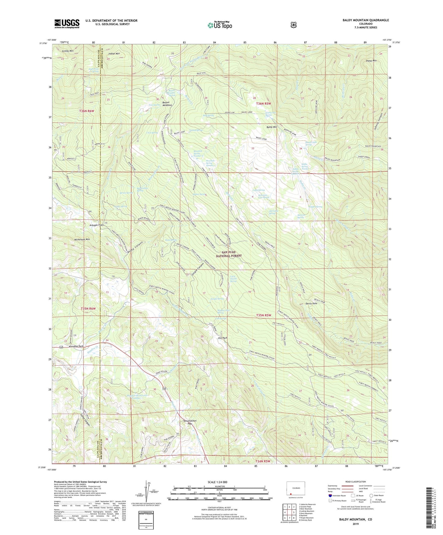
Baldy Mountain Colorado US Topo Map
Couldn't load pickup availability
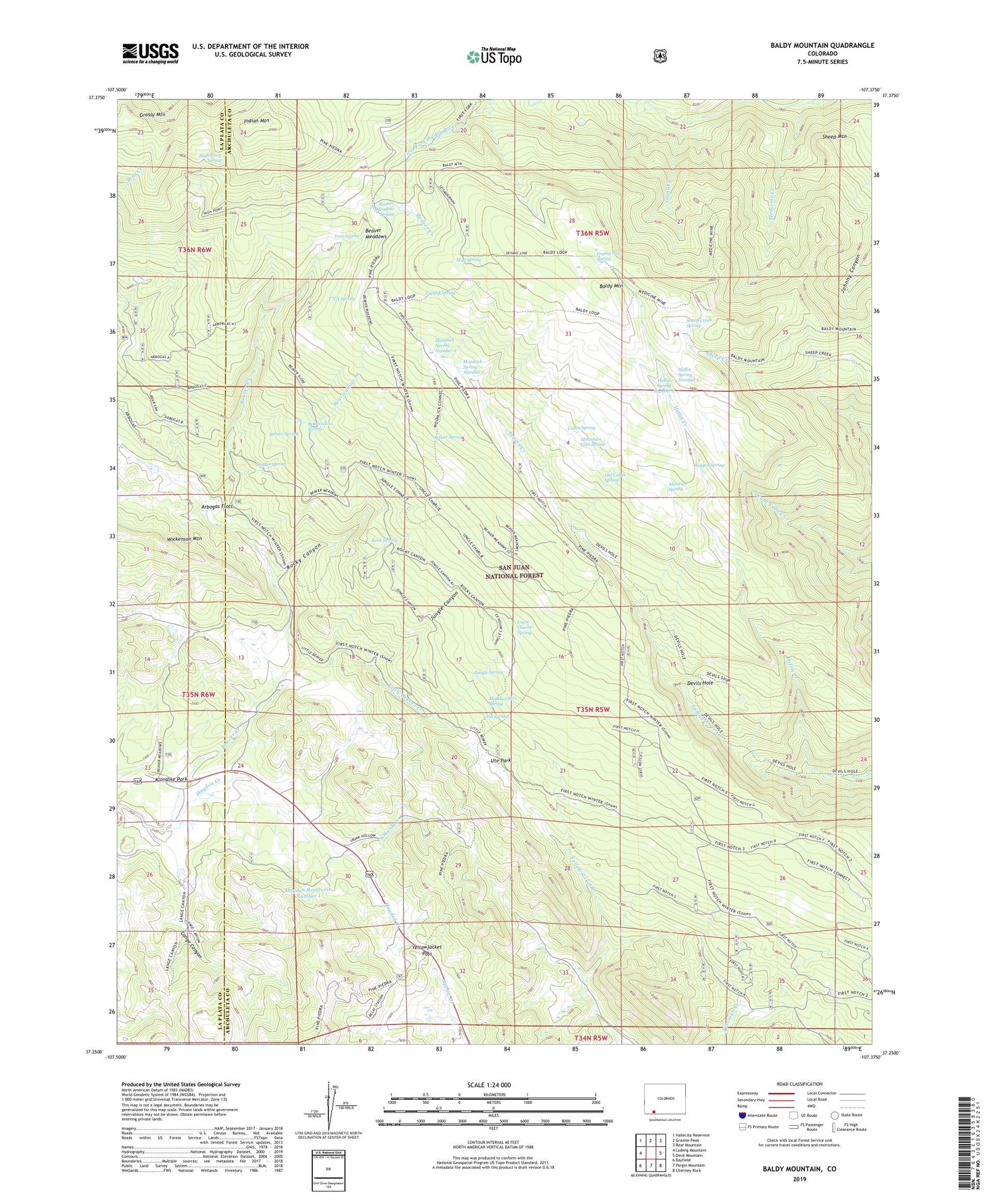
Also explore the Baldy Mountain Forest Service Topo of this same quad for updated USFS data
2023 topographic map quadrangle Baldy Mountain in the state of Colorado. Scale: 1:24000. Based on the newly updated USGS 7.5' US Topo map series, this map is in the following counties: Archuleta, La Plata. The map contains contour data, water features, and other items you are used to seeing on USGS maps, but also has updated roads and other features. This is the next generation of topographic maps. Printed on high-quality waterproof paper with UV fade-resistant inks.
Quads adjacent to this one:
West: Ludwig Mountain
Northwest: Vallecito Reservoir
North: Granite Peak
Northeast: Bear Mountain
East: Devil Mountain
Southeast: Chimney Rock
South: Pargin Mountain
Southwest: Bayfield
This map covers the same area as the classic USGS quad with code o37107c4.
Contains the following named places: Arbogas Flats, Arthur Spring, Baldy Mountain, Bearwallow Creek, Bearwallow Spring, Beaver Meadow Spring, Beaver Meadows, Cabin Spring, Columbine Mine, Cooper Mine, Crib Spring, Devils Hole, Dry Lake Reservoir, Frying Pan Spring, Grass Creek, Grassy Mountain, Hayden Creek, Hayden Reservoir Number 1, Heflin Creek, Heflin Spring Number 1, Heflin Spring Number 2, Hidden Spring, High Point Spring, Indian Mountain, Iron Spring, Jungle Canyon, Jungle Spring, Klondike Park, Lange Canyon, Little Beaver Creek, Medicine Creek, Medicine Mine, Mexican Spring, Moonlick Spring Number 1, Moonlick Spring Number 2, Mountain Lion Spring, Mud Spring, Muddy Lakes Spring, Old Cabin Spring, Pine-Piedra Stock Driveway, Rock Spring, Rocky Canyon, Shamrock Mine, Shamrock Mines, Shamrock Ranch, Sheep Creek Spring, Sheep Mountain, Skunk Creek, Snyder Spring, Spruce Spring, T N Y Spring, Triple S Mine, Trout Creek, Turkey Spring, Uncle Charlie Spring, Ute Park, Yellowjacket Pass, ZIP Code: 81122