
MyTopo
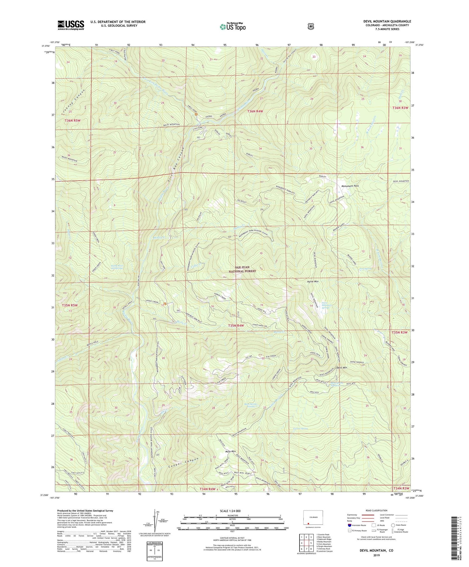
Devil Mountain Colorado US Topo Map
Couldn't load pickup availability
Also explore the Devil Mountain Forest Service Topo of this same quad for updated USFS data
2022 topographic map quadrangle Devil Mountain in the state of Colorado. Scale: 1:24000. Based on the newly updated USGS 7.5' US Topo map series, this map is in the following counties: Archuleta. The map contains contour data, water features, and other items you are used to seeing on USGS maps, but also has updated roads and other features. This is the next generation of topographic maps. Printed on high-quality waterproof paper with UV fade-resistant inks.
Quads adjacent to this one:
West: Baldy Mountain
Northwest: Granite Peak
North: Bear Mountain
Northeast: Oakbrush Ridge
East: Chris Mountain
Southeast: Lonetree Canyon
South: Chimney Rock
Southwest: Pargin Mountain
This map covers the same area as the classic USGS quad with code o37107c3.
Contains the following named places: Coffee Creek, Coldwater Creek, Cooper Canyon, Davis Creek, Death Valley Creek, Devil Mountain, Devil Mountain Trail, Dudley Creek, Elk Creek, Farrow Spring, First Box Canyon, First Fork Hunter campground, First Fork Piedra River, First Fork Trailhead, Ford Spring, Horse Creek, Horse Mountain, Horse Mountain Springs, Indian Creek, Johnny Canyon, Mesa Spring Hunter Campground, Mesa Spring Number 1, Mesa Spring Number 2, Monument Park, Mule Mountain, Piedra Hunter Campground, Piedra River Hot Springs, Second Box Canyon, Sheep Creek, Tres Piedras Ranch


