MyTopo
Lodore School Colorado US Topo Map
Couldn't load pickup availability
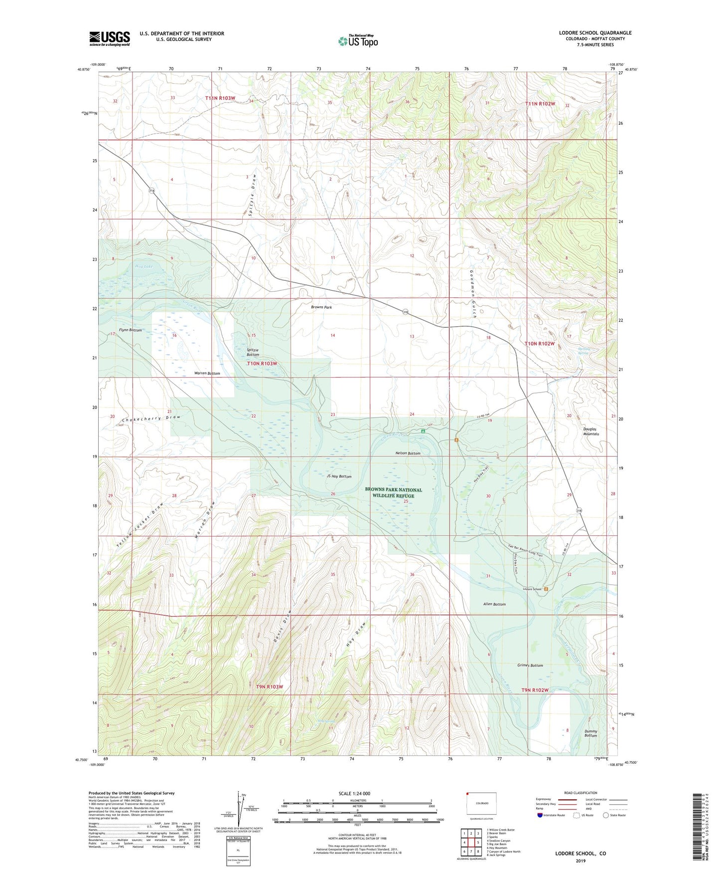
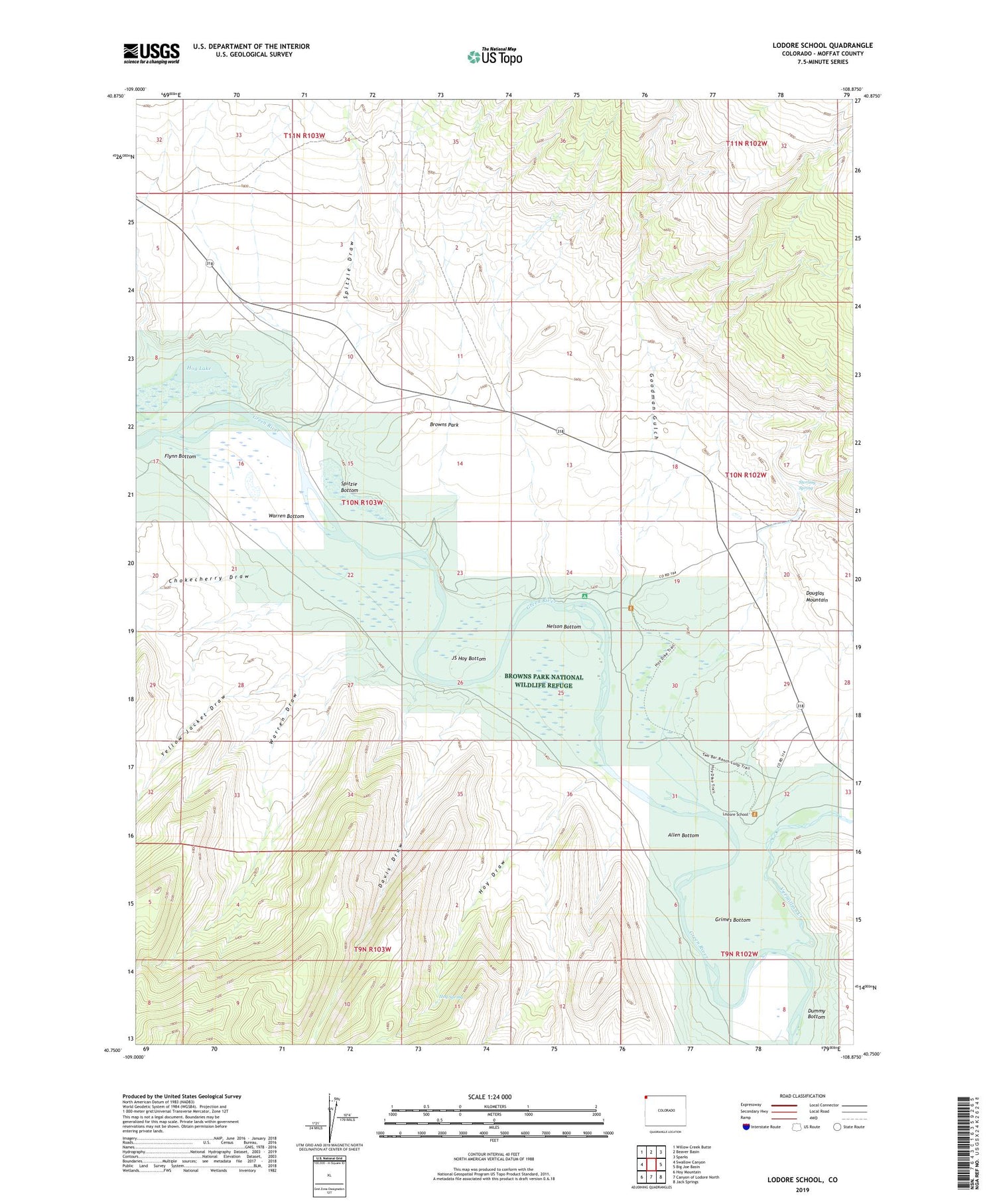
2022 topographic map quadrangle Lodore School in the state of Colorado. Scale: 1:24000. Based on the newly updated USGS 7.5' US Topo map series, this map is in the following counties: Moffat. The map contains contour data, water features, and other items you are used to seeing on USGS maps, but also has updated roads and other features. This is the next generation of topographic maps. Printed on high-quality waterproof paper with UV fade-resistant inks.
Quads adjacent to this one:
West: Swallow Canyon
Northwest: Willow Creek Butte
North: Beaver Basin
Northeast: Sparks
East: Big Joe Basin
Southeast: Jack Springs
South: Canyon of Lodore North
Southwest: Hoy Mountain
This map covers the same area as the classic USGS quad with code o40108g8.
Contains the following named places: Airborne Anomaly 56-10 Mine, Airborne Anomaly 56-9 Mine, Allen Bottom, Browns Park, Browns Park National Wildlife Refuge, Buffham Place, Calloway Place, Carr Place, Chokecherry Draw, Davis Draw, Dummy Bottom, Flynn Bottom, Flynn Bottom Ditch, Goodman Gulch, Grimes Bottom, Hog Lake, Hoy Draw, Hoy Spring, Hoy Trail, JS Hoy Bottom, Lodore Ditch, Lodore School, Matt Trail, Nelson Bottom, Spitzie Bottom, Spitzie Draw, Spitzie Place, Sterling Place, Sterling Spring, Two Bar Ranch, Vermillion Creek, Warren Bottom, Warren Draw, Watson Place, Wilson Place, Yellow Jacket Draw