MyTopo
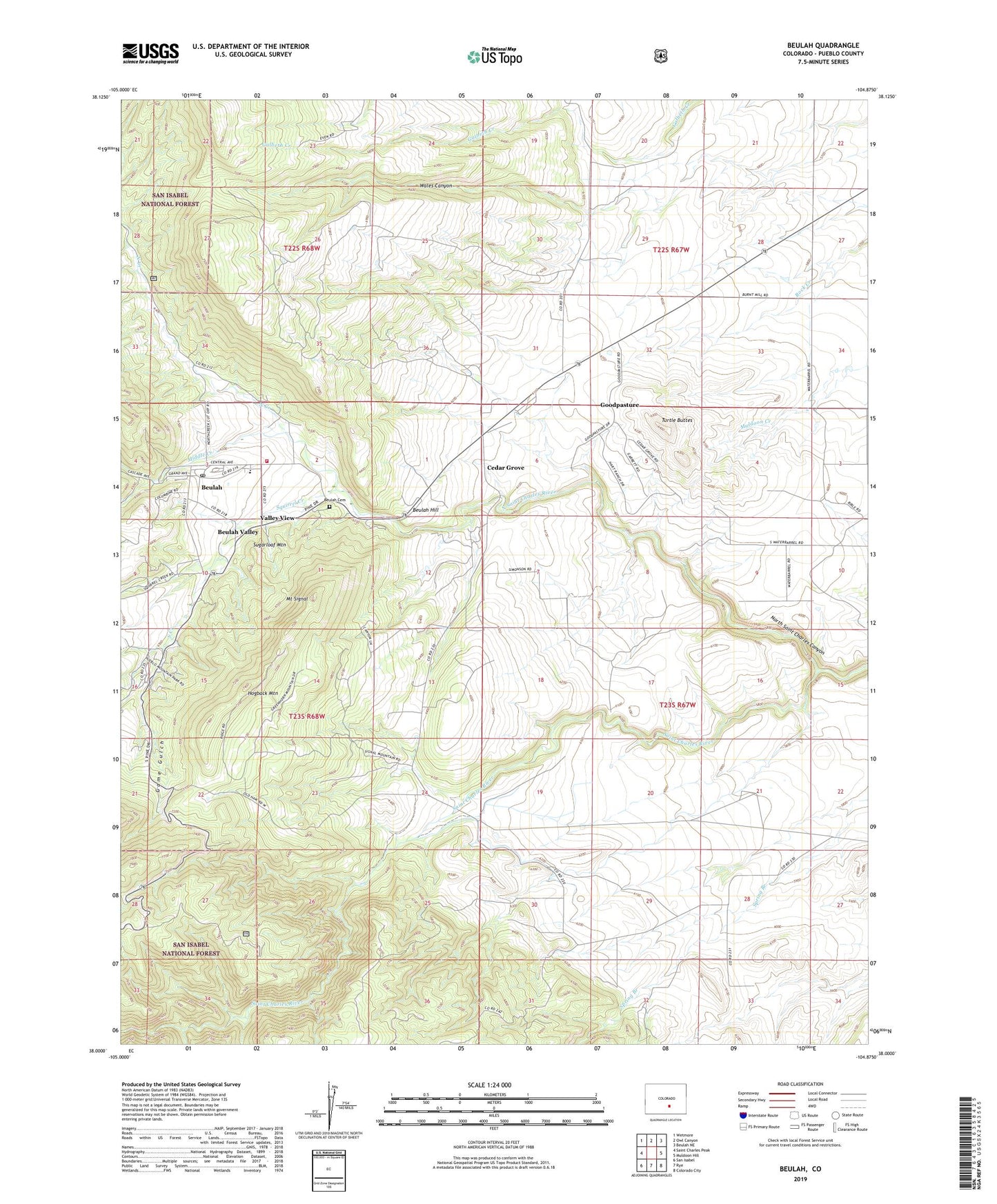
Beulah Colorado US Topo Map
Couldn't load pickup availability
Also explore the Beulah Forest Service Topo of this same quad for updated USFS data
2022 topographic map quadrangle Beulah in the state of Colorado. Scale: 1:24000. Based on the newly updated USGS 7.5' US Topo map series, this map is in the following counties: Pueblo. The map contains contour data, water features, and other items you are used to seeing on USGS maps, but also has updated roads and other features. This is the next generation of topographic maps. Printed on high-quality waterproof paper with UV fade-resistant inks.
Quads adjacent to this one:
West: Saint Charles Peak
Northwest: Wetmore
North: Owl Canyon
Northeast: Beulah NE
East: Muldoon Hill
Southeast: Colorado City
South: Rye
Southwest: San Isabel
This map covers the same area as the classic USGS quad with code o38104a8.
Contains the following named places: Beulah, Beulah Cemetery, Beulah Emergency Medical Services, Beulah Hill, Beulah Post Office, Beulah Valley, Beulah Valley Census Designated Place, Beulah Valley Fire Protection District and Ambulance Station 1, Cedar Grove, Dotson Ditch Number 1, Game Gulch, Good Pasture Airport, Goodpasture, Hogback Mountain, Little Saint Charles Creek, Middle Creek, Mount Signal, North Creek, North Saint Charles Canyon, North Saint Charles River, Panther Creek, Siloam Clay Mine, Sitton Corner, South Creek, Squirrel Creek, Sugarloaf Mountain, Three R Ranch, Turtle Buttes, Valley View, ZIP Code: 81023