MyTopo
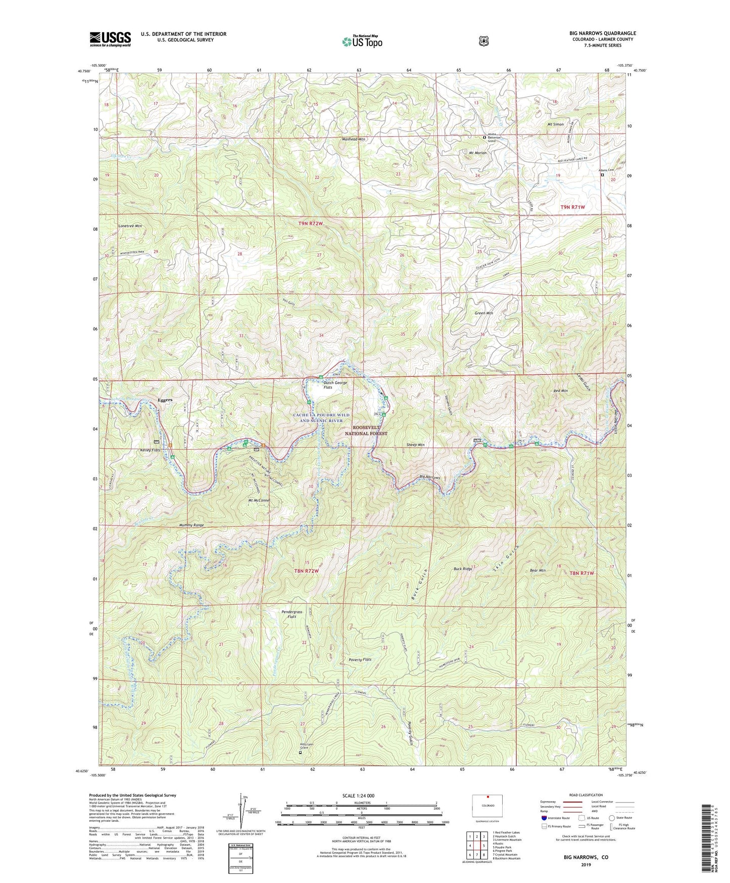
Big Narrows Colorado US Topo Map
Couldn't load pickup availability
Also explore the Big Narrows Forest Service Topo of this same quad for updated USFS data
2022 topographic map quadrangle Big Narrows in the state of Colorado. Scale: 1:24000. Based on the newly updated USGS 7.5' US Topo map series, this map is in the following counties: Larimer. The map contains contour data, water features, and other items you are used to seeing on USGS maps, but also has updated roads and other features. This is the next generation of topographic maps. Printed on high-quality waterproof paper with UV fade-resistant inks.
Quads adjacent to this one:
West: Rustic
Northwest: Red Feather Lakes
North: Haystack Gulch
Northeast: Livermore Mountain
East: Poudre Park
Southeast: Buckhorn Mountain
South: Crystal Mountain
Southwest: Pingree Park
This map covers the same area as the classic USGS quad with code o40105f4.
Contains the following named places: Adams Cemetery, Azuba Batterson Grave, Bear Mountain, Bennett Creek, Big Narrows, Bosworth Homestead, Buck Gulch, Buck Ridge, Cache La Poudre Wilderness, Cedar Gulch, Clark Homestead, Dutch George Flats, Eggers, Eggers Post Office, Eggers Rest Area, Elkhorn Creek, Fort Collins Mountain Recreation Area, Green Mountain, Heline Property Mine, Hole-in-the-Wall Mine, Kelley Flats, Kelly Flats Campground, Kitty Lyon Grave, Kreutzer Nature Trail, Larimer County, Lewis Ranch, Lonetree Mountain, Lookout Lode, Manhead Mountain, Mica Dike Claims, Mount McConnel, Mount McConnel Trail, Mount McConnel Trailhead, Mount Morian, Mount Simon, Mountain Park Campground, Narrows Campground, Narrows Picnic Area, Pendergrass Creek, Pendergrass Flats, Poverty Flats, Poverty Gulch, Red Mountain, Red Mountain Lode, Sheep Mountain, Skin Gulch, Sky Corral Ranch, South Fork Cache la Poudre River, Stevens Gulch, Stevens Gulch Campground, Stove Prairie Landing, Stove Prairie Landing Campground, Trail Gulch, Upper Landing Campground