MyTopo
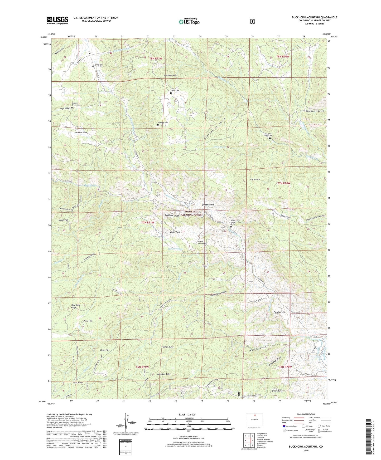
Buckhorn Mountain Colorado US Topo Map
Couldn't load pickup availability
Also explore the Buckhorn Mountain Forest Service Topo of this same quad for updated USFS data
2022 topographic map quadrangle Buckhorn Mountain in the state of Colorado. Scale: 1:24000. Based on the newly updated USGS 7.5' US Topo map series, this map is in the following counties: Larimer. The map contains contour data, water features, and other items you are used to seeing on USGS maps, but also has updated roads and other features. This is the next generation of topographic maps. Printed on high-quality waterproof paper with UV fade-resistant inks.
Quads adjacent to this one:
West: Crystal Mountain
Northwest: Big Narrows
North: Poudre Park
Northeast: Laporte
East: Horsetooth Reservoir
Southeast: Masonville
South: Drake
Southwest: Glen Haven
This map covers the same area as the classic USGS quad with code o40105e3.
Contains the following named places: Bald Ridge, Bear Gulch, Blackhurst Gulch, Buckhorn Canyon Campground, Buckhorn Lodge, Buckhorn Mica Mine, Buckhorn Mountain, Charles C Green Grave, Christ Mountain, Deadman Gulch, Deadman Hill, Fiddler Ridge, Fish Creek, Fletcher Hill, Happy Hollow, Hyatt Hill, Kirchner Ditch, Lampton Ridge, Lass Family Cemetery, Little Bear Gulch, Martin Family Cemetery, Mica Mine Ridge, Moody Park, North Fork Fish Creek, Paradise Park, Parks Hill, Pittington Family Cemetery, Ralph Darby Grave, Raspberry Gulch, Rist Canyon Volunteer Fire Department Station 3 Stove Prairie, Rist Canyon Volunteer Fire Department Station 5 Buckhorn, Sheep Creek, Stove Prairie Creek, Stove Prairie School, Stringtown Gulch, Thomson Cemetery, Vannorsdel Family Cemetery