MyTopo
Fort Garland SW Colorado US Topo Map
Couldn't load pickup availability
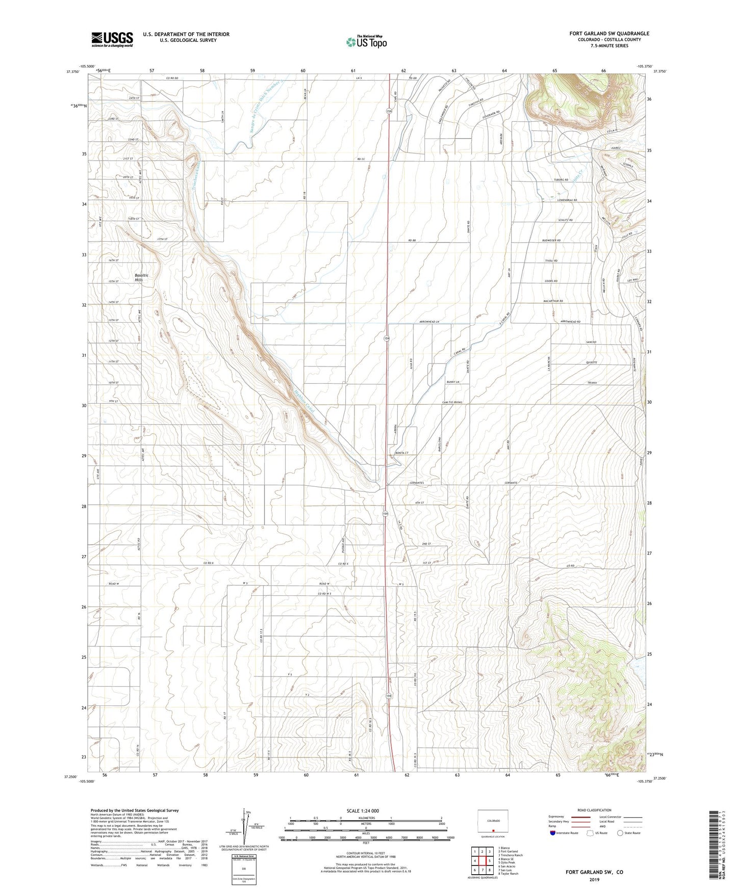
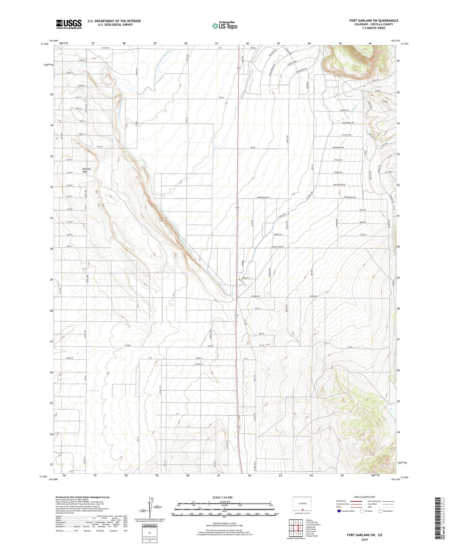
2022 topographic map quadrangle Fort Garland SW in the state of Colorado. Scale: 1:24000. Based on the newly updated USGS 7.5' US Topo map series, this map is in the following counties: Costilla. The map contains contour data, water features, and other items you are used to seeing on USGS maps, but also has updated roads and other features. This is the next generation of topographic maps. Printed on high-quality waterproof paper with UV fade-resistant inks.
Quads adjacent to this one:
West: Blanca SE
Northwest: Blanca
North: Fort Garland
Northeast: Trinchera Ranch
East: Ojito Peak
Southeast: Taylor Ranch
South: San Luis
Southwest: San Acacio
This map covers the same area as the classic USGS quad with code o37105c4.
Contains the following named places: Basaltic Hills, Costilla County, Escheman Landing Strips, Highline Canal, Ojito Creek, Trinchera Canal, Willow Creek Reservoir