MyTopo
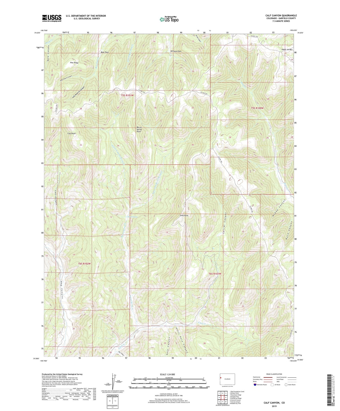
Calf Canyon Colorado US Topo Map
Couldn't load pickup availability
2022 topographic map quadrangle Calf Canyon in the state of Colorado. Scale: 1:24000. Based on the newly updated USGS 7.5' US Topo map series, this map is in the following counties: Garfield. The map contains contour data, water features, and other items you are used to seeing on USGS maps, but also has updated roads and other features. This is the next generation of topographic maps. Printed on high-quality waterproof paper with UV fade-resistant inks.
Quads adjacent to this one:
West: Douglas Pass
Northwest: Big Foundation Creek
North: Brushy Point
Northeast: Razorback Ridge
East: Henderson Ridge
Southeast: Middle Dry Fork
South: Garvey Canyon
Southwest: Howard Canyon
This map covers the same area as the classic USGS quad with code o39108e6.
Contains the following named places: Barrel Spring, Barrel Spring Creek, Barrel Spring Point, Bear Canyon, Bear Park, Calf Canyon, Calf Point, Corral Canyon, Dark Canyon, Hells Hole Canyon, Left Fork Barrel Spring Creek, Left Roberts Canyon, Long Point, McKay Canyon, Pike Ridge, Pole Canyon, Right Fork Barrel Spring Creek, Right Roberts Canyon, U C Cow Camp, Upper 4A Mountain, Williams Park