
MyTopo
Garvey Canyon Colorado US Topo Map
Couldn't load pickup availability
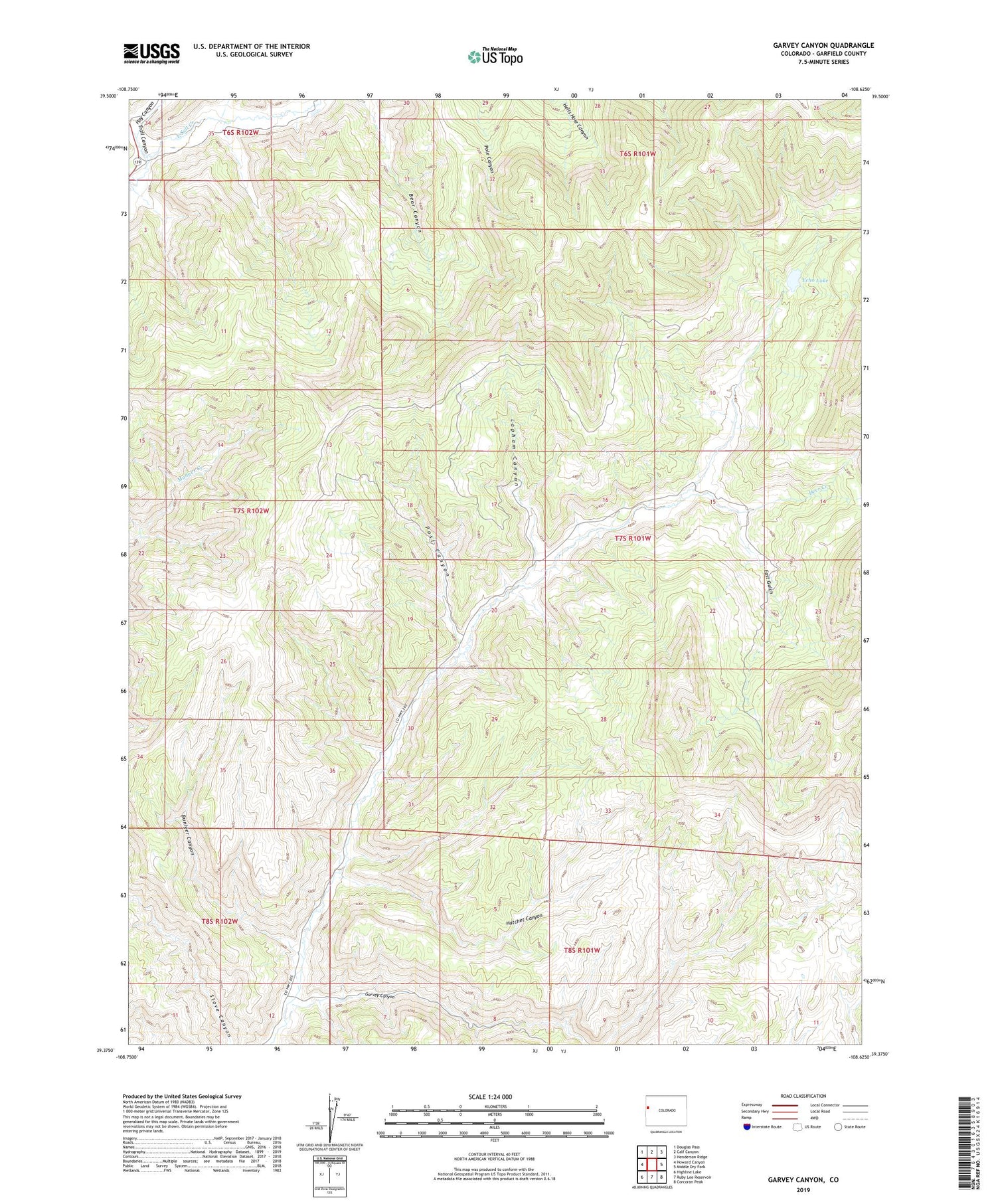
2022 topographic map quadrangle Garvey Canyon in the state of Colorado. Scale: 1:24000. Based on the newly updated USGS 7.5' US Topo map series, this map is in the following counties: Garfield. The map contains contour data, water features, and other items you are used to seeing on USGS maps, but also has updated roads and other features. This is the next generation of topographic maps. Printed on high-quality waterproof paper with UV fade-resistant inks.
Quads adjacent to this one:
West: Howard Canyon
Northwest: Douglas Pass
North: Calf Canyon
Northeast: Henderson Ridge
East: Middle Dry Fork
Southeast: Corcoran Peak
South: Ruby Lee Reservoir
Southwest: Highline Lake
This map covers the same area as the classic USGS quad with code o39108d6.
Contains the following named places: Buniger Canyon, Bunniger Mine, Cuddy Ranch, Deer Creek, East Gulch, Echo Lake, Garvey Canyon, Hatchet Canyon, Hay Canyon, Lapham Canyon, Post Canyon, Trail Canyon


