
MyTopo
Carpenter Ridge Colorado US Topo Map
Couldn't load pickup availability
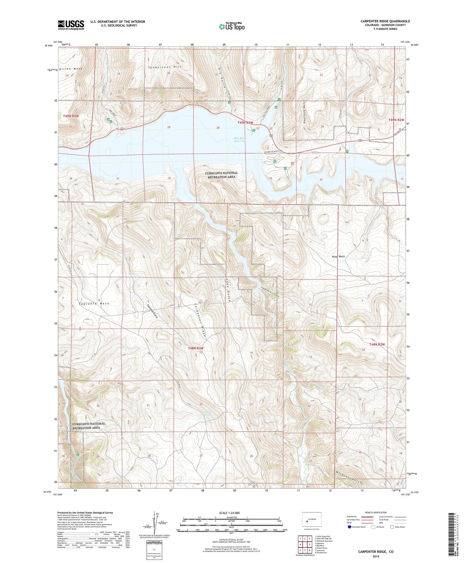
2022 topographic map quadrangle Carpenter Ridge in the state of Colorado. Scale: 1:24000. Based on the newly updated USGS 7.5' US Topo map series, this map is in the following counties: Gunnison. The map contains contour data, water features, and other items you are used to seeing on USGS maps, but also has updated roads and other features. This is the next generation of topographic maps. Printed on high-quality waterproof paper with UV fade-resistant inks.
Quads adjacent to this one:
West: Sapinero
Northwest: Little Soap Park
North: West Elk Peak SW
Northeast: McIntosh Mountain
East: Big Mesa
Southeast: Powderhorn
South: Gateview
Southwest: Poison Draw
This map covers the same area as the classic USGS quad with code o38107d2.
Contains the following named places: Blue Mesa Reservoir, Carpenter Ridge, Cebolla Creek, Dry Creek, Dry Gulch, East Elk Creek, Haystack Gulch, Holman Ranch, Kezar Basin, Lake Gulch, Lily Belle Mine, Little Willow Creek, Old Haines Place, Red Creek, Tenmile Springs, Wildcat Gulch, Wolf Creek


