
MyTopo
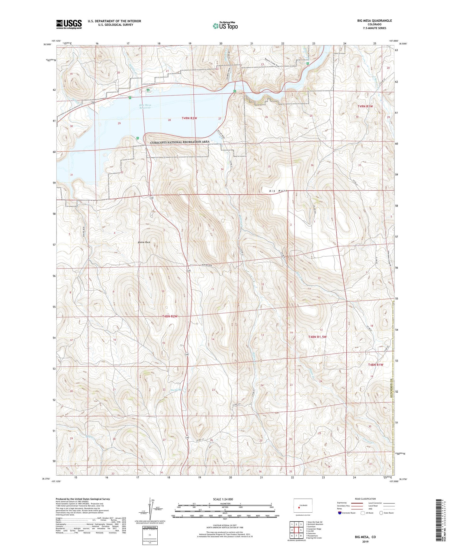
Big Mesa Colorado US Topo Map
Couldn't load pickup availability
2022 topographic map quadrangle Big Mesa in the state of Colorado. Scale: 1:24000. Based on the newly updated USGS 7.5' US Topo map series, this map is in the following counties: Gunnison, Saguache. The map contains contour data, water features, and other items you are used to seeing on USGS maps, but also has updated roads and other features. This is the next generation of topographic maps. Printed on high-quality waterproof paper with UV fade-resistant inks.
Quads adjacent to this one:
West: Carpenter Ridge
Northwest: West Elk Peak SW
North: McIntosh Mountain
Northeast: Gunnison
East: Iris NW
Southeast: Spring Hill Creek
South: Powderhorn
Southwest: Gateview
This map covers the same area as the classic USGS quad with code o38107d1.
Contains the following named places: Beaver Creek, Big Mesa, Big Springs, Blaine Rock, Camp Creek, Corral Creek, Hierro, Iola, Pole Creek, Shaw Ranch, Steuben Creek, Stevens Creek, Sugar Creek, Willow Creek


