MyTopo
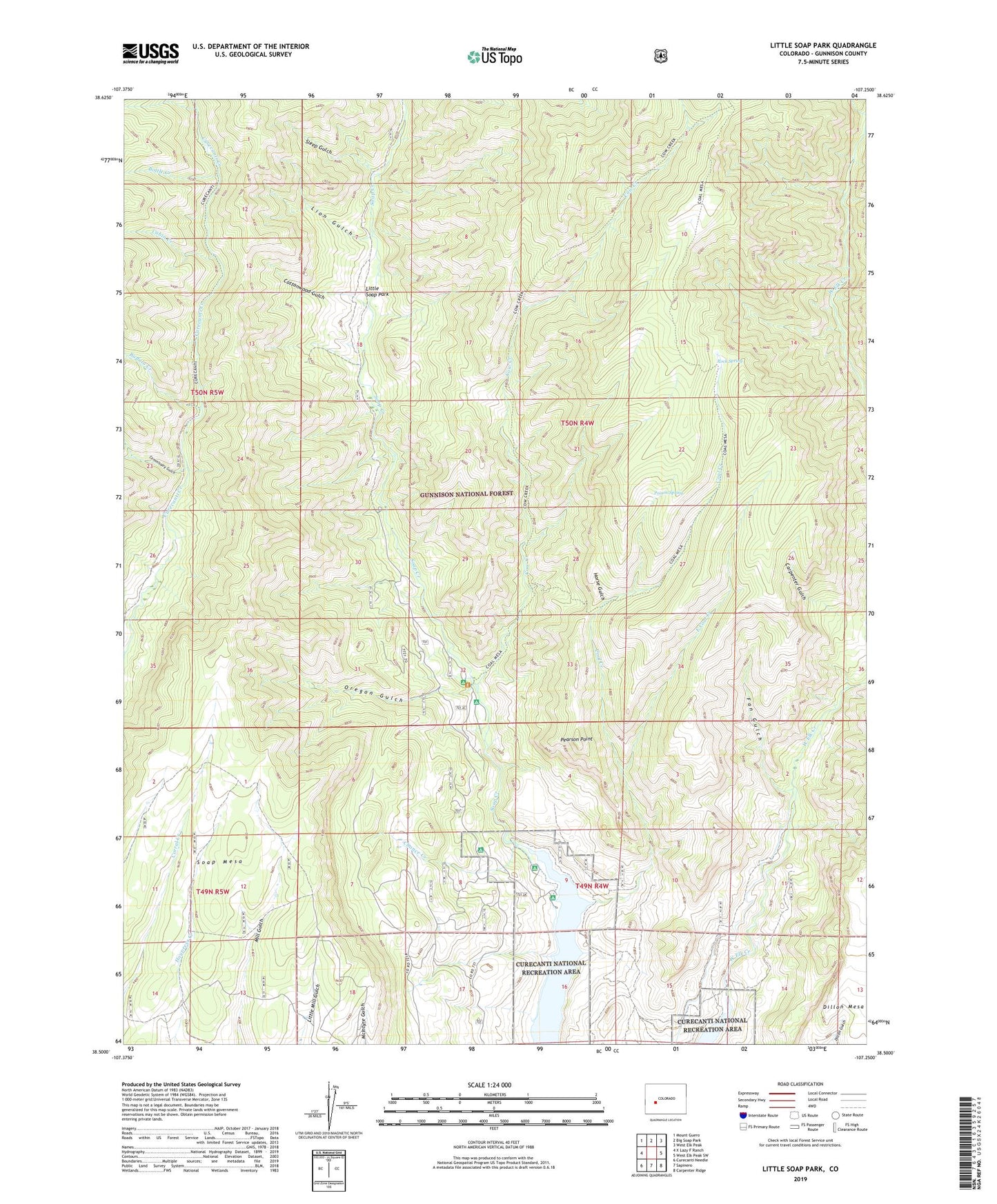
Little Soap Park Colorado US Topo Map
Couldn't load pickup availability
Also explore the Little Soap Park Forest Service Topo of this same quad for updated USFS data
2022 topographic map quadrangle Little Soap Park in the state of Colorado. Scale: 1:24000. Based on the newly updated USGS 7.5' US Topo map series, this map is in the following counties: Gunnison. The map contains contour data, water features, and other items you are used to seeing on USGS maps, but also has updated roads and other features. This is the next generation of topographic maps. Printed on high-quality waterproof paper with UV fade-resistant inks.
Quads adjacent to this one:
West: X Lazy F Ranch
Northwest: Mount Guero
North: Big Soap Park
Northeast: West Elk Peak
East: West Elk Peak SW
Southeast: Carpenter Ridge
South: Sapinero
Southwest: Curecanti Needle
This map covers the same area as the classic USGS quad with code o38107e3.
Contains the following named places: Bottle Creek, Buffalo Creek, Cabin Creek, Carpenter Gulch, Chance Creek, Coal Creek, Commissary Gulch, Commissary Gulch Campground, Cottonwood Gulch, Cow Creek, East Coal Creek, Fan Gulch, Horse Gulch, Lion Gulch, Little Soap Park, Oregon Gulch, Pearson Point, Poison Spring, Rock Spring, Saddle Creek, Sleep Gulch, Soap Creek Campground, Soap Mesa, Trail Creek