
MyTopo
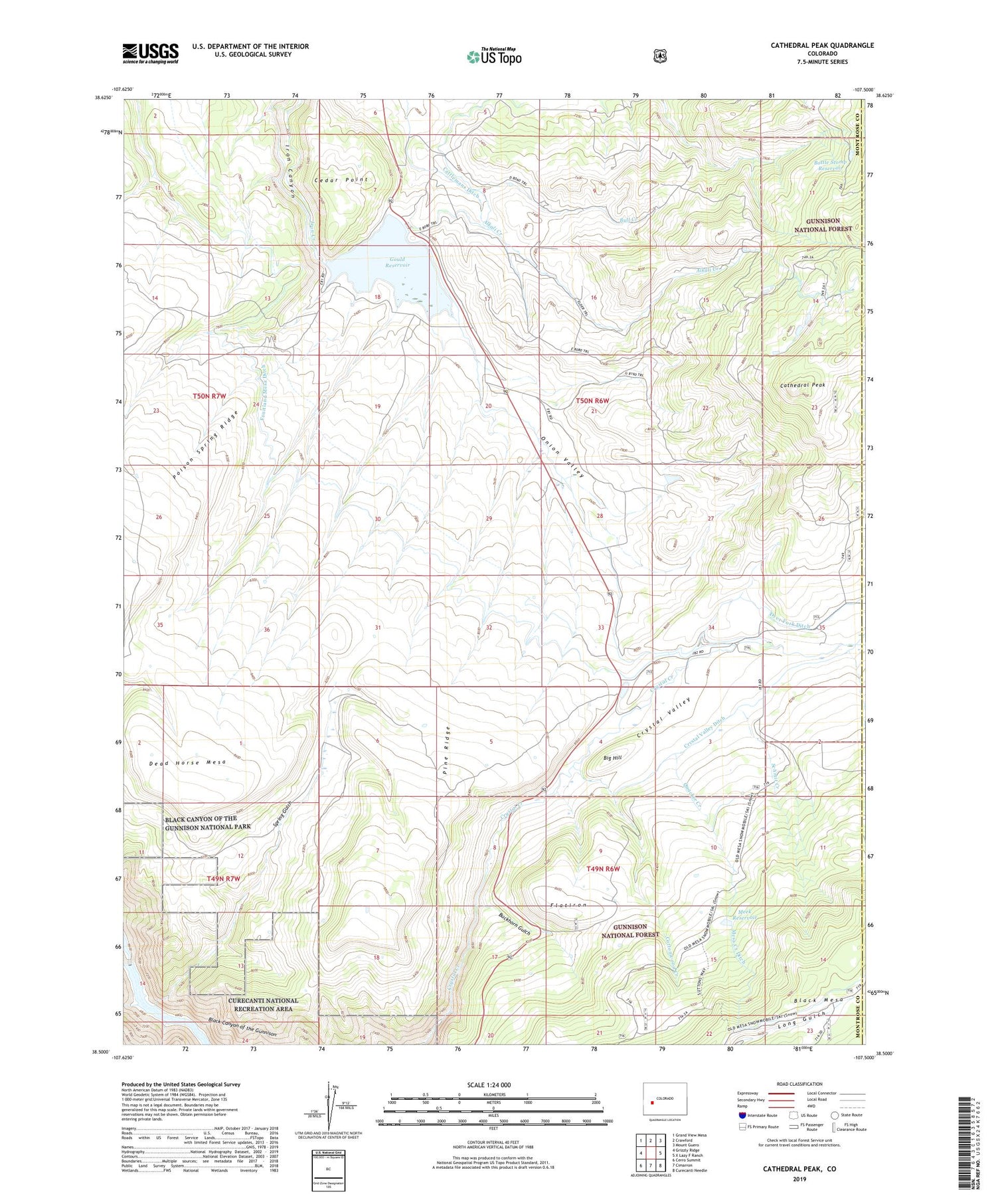
Cathedral Peak Colorado US Topo Map
Couldn't load pickup availability
Also explore the Cathedral Peak Forest Service Topo of this same quad for updated USFS data
2022 topographic map quadrangle Cathedral Peak in the state of Colorado. Scale: 1:24000. Based on the newly updated USGS 7.5' US Topo map series, this map is in the following counties: Montrose, Gunnison. The map contains contour data, water features, and other items you are used to seeing on USGS maps, but also has updated roads and other features. This is the next generation of topographic maps. Printed on high-quality waterproof paper with UV fade-resistant inks.
Quads adjacent to this one:
West: Grizzly Ridge
Northwest: Grand View Mesa
North: Crawford
Northeast: Mount Guero
East: X Lazy F Ranch
Southeast: Curecanti Needle
South: Cimarron
Southwest: Cerro Summit
This map covers the same area as the classic USGS quad with code o38107e5.
Contains the following named places: Big Hill, Bottle Stomp Dam, Bottle Stomp Reservoir, Buckhorn Gulch, Bull Creek, Cathedral Peak, Cattlemans Ditch, Cedar Point, Cottonwood Creek, Crystal Dam, Crystal Valley, Crystal Valley Ditch, Dead Horse Mesa, Don Meek Number 1 Dam, Dyer Fork Ditch, Flatiron, Gates Camp, Gould Reservoir, Hay Park Reservoir Dam, Meek Reservoir, Onion Valley, Onion Valley Dam, Onion Valley Reservoir, Pine Ridge, Pool Gulch, Quacker Creek, Schmit Creek, Spring Gulch


