MyTopo
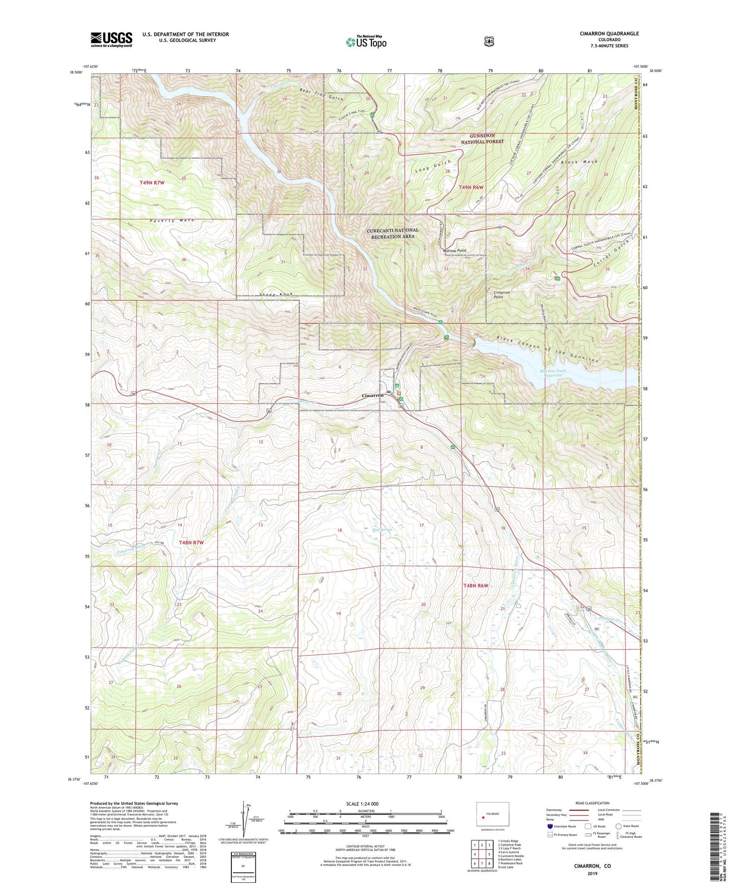
Cimarron Colorado US Topo Map
Couldn't load pickup availability
Also explore the Cimarron Forest Service Topo of this same quad for updated USFS data
2023 topographic map quadrangle Cimarron in the state of Colorado. Scale: 1:24000. Based on the newly updated USGS 7.5' US Topo map series, this map is in the following counties: Montrose, Gunnison. The map contains contour data, water features, and other items you are used to seeing on USGS maps, but also has updated roads and other features. This is the next generation of topographic maps. Printed on high-quality waterproof paper with UV fade-resistant inks.
Quads adjacent to this one:
West: Cerro Summit
Northwest: Grizzly Ridge
North: Cathedral Peak
Northeast: X Lazy F Ranch
East: Curecanti Needle
Southeast: Lost Lake
South: Washboard Rock
Southwest: Buckhorn Lakes
This map covers the same area as the classic USGS quad with code o38107d5.
Contains the following named places: Bear Trap Gulch, Cimarron, Cimarron Campground, Cimarron Ditch, Cimarron Point, Cimarron Post Office, Cimarron River, Collier Ditch, Corral Gulch, Cottonwood Creek, Crystal Creek, Crystal Reservoir, Curecanti Heliport, Diehl Point, District Number 9 School, Goat Hill Mine, Little Cimarron River, Long Gulch, Marrow Point Dam, Mesa Creek, Mesa Creek Campground, Morrow Point, Morrow Point Dam, Morrow Point Reservoir, Mud Springs, Poverty Mesa, Sheep Knob, Squaw Creek, Stumpy Creek