MyTopo
Cerro Summit Colorado US Topo Map
Couldn't load pickup availability
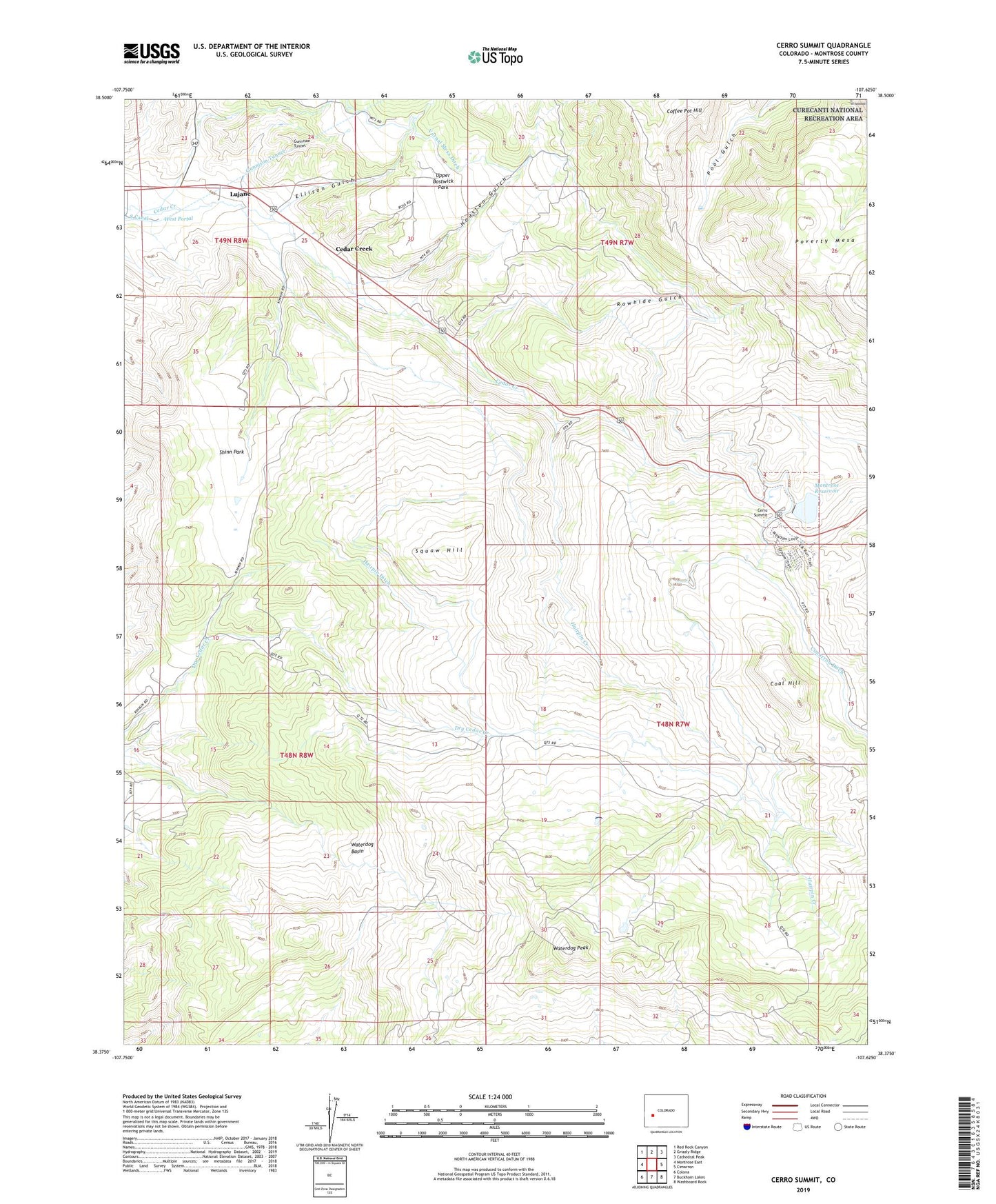
2023 topographic map quadrangle Cerro Summit in the state of Colorado. Scale: 1:24000. Based on the newly updated USGS 7.5' US Topo map series, this map is in the following counties: Montrose. The map contains contour data, water features, and other items you are used to seeing on USGS maps, but also has updated roads and other features. This is the next generation of topographic maps. Printed on high-quality waterproof paper with UV fade-resistant inks.
Quads adjacent to this one:
West: Montrose East
Northwest: Red Rock Canyon
North: Grizzly Ridge
Northeast: Cathedral Peak
East: Cimarron
Southeast: Washboard Rock
South: Buckhorn Lakes
Southwest: Colona
This map covers the same area as the classic USGS quad with code o38107d6.
Contains the following named places: Cedar Creek, Cerro Dam, Cerro Summit, Cerro Summit Heliport, Coal Hill, Coffee Pot Hill, Ellison Gulch, Flying M Ranch Airport, Gunnison Tunnel, Hairpin Creek, Hairpin Ditch, Houston Gulch, Kinikin Heights, Lujane, Montrose Reservoir, Portal, Rawhide Gulch, Shinn Park, Squaw Hill, Upper Bostwick Park, Vernal Mesa Ditch, Waterdog Basin, Waterdog Peak, West Portal